Mount Waldron facts for kids
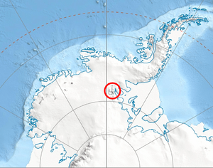
Mount Waldron is a tall mountain in Antarctica. It stands at 3,100 meters (about 10,170 feet) high. This impressive peak is part of the Veregava Ridge, which is located within the larger Sentinel Range. The Sentinel Range itself is a major part of the Ellsworth Mountains.
Where is Mount Waldron?
Mount Waldron is found in a very cold and icy part of the world. It is about 6 kilometers (3 nautical miles) north of another mountain called Mount Tuck. This mountain also rises above several large ice rivers, known as glaciers. To its west, you can find the Dater Glacier. The Orizari Glacier is to its north, and the Berisad Glacier is to its northeast. Finally, the Hansen Glacier lies to the southeast.
How Mount Waldron Was Found and Named
Mount Waldron was first seen and recorded by a special group from the United States Navy. This group was called Squadron VX-6. They discovered the mountain during flights where they took many photographs. These flights happened on December 14 and 15, 1959.
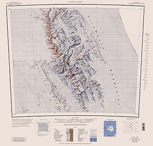
After the photos were taken, the United States Geological Survey (USGS) used them to create detailed maps of the area. The mountain was later given its name by the Advisory Committee on Antarctic Names (US-ACAN). They decided to name it after Kenneth L. Waldron. He was an electrician in the United States Navy. Kenneth Waldron was also part of a group that spent the winter of 1957 at the South Pole Station. This was during a big science project called the International Geophysical Year (IGY).
Maps
![]() This article incorporates public domain material from the United States Geological Survey document "Mount Waldron" (content from the Geographic Names Information System). Lua error in Module:EditAtWikidata at line 29: attempt to index field 'wikibase' (a nil value).
This article incorporates public domain material from the United States Geological Survey document "Mount Waldron" (content from the Geographic Names Information System). Lua error in Module:EditAtWikidata at line 29: attempt to index field 'wikibase' (a nil value).
 | Stephanie Wilson |
 | Charles Bolden |
 | Ronald McNair |
 | Frederick D. Gregory |


