
Wade, North Carolina facts for kids
Quick facts for kids
Wade, North Carolina
|
|
|---|---|

Water tower on Highway 301
|
|
| Motto(s):
"Home of Southern Hospitality"
|
|

Location in Cumberland County and the state of North Carolina.
|
|
| Country | United States |
| State | North Carolina |
| County | Cumberland |
| Area | |
| • Total | 1.75 sq mi (4.54 km2) |
| • Land | 1.74 sq mi (4.51 km2) |
| • Water | 0.01 sq mi (0.02 km2) |
| Elevation | 138 ft (42 m) |
| Population
(2020)
|
|
| • Total | 638 |
| • Density | 366.46/sq mi (141.46/km2) |
| Time zone | UTC-5 (Eastern (EST)) |
| • Summer (DST) | UTC-4 (EDT) |
| ZIP code |
28395
|
| Area codes | 910, 472 |
| FIPS code | 37-70340 |
| GNIS feature ID | 2406811 |
Wade is a small town located in Cumberland County, North Carolina, in the United States. In 2020, about 638 people lived there. The town's motto is "Home of Southern Hospitality."
Contents
History of Wade
Wade has an interesting past. One important historical building is the Old Bluff Presbyterian Church. This church was added to the National Register of Historic Places in 1974. This means it's a special place recognized for its history and importance.
Where is Wade Located?
Wade is found in the northeastern part of Cumberland County. It's easy to get to, as U.S. Route 301 goes right through the town. This road can take you about 12 miles southwest to Fayetteville, which is the main city of the county. If you go 12 miles northeast, you'll reach Dunn.
Interstate 95, a major highway, also passes close to Wade. You can get on or off I-95 at Exit 61.
Land and Water Around Wade
The town of Wade covers an area of about 4.54 square kilometers (or 1.75 square miles). Most of this area is land. Only a tiny part, about 0.02 square kilometers (or 0.01 square miles), is water. The Cape Fear River flows just north of the town.
People Living in Wade
The number of people living in Wade has changed over the years. Here's how the population has grown and shrunk:
| Historical population | |||
|---|---|---|---|
| Census | Pop. | %± | |
| 1920 | 190 | — | |
| 1930 | 362 | 90.5% | |
| 1970 | 315 | — | |
| 1980 | 474 | 50.5% | |
| 1990 | 238 | −49.8% | |
| 2000 | 480 | 101.7% | |
| 2010 | 556 | 15.8% | |
| 2020 | 638 | 14.7% | |
| U.S. Decennial Census | |||
Who Lives in Wade?
Based on information from the year 2000, there were 480 people living in Wade. These people lived in 196 households, and 131 of these were families.
Most people in Wade were White, making up about 72% of the population. About 23% were African American. Smaller groups included Native American, Asian, and Pacific Islander people. About 3% of the population identified as Hispanic or Latino.
Many households (34.7%) had children under 18 living with them. About 48.5% of households were married couples. Some households (13.8%) had a female head of the house without a husband present. About 30% of all households were individuals living alone.
The average age of people in Wade in 2000 was 37 years old. About 27% of the population was under 18. Another 15.6% were 65 years old or older.
Images for kids
-
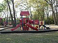
Wade Community Park
-
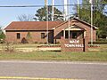
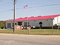
Town Hall
-
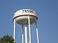
The Wade Water Tower
-
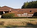
Wade Medical Center
-
Wade Fire Department
-
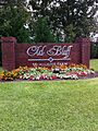
Old Bluff at McAllister Farm
-
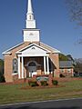
Bluff Presbyterian Church


See also
 In Spanish: Wade (Carolina del Norte) para niños
