Waikanae River facts for kids
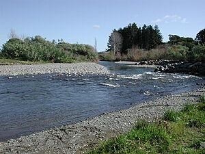
The Waikanae River is a cool river found on the Kapiti Coast in the North Island of New Zealand. It's a really important part of the local area.
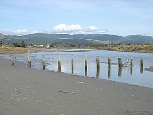
This river starts high up in the Tararua Ranges. It flows through places like Reikorangi and the Akatarawa Valley. Then, it passes by the town of Waikanae before reaching the Tasman Sea. You can see where it meets the sea at Waikanae Beach.
Smaller streams, called tributaries, join the Waikanae River. These include the Maungakotukutuku Stream, Ngatiawa River, and Reikorangi Stream. Where the river meets the sea, there's a special area called an estuary. This estuary is like a safe home for many local and traveling seabirds. It's also a popular spot for fun activities for both people who live nearby and visitors.
Contents
Waikanae River: A Lifeline
The Waikanae River provides water for the towns of Waikanae and Paraparaumu. Sometimes, if the river gets too low, people might need to save water. This helps make sure there's enough for everyone.
Even though it can get low, the river can also get very full. For example, in January 2005, after a lot of rain, the river overflowed its banks.
River Health
The water in the Waikanae River is usually very clean. It's home to many different types of water creatures and plants. This shows it has good biodiversity, meaning a wide variety of life.
However, sometimes after long periods of hot, dry weather, you might see something called cyanobacteria. These are tiny organisms that can sometimes grow a lot and make the water look a bit green.
Bridges Over the Waikanae River
Many bridges have been built over the Waikanae River over the years. These bridges help people and trains cross the river safely.
Early Railway Bridges
The very first bridge was built around 1885. It was made of timber and used by the Wellington and Manawatu Railway Company. This bridge had three main sections.
Later, in 1925, a fence made of old railway tracks was put up to protect the bridge. Behind this fence, there were big iron tanks filled with stones from the riverbed. By 1938, this old timber bridge was replaced with a stronger one made of steel and concrete.
Other Important Bridges
Another bridge was built nearby and opened in 1901. It was also made of timber and was about 75 meters (247 feet) long. It also had three sections.
The newest bridge is part of the Kapiti Expressway. This bridge is a single, strong concrete beam. It stands about 35 meters (115 feet) above the river. Its main span, the part that crosses the river, is about 39 meters (128 feet) long.
 | Stephanie Wilson |
 | Charles Bolden |
 | Ronald McNair |
 | Frederick D. Gregory |


