Akatarawa Valley facts for kids
Quick facts for kids
Akatarawa
|
|
|---|---|
|
Rural locality
|
|

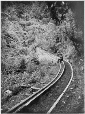
Price's Bush Tramway, 1903
|
|
| Country | New Zealand |
| Region | Wellington Region |
| Territorial authority | Upper Hutt |
| Electorates |
|
| Area | |
| • Total | 334.15 km2 (129.02 sq mi) |
| Population
(June 2023)
|
|
| • Total | 710 |
| • Density | 2.125/km2 (5.50/sq mi) |
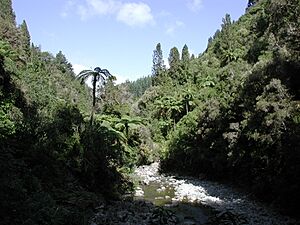
The Akatarawa Valley is a beautiful valley located in the Tararua Range of New Zealand's North Island. It acts like a natural bridge. It connects the upper part of the Hutt Valley to Waikanae on the Kāpiti Coast. This connection goes through some rugged hills.
The valley is not very crowded. It includes small areas called Reikorangi and Cloustonville. At the Hutt Valley end, the land is rough, and the Akatarawa River flows through it. The Kāpiti end is a bit easier to travel. Here, the Waikanae River flows through the valley. It gets water from other streams like the Ngatiawa River and the Reikorangi Stream.
Contents
Life in Akatarawa Valley
Many people living in the Akatarawa Valley are skilled craftspeople. Others enjoy gardening, and some even open their gardens for visitors to see. The valley is also home to a special place called Staglands Wildlife Reserve & Cafe. This reserve started in 1972.
Staglands Wildlife Reserve
Staglands Wildlife Reserve is a project focused on protecting nature. It works with the New Zealand Department of Conservation. The reserve helps many native birds, insects, and other animals. It also cares for some rare species. It's a great place to learn about New Zealand's wildlife.
Community and History
There was once a camp in the valley run by the Salvation Army. It was for young people and families. Now, the Wellesley Group manages this camp after upgrading it. Long ago, there were also small train tracks here. These were called Price's Bush Tramway. They were used by logging companies to move wood. Today, these old tracks and mills are gone.
Population and People
The Akatarawa area covers about 334 square kilometers. It is a rural area, meaning it has fewer people living there compared to cities.
Population Changes Over Time
The population of Akatarawa has grown steadily. In 2006, there were 555 people. By 2013, this number increased to 606. In 2018, the population reached 648 people. This shows a good increase over the years.
Who Lives in Akatarawa?
In 2018, there were 237 households in Akatarawa. There were slightly more males than females. The average age of people living here was 45.3 years old. About 15% of the population was under 15 years old. Most people were between 30 and 64 years old.
Most residents in Akatarawa are of European/Pākehā background. There is also a good number of Māori residents. Some people from other parts of the world also live here. About 21% of the people were born outside New Zealand.
See Also
- Akatarawa Forest
 | John T. Biggers |
 | Thomas Blackshear |
 | Mark Bradford |
 | Beverly Buchanan |


