Waikanae facts for kids
Quick facts for kids
Waikanae
|
|
|---|---|
|
Medium urban area
|
|
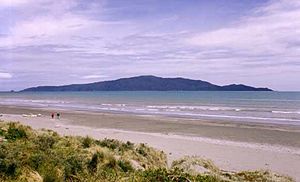
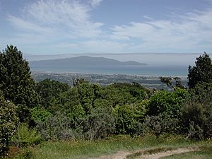
Kapiti Island seen from Waikanae Beach
|
|
| Country | New Zealand |
| Region | Wellington Region |
| Territorial authority | Kāpiti Coast District |
| Ward | Waikanae Ward |
| Community | Waikanae Community |
| Electorates |
|
| Area | |
| • Total | 19.59 km2 (7.56 sq mi) |
| Population
(June 2023)
|
|
| • Total | 13,150 |
| • Density | 671.3/km2 (1,738.6/sq mi) |
Waikanae (pronounced "why-kuh-NY") is a lovely town located on the Kāpiti Coast in New Zealand. It's about 60 kilometers (37 miles) north of Wellington, the capital city. The name "Waikanae" comes from the Māori language. It means "waters" (wai) "of the grey mullet" (a type of fish).
This area is famous for its beautiful 2.4-kilometer (1.5-mile) long beach. You can also find the Waikanae River estuary here. The Kapiti Marine Reserve and Kapiti Island are also nearby. Kapiti Island is about 4 kilometers (2.5 miles) offshore in the Tasman Sea. Waikanae is a popular place for people to retire. This is because it has mild weather all year round. It also gets moderate rain and less wind compared to Wellington.
The town is about 8 kilometers (5 miles) northeast of Paraparaumu. It is also 15 kilometers (9 miles) southwest of Ōtaki. The Waikanae railway station is the last stop on the Metlink train line. This line connects Waikanae with Wellington railway station in central Wellington.
Contents
Exploring Waikanae's Geography
Waikanae is nestled between the Tasman Sea and the rugged Tararua Range. It has open farmland and forests. Long ago, before people settled here, the Waikanae coast was full of wetlands. These wetlands had many natural waterways and kohekohe forests.
Waikanae and its neighbor, Waikanae Beach, are quiet places. They are popular with families and people who are retired. Just north of Waikanae is a small community called Peka Peka.
Natural Wonders of Waikanae
The area around Waikanae is known for its beautiful beach. It also has the Waikanae River estuary and Kapiti Island. Kapiti Island is about 4 kilometers (2.5 miles) offshore in the Tasman Sea. Waikanae Beach stretches for about 2.4 kilometers (1.5 miles). It goes from the Waikanae River estuary to the Waimeha Stream.
Part of the Kapiti Marine Reserve is between Kapiti Island and Waikanae Beach. It is next to the Waikanae Estuary Scientific Reserve. Sometimes, you can spot whales and Hector's dolphins here. They pass through this narrow area on their migration journeys.
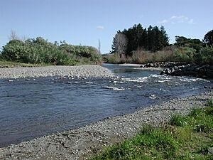
Inland, to the east of Waikanae, you'll find the Hemi Matenga Reserve. It is covered in bush. There are also the Tararua Ranges and the Akatarawa Valley. This valley is home to a conservation park and Staglands Wildlife Reserve & Cafe. A road through the valley, over the Akatarawa Saddle, connects to the Hutt Valley. This route goes through Reikorangi and Cloustonville. The Waikanae River starts where several streams meet in the Reikorangi Basin. From there, the river flows through a gap in the hills. It then crosses the coastal plain and sand dunes to reach the sea.
Waikanae's Climate
The Tararua Range protects Waikanae from strong winds from the south and east. Kapiti Island also provides shelter from the west. Because of this, Waikanae avoids the heavy winds and storms common in the nearby Cook Strait region. The shallow water at Waikanae Beach means the water temperature is warmer. This is different from the deeper coastlines of Wellington harbour to the south. The most common wind comes from the north-west. This wind pushes rain clouds inland towards the ranges. This leads to a lot of rain during winter and spring.
History and Culture of Waikanae
Experts believe that Waikanae might have been first settled by the Waitaha moa-hunters. This was as early as a thousand years ago. Later, different Iwi (tribal groups) like the Ngāti Apa, Rangitāne, and Muaūpoko settled here. This means the area is very important historically and mythologically for the Māori people of New Zealand. You can find more details about this on the Kāpiti Coast page.
In 1824, Waikanae Beach was a starting point for a large group of fighters. Between 2,000 and 3,000 warriors from coastal Iwi gathered here. They planned to take Kapiti Island from the Ngāti Toa tribe, led by Te Rauparaha. They crossed the strait in waka canoes under the cover of darkness. However, the attackers were met and defeated as they landed at the northern end of Kapiti Island.
Waikanae Marae
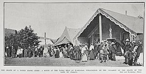
Whakarongotai Marae is located in Waikanae. A marae is a special social and cultural meeting place for Māori people. This marae belongs to Te Atiawa ki Whakarongotai. It includes the Whakarongotai or Puku Mahi Tamariki wharenui (meeting house).
Nature Reserves in Waikanae
Waikanae Beach is a home for many birds. These include terns, seagulls, oystercatchers, and stilts. The wetlands inland provide homes for pūkeko, crake, and New Zealand dabchicks. White-fronted herons, tūī, and shags can be seen across the coastal plain. The easy access to birds and seafood encouraged early Māori settlement here. Birds like ducks and black swans, which were brought here by people, have also thrived over the last 100 years.
Wildlife Protection Areas
The Waikanae Estuary Scientific Reserve is a very important reserve at the mouth of the Waikanae River. It was created in 1987. Its purpose is to protect the many bird species that use this area.
The Ngā Manu Nature Reserve is a 14-hectare (35-acre) reserve north of the town. It protects the largest remaining part of coastal lowland swamp forest on the Kāpiti Coast. It is a popular place for visitors. Pharazyn Reserve is north of Waikanae Beach. It is next to the Te Harakeke Swamp. This swamp is an important area of harakeke (flax) and raupō (bulrush) wetland. This site was once a sewage treatment plant in the 1970s. However, it was closed down in 2002. A long-term project began to restore the site. The goal was to turn it into a recreation and wildlife reserve. Today, it is known as one of the top 10 birdwatching spots in the Wellington region.
Hemi Matenga Memorial Scenic Reserve
East of Waikanae is the Hemi Matenga Reserve. This large 330-hectare (815-acre) forest covers a hill overlooking the town. It rises to 514 meters (1,686 feet) above sea level. The forest here has one of the biggest areas of kohekohe woodland left in New Zealand. The reserve was named after its previous owner, Hemi Matenga Waipunahau of the Ngāti Toa tribe. This happened after he passed away in 1912. The reserve has several walking tracks. It is also an extension of the Tararua Range.
Waikanae's Population
Statistics New Zealand defines Waikanae as a medium urban area. It covers 19.59 square kilometers (7.56 square miles). As of June 2023, it had an estimated population of 13,150 people. This means there are about 671.26 people per square kilometer.
| Historical population | ||
|---|---|---|
| Year | Pop. | ±% p.a. |
| 2006 | 10,563 | — |
| 2013 | 11,106 | +0.72% |
| 2018 | 12,711 | +2.74% |
In 2018, Waikanae had a population of 12,711 people. This was an increase of 1,605 people (14.5%) since 2013. It was also an increase of 2,148 people (20.3%) since 2006. There were 5,460 households. For every 100 females, there were about 85 males. About 14.8% of the people were under 15 years old. About 36.4% were aged 65 or older.
Most people in Waikanae are of European/Pākehā descent (90.9%). About 9.2% are Māori. Other groups include Pasifika (2.1%) and Asian (4.5%). About 24.9% of people were born overseas.
When asked about religion, 48.8% said they had no religion. About 41.3% were Christian. Smaller numbers followed Māori religious beliefs, Hinduism, Islam, or Buddhism.
Many people in Waikanae have higher education. About 25.5% of people aged 15 or older had a bachelor's degree or higher. About 37.0% of people aged 15 or older worked full-time.
What Waikanae Offers
The center of Waikanae village has many useful places. These include two supermarkets and the Toi Mahara gallery. There are also three bank branches, a health center, and pharmacies. You'll find a post shop, a war memorial hall, and a community hall. There's also the Kapiti Coast Museum, a church, a public library, and a cinema. Many other shops, restaurants, and businesses are here too. Waikanae has two primary schools, a golf course, and a bowling club. It also has the Waikanae Park rugby and cricket ground. Several retirement centers are located in the town.
Mahara Gallery is an art gallery that opened in 1996. It was updated in 2023 and is now called "Toi Mahara."
Te Araroa, which is New Zealand's long-distance walking trail, passes through Waikanae.
Homes in Waikanae
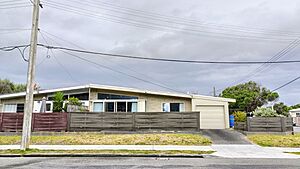
Waikanae has the most homes out of the 14 residential areas in the Kāpiti Coast District. Most of the houses in Waikanae were built between 1970 and 1979.
Many private gardens have been created in Waikanae. This has led to the town using a lot of water per person. The community gets its water from the Waikanae River. During warmer months, there can be water shortages. This is becoming a bigger problem for the area. Plans for new homes now include making sure there is enough water supply.
Getting Around Waikanae
The town is located on State Highway 1 and the North Island Main Trunk railway. In February 2017, the Kāpiti Expressway opened. This road helps State Highway 1 go around the town center. The opening of the Transmission Gully Motorway also made it easier for people to travel to and from Wellington.
Waikanae is the last stop on the Kapiti Line for the Metlink train service. This service started in February 2011. It uses the newly rebuilt Waikanae Railway Station. New Matangi electric trains also started running in 2011. Before that, the only direct train to Wellington was the Capital Connection. This train still leaves for Wellington in the morning and returns in the evening.
Local bus services connect Waikanae Village with Waikanae Beach and Ōtaki.
Local News and Media
A radio station called Beach FM 106.3 broadcasts from Waikanae Village. It covers the Kāpiti and Horowhenua districts. Two local newspapers also provide news for the Kāpiti region.
Schools in Waikanae
Waikanae School is a primary school for students in Year 1 to 8. It has 502 students as of February 2024.
Kapakapanui School is also a primary school for students in Year 1 to 8. It has 508 students.
Famous People from Waikanae
- Erunui Matioro Te Tupe-o-Tu: He was a tribal leader, warrior, and whaler. He retired to Waikanae in the early colonial period (1820s to 1850s).
- Jim Bolger: He was a former Prime Minister of New Zealand. He currently lives in Waikanae.
- Joan Bolger: She is the wife of Jim Bolger.
- Mary Cresswell: She is a poet.
|
 | Delilah Pierce |
 | Gordon Parks |
 | Augusta Savage |
 | Charles Ethan Porter |


