Waini River facts for kids
Quick facts for kids Waini River |
|
|---|---|
 |
|
|
Location of mouth
|
|
| Country | Guyana |
| Region | Barima-Waini |
| Physical characteristics | |
| Main source | 7°00′N 59°24′W / 7.0°N 59.4°W |
| River mouth | Atlantic Ocean Waini Point Sea level 8°23′25″N 59°50′14″W / 8.390186°N 59.837208°W |
| Basin features | |
| Tributaries |
|
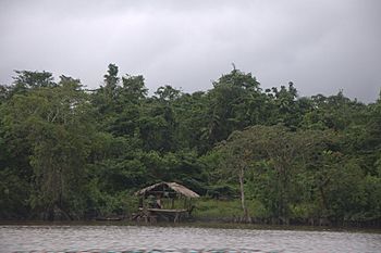
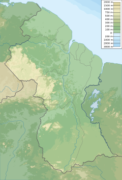
The Waini River is an important river located in the northern part of Guyana. It flows through the Barima-Waini region and eventually empties into the huge Atlantic Ocean. This river is special because its upper parts flow through lush, wet forests, while its lower parts pass through a large swampy area before reaching the sea.
Contents
Exploring the Waini River's Natural Wonders
The Waini River is home to many amazing natural features and important wildlife areas. It's a place where nature thrives.
Amazing Sea Turtle Nesting Grounds
Near where the Waini River meets the ocean, you'll find a special place called Almond Beach. This beach is super important for several types of sea turtles. It's one of the main places where leatherback, green, hawksbill, and olive ridley turtles come to lay their eggs.
Unique Coastal Environment
Almond Beach is also the only spot in Guyana that has a long, healthy stretch of mangrove forest. These unique trees grow in salty water and are very important for the environment. The area also has brackish water (a mix of fresh and salt water) and coastal swamps, making it a rich habitat for many different plants and animals.
Discovering Waini River's Waterfalls
The Waini River also features some beautiful waterfalls. There are three main waterfalls along its path. The one furthest upstream is called Kasatu Falls. It's a stunning sight to see the water tumbling down.
Villages Along the River
Several communities are located along the Waini River. These include the villages of Santa Cruz and Santa Rosa. Santa Rosa is a well-known Amerindian community, meaning it's home to some of the original people of the Americas.
See also
 In Spanish: Río Guainí para niños
- List of rivers of Guyana
- List of rivers of the Americas by coastline
 | Tommie Smith |
 | Simone Manuel |
 | Shani Davis |
 | Simone Biles |
 | Alice Coachman |


