Wall, Pennsylvania facts for kids
Quick facts for kids
Wall, Pennsylvania
|
|
|---|---|
|
Borough
|
|

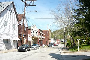
Main Street
|
|

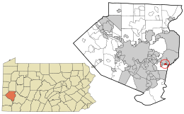
Location in Allegheny County and the U.S. state of Pennsylvania.
|
|
| Country | United States |
| State | Pennsylvania |
| County | Allegheny |
| Area | |
| • Total | 0.44 sq mi (1.13 km2) |
| • Land | 0.44 sq mi (1.13 km2) |
| • Water | 0.00 sq mi (0.00 km2) |
| Population
(2020)
|
|
| • Total | 519 |
| • Estimate
(2019)
|
557 |
| • Density | 1,271.69/sq mi (491.40/km2) |
| Time zone | UTC-5 (Eastern (EST)) |
| • Summer (DST) | UTC-4 (EDT) |
| FIPS code | 42-80600 |
Wall is a small town called a borough in Allegheny County, Pennsylvania, United States. In 2020, about 519 people lived there.
Contents
History of Wall Borough
Wall is built on land that James Walls bought in 1829. This land was on the south side of Turtle Creek. James' sons, Henry and John Walls, later owned the property. They lived in a log cabin near where Wall is today.
How Wall Got Its Name
In the early 1840s, a train station opened nearby. It was part of the Pennsylvania Railroad. People called it "Walls' Station" to honor the Walls family. Over time, the name became shorter, just "Wall Station."
Henry and John Walls sold their land to their cousin, Frank Wall. Frank was an engineer who worked on riverboats. He started building houses and developing the area around the station. Frank Wall built the first two houses there. Because of his work developing the land, the town was named after him.
Growth and Change in Wall
The town around Wall Station officially became "Wall Borough" in 1904. It grew quickly in the first half of the 1900s. This was because the Pennsylvania Railroad had a large freight depot in Wall. A freight depot is a place where goods are loaded and unloaded from trains.
However, in the second half of the 1900s, the town's population and economy started to shrink. This happened because more people began using airplanes and trucks to move goods. The railroad industry became less important.
Local Services and Media
Today, Channel 40, WPCB-TV, broadcasts from Wall. This is a local television station. Wall also shares a volunteer fire and rescue service. It works with East McKeesport to keep the community safe.
Geography of Wall
Wall is located at 40°23′36″N 79°47′16″W / 40.39333°N 79.78778°W. This means it's in a specific spot on the map.
Size of the Borough
The United States Census Bureau says that Wall is about 0.4 square miles (1.1 square kilometers) in total area. All of this area is land. There are no large bodies of water within the borough.
Neighboring Communities
Wall is mostly surrounded by North Versailles Township. This means North Versailles Township is on almost all sides of Wall. The only other town that borders Wall is Wilmerding, which is to the west.
Education in Wall
Students living in Wall attend schools in the East Allegheny School District. This school district serves several nearby communities.
Population Over Time
| Historical population | |||
|---|---|---|---|
| Census | Pop. | %± | |
| 1910 | 1,962 | — | |
| 1920 | 2,426 | 23.6% | |
| 1930 | 2,236 | −7.8% | |
| 1940 | 2,098 | −6.2% | |
| 1950 | 1,850 | −11.8% | |
| 1960 | 1,493 | −19.3% | |
| 1970 | 1,265 | −15.3% | |
| 1980 | 989 | −21.8% | |
| 1990 | 853 | −13.8% | |
| 2000 | 727 | −14.8% | |
| 2010 | 580 | −20.2% | |
| 2020 | 519 | −10.5% | |
| 2019 (est.) | 557 | −4.0% | |
| Sources: | |||
The population of Wall has changed a lot over the years. In 1910, nearly 2,000 people lived there. The population grew until the 1920s, then slowly started to decrease. By 2020, the population was 519 people.
Population Details from 2000
In the year 2000, there were 727 people living in Wall. The average age of people in Wall was 40 years old. About 19.7% of the population was under 18 years old. Also, 19.5% of the people were 65 years old or older.
See also
 In Spanish: Wall (Pensilvania) para niños
 | James Van Der Zee |
 | Alma Thomas |
 | Ellis Wilson |
 | Margaret Taylor-Burroughs |

