Turtle Creek (Monongahela River tributary) facts for kids
Quick facts for kids Turtle Creek |
|
|---|---|
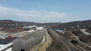
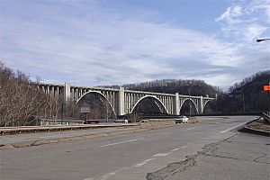
Turtle Creek, as seen looking north from the George Westinghouse Bridge
|
|
| Country | United States |
| State | Pennsylvania |
| Counties | Westmoreland, Allegheny |
| Physical characteristics | |
| Main source | 40°25′39″N 79°34′37″W / 40.4275675°N 79.5769871°W |
| River mouth | 718.7 ft (219.1 m) 40°23′23″N 79°51′07″W / 40.3897913°N 79.8519929°W |
| Length | 21.1 mi (34.0 km) |
| Basin features | |
| River system | Monongahela River |
| Basin size | 147.41 sq mi (381.8 km2) |
Turtle Creek is a stream in Pennsylvania, United States. It's about 21 miles (34 km) long. It flows through Allegheny and Westmoreland counties. This creek eventually flows into the Monongahela River.
Near where Turtle Creek meets the Monongahela River is Braddock, Pennsylvania. A famous battle called the Battle of the Monongahela happened there in 1755. Later, in the mid-1800s, the Pennsylvania Railroad built train tracks along the creek. These tracks were part of its main route from Philadelphia to Pittsburgh.
Contents
Where Turtle Creek Flows
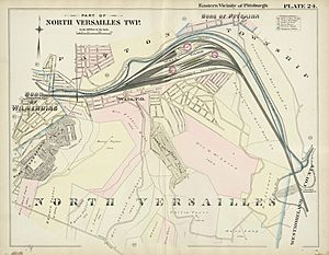
Turtle Creek starts in a place called Delmont. It then flows west through several towns. These towns include Export, Murrysville, Monroeville, Penn Township, Trafford, Pitcairn, Wilmerding, Turtle Creek, East Pittsburgh, and North Braddock. Finally, it joins the Monongahela River in North Versailles Township.
History of Turtle Creek
Early Days: The 1700s Frontier
The name "Turtle Creek" comes from Native American words. It means the area had many turtles.
In the mid-1700s, the Turtle Creek valley was on the edge of the British colony of Pennsylvania. Much of its early story is about the French and Indian War. In 1755, a big battle happened near where Turtle Creek meets the Monongahela River. British General Edward Braddock was badly hurt, and his soldiers had to retreat. They were trying to capture the French Fort Duquesne.
In 1758, General John Forbes led another, more successful, mission against the fort. He built a military road that crossed Turtle Creek in what is now Murrysville. After the war with the French ended in 1763, Pontiac's War began. During this war, Henry Bouquet's forces fought Native American tribes at the Battle of Bushy Run. After winning, Bouquet followed the tribes to Turtle Creek near where Pitcairn is today. He found their camp quickly left behind and called it a "Dirty Camp." This name inspired a small stream flowing into Turtle Creek, called "Dirty Camp Run."
After these conflicts, George Washington visited the area many times. He was part of both Braddock's and Forbes' missions. He is thought to have used roads along Brush Creek and Turtle Creek to get to and from Fort Pitt. Washington also stopped at the homes of early settlers in the area. One was Martha Miers, who ran an inn near Thompson Run. Another was John Fraser, who had served with Washington and settled near the mouth of Turtle Creek.
Railroads and Factories: The 1800s
About 100 years after the first military roads, another type of path was built: railroads. These railroads used the gentle slopes that Turtle Creek had carved. In 1852, the Main Line of the Pennsylvania Railroad opened. It carried people and goods between Philadelphia and Pittsburgh. The tracks were laid along the lower part of Turtle Creek.
Later, in 1891, the Turtle Creek Valley Railroad started service. It ran along the middle and upper parts of Turtle Creek. The Pennsylvania Railroad bought it in 1903. Andrew Carnegie's Union Railroad also ran along Turtle Creek. It connected to his steel factory, the Edgar Thomson Steel Works, in Braddock. George Westinghouse's Interworks Railway started in 1902. It linked his three big factories in the lower Turtle Creek valley.
As factories grew, new towns appeared along the creek. By 1876, the biggest towns were Port Perry (which no longer exists) and Turtle Creek. Pitcairn and Wall also grew because of the large train yards between them. East Pittsburgh, Wilmerding, and Trafford became home to workers from Westinghouse factories. The town of Export started as a mining town. It sent coal by train down the Turtle Creek Branch of the Pennsylvania Railroad.
Turtle Creek Today: The 21st Century
Today, much of the old railroad and factory setup is still there, but it has changed. The Pennsylvania Railroad's main line is now Norfolk Southern's Pittsburgh Line. It still carries a lot of freight. Passenger trains (Amtrak's Pennsylvanian) run only once a day. The Pitcairn Station is now a large shipping terminal.
The Edgar Thomson Steel Works and Union Railroad still operate. They are now owned by US Steel. Westinghouse's own railroad is gone. However, his airbrake factory still works under the name Wabtec. The old Westinghouse electrical plant is now an industrial park. Parts of the factories in Trafford are now baseball fields.
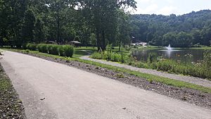
The Turtle Creek Branch of the Pennsylvania Railroad is now part of the Westmoreland Heritage Trail. The coal mines in the Turtle Creek area have all closed. But the water from these old mines still flows into the creek. This water, called abandoned mine drainage, can harm the fish and other life in the creek.
Turtle Creek Watershed
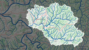
The Turtle Creek watershed is the entire area of land that drains water into Turtle Creek. About 66% of this area is in Westmoreland County. The rest is in Allegheny County. The watershed covers about 147 square miles (382 square kilometers). It includes forests, farms, old mines, and towns. The lower part of the watershed is a busy industrial area.
Different groups divide the watershed into smaller "subwatersheds." The United States Geological Survey (USGS) divides it into four main subwatersheds. The Turtle Creek Watershed Association (TCWA) divides these further into 14 smaller planning units.
| Designator | Subwatershead | Sq mi | Sq km |
| USGS | 050200050701 | 67.42 | 132.22 |
| TCWA | Upper Turtle Creek | 12.98 | 33.62 |
| TCWA | Steel's Run | 4.81 | 12.46 |
| TCWA | Haymaker Run | 10.97 | 28.41 |
| TCWA | Abers Creek | 10.64 | 27.56 |
| TCWA | Middle Turtle Creek | 19.24 | 7.43 |
| TCWA | Lyons Run | 8.78 | 22.74 |
| USGS | 050200050702 | 80.63 | 148.92 |
| TCWA | Upper Brush Creek | 26.13 | 67.68 |
| TCWA | Bushy Run | 13.94 | 36.10 |
| TCWA | Lower Brush Creek | 17.43 | 45.14 |
| USGS | 050200050704 | 18.43 | 47.73 |
| TCWA | Lower Turtle Creek | 10.02 | 25.95 |
| TCWA | Dirty Camp Run | 3.23 | 8.37 |
| TCWA | Sawmill Run | 2.02 | 5.23 |
| TCWA | Ardmore Run | 3.16 | 8.18 |
| USGS | 050200050703 | 15.87 | 41.10 |
| TCWA | Thompson Run | 15.87 | 41.10 |
Changes to Turtle Creek's Flow
Straightening the Creek Channel
In the mid-1900s, Turtle Creek became much straighter. This was especially true in its lower parts, between Trafford and the Monongahela River. This change was made because of the growth of factories and railroads in the area. The Pennsylvania Railroad made the biggest changes to the creek's path. George Westinghouse's factories and Andrew Carnegie's steel operations also caused changes.
In 1852, the Pennsylvania Railroad started running its main line along the lower part of Turtle Creek. In 1874, it bought land for its Wall Yard (later called Pitcairn Yard). Building this yard meant moving much of Turtle Creek north. The creek was moved again between 1903 and 1915 to straighten the tracks of the Westinghouse Interworks Railway. The railroad also moved the creek in Trafford to create a "wye." A wye is a Y-shaped track that lets trains change direction. A pond formed from part of the old creek bed. It was named "B-Y Pond" after a local farm and the wye.
When the creek's path was changed, the political borders of towns and counties were not moved. So, some strange borders now exist near Turtle Creek. For example, part of US Steel's Edgar Thomson Steel Works seems to be in North Braddock, but it's actually in North Versailles.
Westinghouse Dams
By 1908, there were at least two dams on Turtle Creek. They were built to get water for factories. One dam was at the Westinghouse Machine Company in East Pittsburgh. It was small and didn't block the creek much. The Trafford dam was larger, about eight feet tall and 50 feet wide. It was near where Turtle Creek meets Brush Creek.
When the Westinghouse factory in Trafford closed, the dam was no longer needed. The water behind the dam became a swimming spot, but it was dangerous due to strong currents. The dam also harmed fish and other water life. It made the water warmer, which meant less oxygen for fish. It also stopped fish from moving up and down the stream. The Trafford dam was finally removed in September 2013.
Controlling Floods
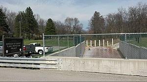
The Westinghouse factories in East Pittsburgh and Turtle Creek were often flooded. This happened when the Monongahela River rose so high that its water backed up into Turtle Creek. A big flood happened in 1936. To stop this, the Westinghouse Floodgate project was built from 1937 to 1938.
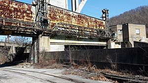
This project included two large gates. One gate, 80 by 30 feet, could be lowered to block the creek itself. The other gate, 40 by 20 feet, blocked a nearby road. Next to the gates was a building with three powerful pumps. These pumps could move a lot of water downstream if the gates were closed. The gates were designed to stop floods as long as the Monongahela River stayed below 750 feet above sea level. By 1999, local governments decided it was too expensive to keep the floodgates working. Photos from 2013 show they are no longer maintained.
The Westinghouse Floodgates protected the lower valley from river floods. But they didn't stop flash floods from smaller streams upstream. Big flash floods happened in 1911, 1942, and 1950. In 1954, Hurricane Hazel caused a record flood. Turtle Creek could only drain 5,100 cubic feet of water per second (cfs), but the flood brought 12,300 cfs. This caused about $13 million in damage.
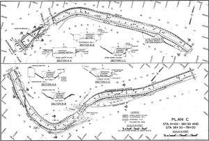
After this, the Turtle Creek District Flood Authority was created. They worked with the Army Corps of Engineers on a huge project to straighten and improve the creek's channel. From Trafford to 2.2 miles downstream, the creek was made wider and deeper. For the next 3.8 miles to the river, the channel was lined with stone and concrete. This part could handle 20,000 cfs. The concrete lining was finished in 1967. This improved channel has helped prevent major damage from floods like Hurricane Agnes in 1972 and Hurricane Ivan in 2004.
The June 2009 flood damaged not only the Thompson Run valley but also parts of Turtle Creek several miles upstream. The town of Export, where the upper part of Turtle Creek flows, had almost $2 million in damage from this flood. Work on a flood control system for Export began in 2010 and was finished in 2012.
This project includes a wall (levee) near the Dura-Bond steel factory. The levee has a small gate for train tracks, though the railroad stopped running after the 2009 flood. The levee guides Turtle Creek into a concrete channel that runs under a road for 1,315 feet. After this, smaller flows go into the natural creek channel, while extra water goes underground through a culvert for another 2,905 feet. This helps protect Export from floods.
 | Tommie Smith |
 | Simone Manuel |
 | Shani Davis |
 | Simone Biles |
 | Alice Coachman |


