Wallagaraugh River facts for kids
Quick facts for kids Wallagaraugh River |
|
|---|---|
 |
|
|
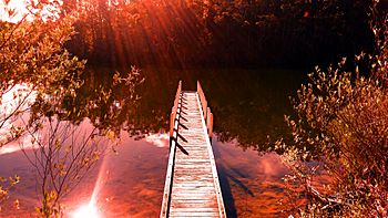
Mouth of the Wallagaraugh River, in Victoria
|
|
| Country | Australia |
| States | New South Wales, Victoria |
| Region | South East Corner (IBRA), South Coast |
| District | East Gippsland |
| Local government areas | Bega Valley, East Gippsland |
| Physical characteristics | |
| Main source | Mount Poole South Coast, New South Wales 424 m (1,391 ft) 37°12′S 149°30′E / 37.200°S 149.500°E |
| River mouth | confluence with the Genoa River east of Genoa, East Gippsland, Victoria 77 m (253 ft) 37°25′41″S 149°42′50″E / 37.42806°S 149.71389°E |
| Length | 34 km (21 mi) |
| Basin features | |
| River system | Genoa River catchment |
| Tributaries |
|
| Nature reserve | Nadgee |
The Wallagaraugh River is a river in Australia that flows all year round. It is part of the larger Genoa River system. The river starts in the South Coast area of New South Wales. Its lower parts flow through the East Gippsland region of Victoria.
Contents
About the Wallagaraugh River
The Wallagaraugh River begins its journey near a place called Mount Poole. This spot is about 10 kilometers (6 miles) northeast of Nungatta in New South Wales.
River's Path and Journey
The river flows mostly south, then turns east, and then south again. Along its way, it crosses an important line called the Black-Allan Line. This line forms part of the border between Victoria and New South Wales.
The Wallagaraugh River is joined by eight smaller streams, which are called tributaries. It also flows through the beautiful Nadgee Nature Reserve. Finally, the river meets the Genoa River at a place called Coleman Inlet. This meeting point is east of Genoa in Victoria.
River's Drop in Height
From where it starts to where it joins the Genoa River, the Wallagaraugh River drops about 423 meters (1,388 feet) in height. This happens over its total length of 66 kilometers (41 miles).
Crossing the River
North of the Black-Allan Line, the main road called the Princes Highway crosses over the Wallagaraugh River. This part of the river is within the Nadgee State Forest.
 | Claudette Colvin |
 | Myrlie Evers-Williams |
 | Alberta Odell Jones |


