Wambaw Swamp facts for kids
Quick facts for kids Wambaw Swamp Wilderness |
|
|---|---|
|
IUCN Category Ib (Wilderness Area)
|
|
| Location | Charleston County, South Carolina, USA |
| Nearest city | McClellanville, South Carolina |
| Area | 4,755 acres (19 km2) |
| Established | 1980 |
| Governing body | U.S. Forest Service |
| Wambaw Creek Wilderness | |
|---|---|
|
IUCN Category Ib (Wilderness Area)
|
|
| Location | Charleston County, South Carolina and Berkeley County, South Carolina, USA |
| Nearest city | McClellanville, South Carolina |
| Area | 1,832 acres (7 km2) |
| Established | 1980 |
| Governing body | U.S. Forest Service |
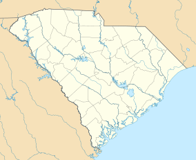
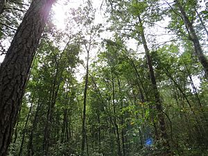
The Wambaw Swamp is a large wetland area found in Charleston County, South Carolina. It is part of the Francis Marion National Forest. This special place is protected as a wilderness area, which means it's kept wild and natural. It covers about 4,755 acres (19.24 km2) and is a mix of forests with hardwood trees and pine trees.
Near the main Wambaw Swamp, you'll find two other important wilderness areas:
- The Little Wambaw Swamp Wilderness is about 4,967 acres (20.10 km2). It's similar to the main swamp but has more dry land, which is good for walking and camping.
- The Wambaw Creek Wilderness protects 1,832 acres (7.41 km2) along the Wambaw Creek. This creek flows from the swamps into the South Santee River.
These areas are managed by the U.S. Forest Service, which helps keep them safe and natural for everyone to enjoy.
Contents
How Wambaw Swamp Was Formed
The Wambaw Swamp is located in a flat area near the coast, called the coastal terraces. Its unique features were created by the Atlantic Ocean many, many years ago during a time called the Pleistocene epoch.
Ocean's Ancient Movements
During the Pleistocene, the Atlantic Ocean's water levels changed a lot. The ocean moved forward and backward over this land many times. Each time the ocean moved, it left behind different features.
Creating Terraces and Swamps
As the ocean moved, it created areas that were once flat tidal flats and also barrier islands. These are similar to the beaches and islands you see along the coast today. When the ocean finally moved back, these old features were left behind on higher ground.
Today, these old shorelines look like flat steps, called terraces, and steep slopes, called scarps. These scarps act like natural walls that stop water from draining away easily. This causes water to collect behind them, forming swamps like the Wambaw Swamp system.
Different Swamp Sections
The highest part of this swamp system is the Little Wambaw Swamp. It formed on a specific terrace called the Princess Anne Terrace. This area is bordered by two scarps: the Mount Pleasant Scarp to the south and the Awendaw Scarp to the north.
Water from the Little Wambaw Swamp flows north through a gap in the Awendaw Scarp. This water then enters the main Wambaw Swamp. The main Wambaw Swamp is located between the Awendaw Scarp and another scarp called the Cainhoy Scarp, on the Pamlico Terrace. Finally, the Wambaw Swamp's water flows east, running parallel to the scarps and the coast, until it reaches the Santee River.
 | Delilah Pierce |
 | Gordon Parks |
 | Augusta Savage |
 | Charles Ethan Porter |


