Wapous River facts for kids
Quick facts for kids Wapous |
|
|---|---|

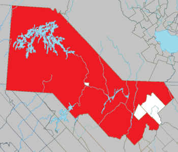
Location of Gouin Reservoir in Haute-Mauricie
|
|

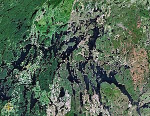
Map of Gouin Reservoir seen from space
|
|
| Country | Canada |
| Province | Quebec |
| Region | Mauricie |
| Physical characteristics | |
| Main source | Unidentified Lake La Tuque, Mauricie, Quebec 526 m (1,726 ft) 48°45′12″N 74°15′21″W / 48.75333°N 74.25583°W |
| River mouth | Gouin Reservoir (lac Déziel) La Tuque, Mauricie, Quebec 402 m (1,319 ft) 48°34′55″N 74°22′15″W / 48.58194°N 74.37083°W |
| Length | 31.6 km (19.6 mi) |
| Basin features | |
| Tributaries |
|
The Wapous River is a river in Quebec, Canada. It flows into the Gouin Reservoir. The river is located in the town of La Tuque, in the Mauricie region.
The Wapous River flows through areas like Lindsay, Berlinguet, and Déziel. It's close to the border of the Saguenay-Lac-Saint-Jean region. The main activity in this river valley is forestry, which means cutting down trees. People also enjoy outdoor activities and tourism here.
A forest road helps people reach the upper part of the river. This road connects to Route 212, which goes around the north-east side of the Gouin Reservoir. This route links the village of Obedjiwan, Quebec and La Tuque.
The Wapous River usually freezes over from mid-November until the end of April. However, it's generally safe to walk or travel on the ice from early December to late March.
River's Journey
The Wapous River is surrounded by many other waterways and lakes. Here are some of them:
- To the north: Oskatcickic Creek, Townsend Creek, Normandin River, Normandin Lake (Normandin River), Buade Lake (Normandin River).
- To the east: Berlinguet Lake, Berlinguet Creek, Little Creek, Du Loup River (Ashuapmushuan Lake), Trenche River South.
- To the south: Atimokateiw River, Leblanc River (Gouin Reservoir), Gouin Reservoir, Jean-Pierre River (Gouin Reservoir), Déziel Lake.
- To the west: Gouin Reservoir, Magnan Lake, McSweeney Lake.
The Wapous River starts from an unnamed lake. This lake is about 0.4 kilometers long and sits at an elevation of 526 meters. The starting point of the river is:
- 20.9 kilometers north-east of where the Wapous River meets the Gouin Reservoir.
- 46.1 kilometers north-west of the dam at the start of the Saint-Maurice River.
- 51.8 kilometers north-east of the village of Obedjiwan, Quebec.
- 181.5 kilometers north-west of downtown La Tuque.
From its starting lake, the Wapous River flows for 31.6 kilometers. Here's how it flows:
- It goes south for 2.2 kilometers through Trap Lake.
- Then, it flows south for 5.9 kilometers, passing through Cold Lake and the "Lake De La Loupe."
- It continues south-east for 2.4 kilometers in Berlinguet Township, crossing Lake First.
- It then turns towards the east for 1.3 kilometers.
- Next, it flows south-west for 12.0 kilometers.
- Finally, it flows south for 7.8 kilometers in Déziel County, making a large S-shape before reaching its end.
The Wapous River joins the Normandin River at a specific point. This meeting point is:
- 5.0 kilometers north of the mouth of Lake Déziel.
- 34.9 kilometers north-west of the Gouin Reservoir dam.
- 87.2 kilometers north-west of the village of Wemotaci.
- 174.2 kilometers north-west of downtown La Tuque.
- 283.7 kilometers north-west of where the Saint-Maurice River meets the Saint Lawrence River at Trois-Rivières.
The Wapous River flows into the eastern side of Déziel Lake. This lake is actually an extension of the Gouin Reservoir. From where the Wapous River meets Déziel Lake, the water flows south into the Gouin Reservoir. It travels 5.4 kilometers through Déziel Lake and then 38.8 kilometers through Kikendatch Bay until it reaches the Gouin Dam.
River's Name
In the past, this river was known as the "Black Castor River."
The name "Wapous River" was officially given on December 5, 1968. This happened when the Commission de toponymie du Québec (Quebec's place name commission) was created.
 | Charles R. Drew |
 | Benjamin Banneker |
 | Jane C. Wright |
 | Roger Arliner Young |

