Ward Branch (Browns Branch tributary) facts for kids
Quick facts for kids Ward Branch |
|
|---|---|
|
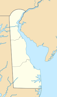
Location of Ward Branch mouth
|
|
| Other name(s) | Tributary to Browns Branch |
| Country | United States |
| State | Delaware |
| County | Kent |
| Physical characteristics | |
| Main source | Lednum Branch divide about 1 mile east-northeast of Marvels Crossroads, Delaware 44 ft (13 m) 38°56′35″N 075°29′07″W / 38.94306°N 75.48528°W |
| River mouth | Browns Branch about 1 mile northeast of Argos Choice, Delaware 0 ft (0 m) 38°58′14″N 075°29′15″W / 38.97056°N 75.48750°W |
| Length | 2.19 mi (3.52 km) |
| Basin features | |
| Progression | generally north |
| River system | Murderkill River |
| Basin size | 2.07 square miles (5.4 km2) |
| Tributaries |
|
| Bridges | Sandbox Road, DE 15 |
Ward Branch is a small stream, about 2.19 miles (3.52 km) long. It flows into a larger stream called Browns Branch. This stream is located in Kent County, Delaware, in the United States. Ward Branch is like a smaller helper stream, bringing its water to Browns Branch.
Where Does Ward Branch Start and End?
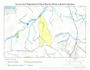
Ward Branch begins in an area near Marvels Crossroads, Delaware. It starts where the land divides the water flow, about 1 mile east-northeast of the crossroads. The stream then flows generally north.
It travels for a little over two miles. Finally, Ward Branch joins Browns Branch. This meeting point is about 1 mile northeast of Argos Choice, Delaware.
What is the Ward Branch Watershed?
A watershed is an area of land where all the water drains into a specific stream or river. The Ward Branch watershed covers about 2.07 square miles (5.36 square kilometers). This means all the rain that falls in this area will eventually flow into Ward Branch.
The area receives about 45.6 inches (116 cm) of rain each year. About 6.7% of the land in the watershed is covered by forests. These forests help keep the water clean. They also provide homes for many animals.
Maps
 | Bessie Coleman |
 | Spann Watson |
 | Jill E. Brown |
 | Sherman W. White |


