Browns Branch (Murderkill River tributary) facts for kids
Quick facts for kids Browns Branch |
|
|---|---|
|
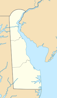
Location of Browns Branch mouth
|
|
| Other name(s) | Tributary to Murderkill River |
| Country | United States |
| State | Delaware |
| County | Kent |
| Physical characteristics | |
| Main source | Nanticoke River divide about 1 mile south of Harrington, Delaware 58 ft (18 m) 38°53′45″N 075°33′50″W / 38.89583°N 75.56389°W |
| River mouth | Murderkill River about 1 mile south-southwest of Frederica, Delaware 0 ft (0 m) 38°59′12″N 075°28′32″W / 38.98667°N 75.47556°W |
| Length | 10.27 mi (16.53 km) |
| Basin features | |
| Progression | northeast |
| River system | Murderkill River |
| Basin size | 23.02 square miles (59.6 km2) |
| Tributaries |
|
| Waterbodies | McColley Pond |
| Bridges | Corn Crib Road, Cluckey Drive, DE 14, Jackson Ditch Road (x2), Killens Pond Road, Sandbox Road, Canterbury Road, Fork Landing Road |
Browns Branch is a stream in Kent County, Delaware. It is about 10 miles (16 kilometers) long. This stream flows into the Murderkill River.
Contents
What is Browns Branch?
Browns Branch is a stream that is part of a larger river system. It's known as a "3rd order tributary." This means it's a smaller stream that flows into a medium-sized stream, which then flows into a larger river. In this case, Browns Branch flows into the Murderkill River.
Where Does Browns Branch Start and End?
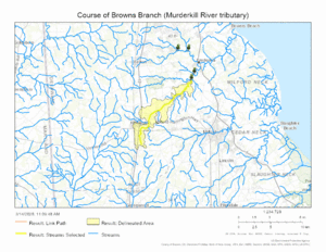
Browns Branch begins in an area called the Nanticoke River divide. This is a high point where water can flow in different directions. Its starting point is about one mile south of a town called Harrington, Delaware.
From there, Browns Branch flows towards the northeast. It travels about 10 miles before it reaches its end. The stream joins the Murderkill River about one mile south-southwest of Frederica, Delaware.
What is the Browns Branch Watershed?
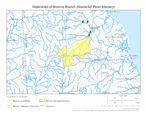
A watershed is all the land where water drains into a particular river or stream. The Browns Branch watershed covers an area of about 23 square miles (about 60 square kilometers).
This area gets about 45.4 inches (115 centimeters) of rain each year. About 10% of the land in the watershed is covered by forests. This means a good portion of the area around the stream has trees.
Other Names for Browns Branch
Sometimes, streams and rivers have more than one name. According to official government records, Browns Branch has also been known by another name in the past:
- Spring Branch
Maps
 | Selma Burke |
 | Pauline Powell Burns |
 | Frederick J. Brown |
 | Robert Blackburn |


