Warner, Oklahoma facts for kids
Quick facts for kids
Warner, Oklahoma
|
|
|---|---|

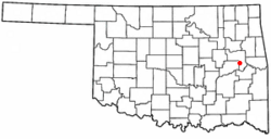
Location of Warner, Oklahoma
|
|
| Country | United States |
| State | Oklahoma |
| County | Muskogee |
| Area | |
| • Total | 1.89 sq mi (4.90 km2) |
| • Land | 1.85 sq mi (4.79 km2) |
| • Water | 0.04 sq mi (0.11 km2) |
| Elevation | 561 ft (171 m) |
| Population
(2020)
|
|
| • Total | 1,593 |
| • Density | 861.08/sq mi (332.49/km2) |
| Time zone | UTC-6 (Central (CST)) |
| • Summer (DST) | UTC-5 (CDT) |
| ZIP code |
74469
|
| Area code(s) | 539/918 |
| FIPS code | 40-78400 |
| GNIS feature ID | 2413450 |
Warner is a small town in Muskogee County, Oklahoma, in the United States. In 2020, about 1,593 people lived there. The town is special because it is home to one of the two campuses of Connors State College.
Contents
History of Warner
The town of Warner started from two older communities called Bennett and Hereford. These places were once part of the Cherokee Nation's Canadian District.
Bennett had a post office from 1895 to 1904. It was about 3 miles (4.8 km) southeast of where Warner is today. Hereford was located right where Warner stands now. It was founded in 1903 and then renamed Warner in 1905.
Railroads and Growth
Trains played a big role in Warner's early days. The Muskogee Southern Railroad, which later became the Midland Valley Railroad, built tracks through the town around 1902-1903.
For a short time, Warner was a connection point for trains. Another railway, the Webbers Falls, Shawnee and Western Railroad, connected Warner to Webbers Falls, Oklahoma in 1911. However, this railway stopped running in 1914 and was taken apart by 1918.
Connors State College
A very important part of Warner's history is Connors State Agricultural College. It was started in Warner in 1908. Later, a second campus was added in Muskogee.
In 2001, the school changed its name to Connors State College. Today, this college is the biggest employer in Warner. It provides many jobs for people living in the town.
Geography of Warner
Warner is located about 20 miles (32 km) south of the city of Muskogee. You can find it along U.S. Highway 64.
The town covers a total area of about 1.3 square miles (3.4 km2). All of this area is land, meaning there are no large lakes or rivers within the town limits.
Population Facts
| Historical population | |||
|---|---|---|---|
| Census | Pop. | %± | |
| 1920 | 318 | — | |
| 1930 | 316 | −0.6% | |
| 1940 | 391 | 23.7% | |
| 1950 | 382 | −2.3% | |
| 1960 | 881 | 130.6% | |
| 1970 | 1,217 | 38.1% | |
| 1980 | 1,310 | 7.6% | |
| 1990 | 1,479 | 12.9% | |
| 2000 | 1,430 | −3.3% | |
| 2010 | 1,641 | 14.8% | |
| 2020 | 1,593 | −2.9% | |
| U.S. Decennial Census | |||
In 2000, there were 1,430 people living in Warner. They lived in 509 households, and 344 of these were families. The town had about 1,128 people per square mile (435.6 per km2).
Many different groups of people live in Warner. In 2000, about 65% of the people were White, 4% were African American, and 24% were Native American. About 6% of the people were from two or more races. A small number, about 2.4%, were Hispanic or Latino.
Households and Families
Out of all the households in 2000, about 31% had children under 18 living there. More than half, about 52.5%, were married couples. About 12.6% were households led by a single mother.
The average household had about 2.45 people. The average family had about 2.99 people.
Age and Income
The population of Warner is spread out across different age groups. In 2000, about 23% of the people were under 18. About 24.8% were between 18 and 24 years old. The median age in the town was 27 years old.
The average income for a household in Warner was $22,500 in 2000. For families, the average income was $27,596. Some families and people in Warner had lower incomes. About 20% of families and 25.3% of the total population were in this group. This included about 42% of children under 18 and 19% of people aged 65 or older.
See also
 In Spanish: Warner (Oklahoma) para niños
 | Janet Taylor Pickett |
 | Synthia Saint James |
 | Howardena Pindell |
 | Faith Ringgold |

