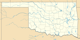
Waurika Lake facts for kids
Quick facts for kids Waurika Lake |
|
|---|---|
| Location | Jefferson County, Oklahoma |
| Coordinates | 34°16′55″N 98°04′40″W / 34.28194°N 98.07778°W |
| Type | Reservoir |
| Primary inflows | Beaver Creek, Oklahoma |
| Primary outflows | Beaver Creek, Oklahoma |
| Catchment area | 562 sq mi (1,460 km2) |
| Managing agency | U.S. Army Corps of Engineers |
| Built | 1963 |
| First flooded | 1980 |
| Max. length | 11 mi (18 km) |
| Surface area | 10,000 acres (4,000 ha) |
| Water volume | 192,000 acre⋅ft (0.237 km3) |
| Shore length1 | 80 mi (130 km) |
| Surface elevation | 951 ft (290 m) |
| Settlements | Waurika, Oklahoma |
| 1 Shore length is not a well-defined measure. | |
Waurika Lake is a large, man-made lake in southwestern Oklahoma. It's a type of lake called a reservoir, which means it was created by building a dam across a river. Waurika Lake is mostly in Jefferson County, near the town of Waurika.
This lake is very important for many reasons. It helps control floods, provides water for farms to grow crops, and supplies drinking water to several cities like Lawton and Duncan. It also helps keep the water clean, supports fish and wildlife, and offers fun activities like boating and fishing. The area around the lake includes a special wildlife management zone that covers about 6,040 acres.
Sometimes, the lake faces challenges. Hot summers can cause a lot of water to evaporate. Also, dirt and clay can build up near the water pumps. This makes it harder to get water out of the lake. However, heavy rains can help raise the lake levels again.
Contents
About Waurika Lake
Waurika Lake was formed by building the Waurika Dam. This dam is located on Beaver Creek, which flows into the Red River. The area that drains into the lake covers about 562 square miles.
Building the Waurika Dam started in 1963 and was finished in 1980. The lake is about 11 miles long. When the water is at its normal level, the lake holds about 192,000 acre-feet of water. Its surface covers about 10,000 acres, and it has about 80 miles of shoreline.
Lake Challenges and Solutions
Waurika Lake has faced some environmental issues, especially during long periods of dry weather. When there isn't much rain, the lake's water levels drop. This can cause problems for the lake and the communities that rely on its water.
Dealing with Drought
Long dry spells, like the ones in 2011 and 2012, have seriously affected Waurika Lake. When water levels get low, cities that use the lake's water have to take steps to save water. This might include limiting how often people can water their lawns or charging more for water. A lot of water can also evaporate during hot, dry times.
Algae Blooms
In August 2011, experts found a lot of blue-green algae in the lake. This type of algae can produce toxins that are harmful to people. Because of this, swimming beaches at the lake had to be closed to keep everyone safe. By December, the algae levels had dropped, and the ban was lifted, but people were still advised to be careful.
Silt Build-up
In 2013, a study showed that a lot of clay and dirt had built up near the lake's water pumps. This happens when water levels are low and a lot of water is being used. Even though the lake got some rain, it wasn't enough to solve the problem for long.
To help with this, officials have suggested that cities use 10 percent less water. They are also thinking about "dredging," which means removing the built-up dirt from the bottom of the lake. This project would cost a lot of money, but it would help keep the water flowing. Low water levels can also make the lake more dangerous for boaters, as old trees and other hidden obstacles might appear.
 | Selma Burke |
 | Pauline Powell Burns |
 | Frederick J. Brown |
 | Robert Blackburn |


