
Wauzeka, Wisconsin facts for kids
Quick facts for kids
Wauzeka, Wisconsin.
|
|
|---|---|
 |
|

Location of Wauzeka in Crawford County, Wisconsin.
|
|
| Country | |
| State | |
| County | Crawford |
| Area | |
| • Total | 4.84 sq mi (12.53 km2) |
| • Land | 4.82 sq mi (12.49 km2) |
| • Water | 0.02 sq mi (0.04 km2) |
| Elevation | 863 ft (263 m) |
| Population
(2020)
|
|
| • Total | 628 |
| • Density | 130.2/sq mi (50.3/km2) |
| Time zone | UTC-6 (Central (CST)) |
| • Summer (DST) | UTC-5 (CDT) |
| Area code(s) | 608 |
| FIPS code | 55-84725 |
| GNIS feature ID | 1576337 |
Wauzeka is a small village in Wisconsin, a state in the United States. It's found in Crawford County. In 2020, about 628 people lived there. Wauzeka is special because it's located near where two rivers meet: the Kickapoo River and the Wisconsin River.
Contents
History of Wauzeka
The village of Wauzeka was first planned in 1856. A man named Hercules L. Dousman created the first maps for it. Another person, John McHarg, added more land in 1857. He was a veteran from the Mexican–American War.
The village got its name from a Native American leader. His name in the Ho-Chunk language was Waaziga, which means "Pine Tree." In 1857, Wauzeka became connected to the Milwaukee & Mississippi Railroad. This helped the village grow. During the 1800s, Wauzeka had many sawmills. These mills processed pine wood that was floated down the Kickapoo River.
Where is Wauzeka?
Wauzeka is located at 43°5′6″N 90°53′1″W / 43.08500°N 90.88361°W. This means it's in the southwestern part of Wisconsin.
The village covers a total area of about 4.84 square miles (12.54 km2). Most of this area, about 4.82 square miles (12.48 km2), is land. A very small part, about 0.02 square miles (0.05 km2), is water.

People Living in Wauzeka
| Historical population | |||
|---|---|---|---|
| Census | Pop. | %± | |
| 1900 | 471 | — | |
| 1910 | 476 | 1.1% | |
| 1920 | 479 | 0.6% | |
| 1930 | 519 | 8.4% | |
| 1940 | 513 | −1.2% | |
| 1950 | 564 | 9.9% | |
| 1960 | 494 | −12.4% | |
| 1970 | 437 | −11.5% | |
| 1980 | 580 | 32.7% | |
| 1990 | 595 | 2.6% | |
| 2000 | 768 | 29.1% | |
| 2010 | 711 | −7.4% | |
| 2020 | 628 | −11.7% | |
| U.S. Decennial Census | |||
The number of people living in Wauzeka changes over time. The table above shows how the population has changed since 1900.
Wauzeka's Population in 2020
In 2020, the village had 628 people. This means there were about 130.2 inhabitants per square mile (50.3/km2) people for every square mile. There were 305 homes in the village.
Most people in Wauzeka were White (94.4%). There were also smaller numbers of Asian, Native American, and Black or African American residents. About 4% of the population identified as being from two or more races. A small group (0.5%) were Hispanic or Latino.
Wauzeka's Population in 2010
In 2010, there were 711 people living in Wauzeka. The population density was 147.5 inhabitants per square mile (57.0/km2). There were 304 homes.
Most people were White (95.8%). Other groups included African American, Native American, and Asian residents. About 1.7% of people were from two or more races. Hispanic or Latino people made up 1.8% of the population.
There were 273 households in 2010.
- 37% of households had children under 18.
- 46.9% were married couples.
- 13.9% were single mothers.
- 6.6% were single fathers.
- 32.6% were people living alone or with non-family members.
The average age in the village was 33 years old.
- 28.8% of residents were under 18.
- 8.1% were between 18 and 24.
- 27.5% were between 25 and 44.
- 26% were between 45 and 64.
- 9.6% were 65 or older.
The village had a nearly equal number of males (49.8%) and females (50.2%).
Famous People from Wauzeka
Some people who became well-known have connections to Wauzeka:
- Cyrus L. Lathrop was born in Wauzeka. He was a farmer and a lawmaker in Wisconsin.
- Jeremiah O'Neil lived in Wauzeka. He was a judge and also a lawmaker in Wisconsin.
Images for kids
-
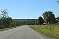
Sign on WIS60
-
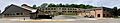
Wauzeka-Steuben Schools
-
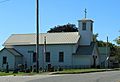
Sacred Heart Catholic Church
-
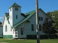
Wauzeka United Methodist Church


See also
 In Spanish: Wauzeka (Wisconsin) para niños
