Weaver Mountains facts for kids
Quick facts for kids Weaver Mountains |
|
|---|---|
| Highest point | |
| Peak | Weaver Peak |
| Elevation | 6,574 ft (2,004 m) |
| Dimensions | |
| Length | 25 mi (40 km) NW-SE |
| Width | 12 mi (19 km) |
| Geography | |
| Country | United States |
| Settlement | Yarnell |
| Range coordinates | 34°13′21″N 112°44′59″W / 34.22250°N 112.74972°W |
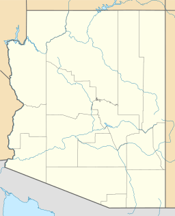
The Weaver Mountains are a smaller mountain range in Arizona. You can find them in the central-west part of Yavapai County. They are southwest of the Bradshaw Mountains. The town of Yarnell is right in the middle of these mountains. Yarnell sits at the top of Yarnell Hill on Arizona State Route 89.
Exploring the Weaver Mountains
This mountain range stretches from the northwest to the southeast. On its eastern side, it turns more towards the east. The Hassayampa River separates the Weaver Mountains from the Bradshaw Mountains to the northeast, east, and southeast.
Famous Peaks in the Range
The Weaver Mountains have several important peaks. Here are some of them, starting from the northwest:
- Ritter Peak
- Weaver Peak
- Rocky Boy Peak
- Antelope Peak
- Rich Hill
- Weaver Mountain
- Wades Butte
Two other peaks, Sam Powell Peak and Seal Mountain, are located near the Hassayampa River. Weaver Peak is about 7 miles (11 km) west of Yarnell. To the west and southwest, the Weaver Mountains are separated from the smaller Date Creek Mountains by Cottonwood Creek and a valley.
History and Fun Facts
The Weaver Mountains are well-known for their old mines. People also found a lot of gold here, especially "placer gold." Placer gold is gold found in riverbeds or streams, often in small flakes or nuggets. It was a big deal during the gold rush times!
 | Sharif Bey |
 | Hale Woodruff |
 | Richmond Barthé |
 | Purvis Young |


