Date Creek Mountains facts for kids
Quick facts for kids Date Creek Mountains |
|
|---|---|
| Highest point | |
| Peak | Tenderfoot Hill (Date Creek Mountains (east terminus)) |
| Elevation | 3,477 ft (1,060 m) |
| Dimensions | |
| Length | 13 mi (21 km) E-W |
| Geography | |
| Country | United States |
| State | Arizona |
| Region | (northwest)-Sonoran Desert (Maria fold and thrust belt) |
| District | Yavapai County |
| Settlement | Congress, Arizona |
| Borders on | Weaver Mountains-NE Vulture Mountains-SE Aguila Valley-S McMullen Valley-SW Butler Valley & Harcuvar Mtns-WSW Alamo Lake-W Maria fold and thrust belt– NW, W & SW |
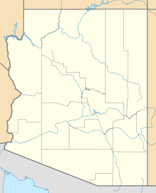
The Date Creek Mountains are a small, dry mountain range in Yavapai County, Arizona, in the southwestern part of the state. The town of Congress is located near the mountains' southeastern base. Another town, Wickenburg, is about 15 miles (24 km) to the southeast.
Contents
About the Date Creek Mountains
The Date Creek Mountains are about 13 miles (21 km) long. They are found in the western part of the Arizona transition zone. This is an area where different types of land meet.
Where are the Date Creek Mountains?
To the southwest, the mountains meet the lower Sonoran Desert. A major road, U.S. Route 93 in Arizona, runs through this desert area. This road goes from Phoenix, Arizona to Kingman, Arizona. People sometimes call this stretch the "Joshua Tree Highway." This is because Joshua trees grow here. This area is also where the Mojave Desert extends to the southeast.
The Date Creek Mountains also help separate the southeast Mojave and northwest Sonoran deserts. This region is part of something called the Maria fold and thrust belt. This is a geological area with many folded and pushed-up rocks.
Highest Point in the Range
The highest point in the Date Creek Mountains is called Tenderfoot Hill. It is located on the southeastern side of the range. Tenderfoot Hill stands at about 3,477 feet (1,059 meters) tall.
Nearby Mountain Ranges
The Date Creek Mountains are surrounded by other interesting landforms. To the northeast are the Weaver Mountains. The Vulture Mountains are to the southeast.
To the southwest, you'll find the McMullen Valley. The Butler Valley and Harcuvar Mountains are also to the southwest. Alamo Lake is located to the west.
Important Geological Area
The region around the Date Creek Mountains is part of the Maria fold and thrust belt. This area has many mountain ranges that were formed by huge forces pushing the Earth's crust. These ranges include:
This geological area is very complex. It includes many different mountains and valleys. The Bill Williams River forms the northern border of this area. This river also helps divide the Mojave Desert to the north from the Sonoran Desert to the south.
 | Toni Morrison |
 | Barack Obama |
 | Martin Luther King Jr. |
 | Ralph Bunche |


