Wellin facts for kids
Quick facts for kids
Wellin
Welin (Walloon)
|
||
|---|---|---|
 |
||
|
||
| Country | Belgium | |
| Community | French Community | |
| Region | Wallonia | |
| Province | Luxembourg | |
| Arrondissement | Neufchâteau | |
| Area | ||
| • Total | 67.52 km2 (26.07 sq mi) | |
| Population
(2018-01-01)Lua error in Module:Wd at line 1575: attempt to index field 'wikibase' (a nil value).
|
||
| • Total | Lua error in Module:Wd at line 1,575: attempt to index field 'wikibase' (a nil value). | |
| Postal codes |
6920-6922, 6924
|
|
| Area codes | 084 | |
| Website | wellin.be | |
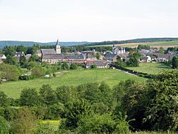
Wellin is a small town and a group of villages located in the southern part of Belgium. It's found in a region called Wallonia, which is known for speaking French. Wellin is part of the Luxembourg province, which is one of the ten provinces in Belgium.
About Wellin
Wellin is officially known as a municipality. This means it's a local government area, similar to a city or a county in other countries. The name "Wellin" is pronounced "weh-LAN" in French. In the local Walloon language, it's called "Welin."
Geography and People
Wellin covers an area of about 67.52 square kilometers. That's roughly the size of 6,752 football fields! As of January 1, 2007, about 2,958 people lived there. This means there were about 43.8 people living in each square kilometer. This is called the population density.
Villages of Wellin
The municipality of Wellin is made up of several smaller areas. These are sometimes called districts or "deelgemeente" in Dutch. The main districts include:
- Chanly
- Halma
- Lomprez
- Sohier
- Wellin (the main town itself)
Other smaller communities and villages within the Wellin area are:
- Barzin
- Froidlieu
- Fays-Famenne
- Neupont
See also
 In Spanish: Wellin para niños
 | Aaron Henry |
 | T. R. M. Howard |
 | Jesse Jackson |


