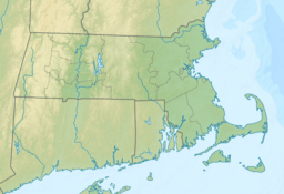
Wequaquet Lake facts for kids
Quick facts for kids Wequaquet Lake |
|
|---|---|
| Location | Barnstable County, Massachusetts |
| Coordinates | 41°40′17″N 70°20′20″W / 41.6713876°N 70.3389619°W |
| Primary outflows | Centerville River |
| Surface area | 654 acres (265 ha) |
| Average depth | 14 feet (4.3 m) |
| Max. depth | 32 feet (9.8 m) |
| Shore length1 | 7.5 miles (12.1 km) |
| Surface elevation | 33 feet (10 m) |
| Settlements | Hyannis |
| 1 Shore length is not a well-defined measure. | |
Wequaquet Lake is a large, beautiful lake in Barnstable County, Massachusetts. It covers about 654 acres, which is like 500 football fields! This lake is known for its warm waters and is a great place for many activities, especially fishing.
The lake is located northwest of Hyannis. It has a dam at Phinneys Lane. Wequaquet Lake's water flows south into the Centerville River, which then empties into the big Atlantic Ocean. People sometimes call this lake by other names, like Chequaquet Lake, Great Pond, or Nine Mile Pond.
The bottom of Wequaquet Lake is mostly sandy. Its shoreline stretches for about 7.5 miles. Most of the shoreline, about 90%, has homes and cottages built along it. Another nearby pond, Bearse Pond, is connected to Wequaquet Lake by a small channel. Other ponds close by include Hathaways Pond and Shallow Pond.
Fishing in Wequaquet Lake
Wequaquet Lake is a popular spot for fishing. Many different kinds of fish live here. If you go fishing, you might catch a pumpkinseed or a yellow perch. Other fish found in the lake include golden shiner and brown bullhead.
You can also find American eel and white sucker in these waters. The lake is home to banded killifish and larger fish like chain pickerel and largemouth bass. An interesting fish here is the alewife. These alewives are "sea-run," meaning they travel from the ocean up the Centerville River to reach the lake.
Points of Interest Around the Lake
There are several interesting spots along the shores of Wequaquet Lake. These points and necks are often used to describe different areas of the lake.
- Fuller Point
- Lewis Point
- Hayes Point
- Great Point
- Little Point
- Long Point
- Gooseberry Island
- Huckins Neck
- Nyes Point
- Nyes Neck
- Stoney Point
- Point Shirley
 | James Van Der Zee |
 | Alma Thomas |
 | Ellis Wilson |
 | Margaret Taylor-Burroughs |


