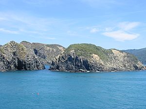
West Head facts for kids

West Head is the name given to three different pieces of land that stick out into the sea, called headlands, on New Zealand's South Island.
- One West Head is found at the entrance to Okains Bay on Banks Peninsula.
- Another West Head is located at the end of a long piece of land on the northern side of Queen Charlotte Sound.
- The third West Head is a rocky headland at the entrance to Tory Channel.
The third West Head, the one at the entrance to Tory Channel, is very special. It is the easternmost point of the entire South Island! It's important not to mix it up with West Cape, which is the westernmost point of the South Island. This West Head marks the western side of the entrance to Tory Channel. On the other side, on Arapaoa Island, you'll find a place called East Head.
Easternmost Point of the South Island
The West Head located at the entrance to Tory Channel holds the title of the easternmost point of the South Island. However, sometimes people get confused because two other headlands are very close by in terms of how far east they are.
Official records from Land Information New Zealand (LINZ) show that West Head, at the Tory Channel entrance, is the furthest east. Its very tip is just a tiny bit further east than Cape Jackson. Cape Jackson is about 100 metres (about 330 feet) further west.
Both West Head and Cape Jackson are at the end of long, narrow pieces of land in the Marlborough Sounds. These areas can be quite tricky to reach. Because of this, a third place called Cape Campbell is sometimes mistakenly thought to be the easternmost point. But Cape Campbell is actually about three kilometres (nearly two miles) further west than West Head.
Sometimes, the exact coordinates for a place might be slightly different depending on the map or source you use. This is because official coordinates might point to a main feature like a hilltop, while other measurements might be for the very tip of the land.
 | Toni Morrison |
 | Barack Obama |
 | Martin Luther King Jr. |
 | Ralph Bunche |

