Tory Channel / Kura Te Au facts for kids
Quick facts for kids Tory Channel / Kura Te Au |
|
|---|---|

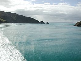
Entrance of Tory Channel / Kura Te Au
|
|
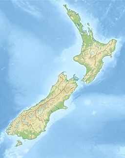
| Location | Marlborough Region, New Zealand |
| Coordinates | 41°14′24″S 174°14′00″E / 41.24000°S 174.23333°E |
| Type | Ria |
| Native name | Kura Te Au Error {{native name checker}}: parameter value is malformed (help) |
| Part of | Marlborough Sounds |
| Max. length | 16.8 kilometres (10.4 mi) |
| Max. width | 1.1 kilometres (0.68 mi) |
| Average depth | 39.2 metres (129 ft) |
| Max. depth | 65 metres (213 ft) |
| Islands | Moioio Island |
Tory Channel / Kura Te Au is a long, narrow waterway in the Marlborough Sounds of New Zealand. It is like a deep valley that the sea has filled. This channel is very important because it is the main path for ferries traveling between Cook Strait and the Marlborough Sounds.
The channel is located south of Arapaoa Island. It separates the island from the mainland. On its western side, Tory Channel joins the larger Queen Charlotte Sound. Its eastern end meets Cook Strait, which is a narrow body of water.
Tory Channel / Kura Te Au is about 16.8 kilometers (10.4 miles) long. It is usually about 1.1 kilometers (0.7 miles) wide. The channel can be up to 65 meters (213 feet) deep. Its average depth is about 39.2 meters (129 feet).
This channel is a big part of the ferry route. Ferries travel here between Wellington and Picton. Sometimes, the waves made by these ferries can cause erosion. Because of this, ferries now have speed limits in certain areas.
At the entrance of Tory Channel, there is a place called West Head. This spot is one of the two possible easternmost points of the South Island. The other is Cape Campbell.
History of Tory Channel
Many years ago, James Cook visited the area. He anchored his ship, HMS Resolution, several times nearby in Ship Cove. On November 5, 1774, he explored the area in a small boat. During this trip, he saw Tory Channel for the first time.
The first permanent whaling station was set up in 1827. John Guard started it on Arapaoa Island. Whalers hunted whales in Tory Channel. They were looking for baleen and whale oil.
In 1840, Tory Channel was carefully mapped. It was named after the ship Tory. This ship brought some of the first British settlers to Wellington. Around this time, other whaling stations were already working in Te Awaiti Bay.
The Perano family hunted whales from Whekenui Bay for many years. They operated their whaling station from 1911 to 1964. They would spot Humpback whales migrating through Cook Strait from the hills near the channel entrance. The Perano Whaling Station was the last one to close in New Zealand. This happened in 1964.
In August 2014, the channel's name was officially changed. It became Tory Channel / Kura Te Au.
Tidal Power Ideas
Some companies have thought about using the strong tides in Tory Channel to make electricity. This is called tidal stream power.
One company, Energy Pacifica, planned to put up to ten underwater turbines here. Each turbine could make up to 1.2 megawatts of power. They believed the channel had strong tidal flows, moving at about 3.6 meters (11.8 feet) per second. The area also had good deep water and was close to the electricity network.
Other ideas included having as many as 50 turbines. However, there are still questions about how strong the water flows really are. Also, the area is about 15 kilometers (9.3 miles) from the main power station at Fighting Bay. In 2013, a study suggested that making money from this project might be difficult.
See also
 In Spanish: Canal Tory para niños
 | Calvin Brent |
 | Walter T. Bailey |
 | Martha Cassell Thompson |
 | Alberta Jeannette Cassell |


