West Siloam Springs, Oklahoma facts for kids
Quick facts for kids
West Siloam Springs, Oklahoma
|
|
|---|---|

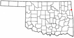
Location of West Siloam Springs, Oklahoma
|
|
| Country | United States |
| State | Oklahoma |
| County | Delaware |
| Area | |
| • Total | 3.84 sq mi (9.94 km2) |
| • Land | 3.84 sq mi (9.94 km2) |
| • Water | 0.00 sq mi (0.00 km2) |
| Elevation | 1,158 ft (353 m) |
| Population
(2020)
|
|
| • Total | 1,000 |
| • Density | 260.48/sq mi (100.57/km2) |
| Time zone | UTC-6 (Central (CST)) |
| • Summer (DST) | UTC-5 (CDT) |
| FIPS code | 40-80350 |
| GNIS feature ID | 2413468 |
West Siloam Springs is a small town in Delaware County, Oklahoma, United States. It's located right next to Siloam Springs, Arkansas. In 2020, about 1,000 people lived here. This was a good increase from the 846 people counted in 2010.
West Siloam Springs is often called a "bedroom community." This means many people who live here travel to work in nearby Siloam Springs, Arkansas. The town is also known for its Cherokee casino. It is the closest town to the beautiful Natural Falls State Park.
Contents
History
How West Siloam Springs Began
In the middle of the 1900s, the town of Siloam Springs, Arkansas, started to grow very quickly. So many people moved there that some began to live just across the state line in Oklahoma.
This growth created a need for a local government on the Oklahoma side. By July 10, 1969, 142 people lived in the community. On that day, 35 out of 49 people who could vote decided to make it an official town.
Geography
Where is West Siloam Springs Located?
West Siloam Springs is found in the eastern part of Oklahoma. It sits directly west of its neighbor, Siloam Springs, Arkansas.
The United States Census Bureau says the town covers about 3.5 square miles (9.94 square kilometers). All of this area is land, with no large bodies of water inside the town limits.
Population and People
How Many People Live Here?
West Siloam Springs has seen its population grow over the years.
| Historical population | |||
|---|---|---|---|
| Census | Pop. | %± | |
| 1970 | 210 | — | |
| 1980 | 431 | 105.2% | |
| 1990 | 539 | 25.1% | |
| 2000 | 877 | 62.7% | |
| 2010 | 846 | −3.5% | |
| 2020 | 1,000 | 18.2% | |
| U.S. Decennial Census | |||
In 2000, there were 877 people living in West Siloam Springs. The town had 306 households. About 22.7% of the people were under 18 years old. About 22.5% were 65 years old or older. The average age in the town was 41 years.
Transportation
Getting Around West Siloam Springs
The town is easy to reach by car. Major roads like U.S. Route 59 and U.S. Route 412 pass right through it.
For air travel, there are a couple of options nearby. Smith Field, also known as Siloam Springs Municipal Airport, is about six miles to the east. It has a long paved runway for smaller planes.
For bigger flights, the Northwest Arkansas Regional Airport is about 24 miles away. It is located to the east-northeast of West Siloam Springs.
Natural Falls State Park
Exploring Nature at Natural Falls
Just west of town, off Highway 412, you can find Natural Falls State Park. This park is one of Oklahoma's most beautiful natural spots. It is famous for its stunning waterfall.
Many movie fans might recognize the waterfall. Part of the popular 1974 film Where the Red Fern Grows was filmed here. At that time, the park was called Dripping Springs. The movie tells the story of a young boy growing up in rural Oklahoma during the Great Depression. It is considered a classic American film.
Hildebrand Mill
A Glimpse into the Past
About 10 miles west of West Siloam Springs is Hildebrand Mill. This historic building was first built in 1907. It started as a mill that used water power to grind grain.
Later, it was used as a lumber mill that ran on gas until 1967. Hildebrand Mill is now listed on the National Register of Historic Places listings in Delaware County, Oklahoma. This means it is an important historical site.
See also
 In Spanish: West Siloam Springs (Oklahoma) para niños
 | Anna J. Cooper |
 | Mary McLeod Bethune |
 | Lillie Mae Bradford |

