Siloam Springs, Arkansas facts for kids
Quick facts for kids
Siloam Springs, Arkansas
|
|||
|---|---|---|---|
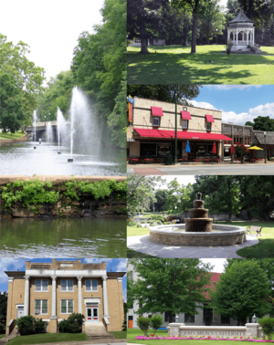
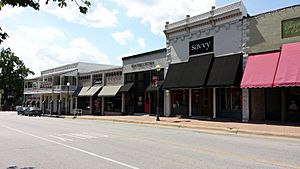
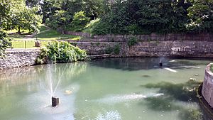
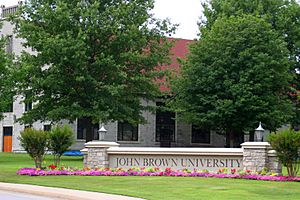
Clockwise, from top: Gazebo in City Park, Main Street Siloam Springs, fountain in Twin Springs Park, entrance to John Brown University, Sager Creek Arts Center, fountains in Sager Creek
|
|||
|
|||
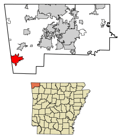
Location of Siloam Springs in Benton County, Arkansas.
|
|||
| Country | United States | ||
| State | Arkansas | ||
| County | Benton | ||
| Incorporated | December 22, 1881 | ||
| Government | |||
| • Type | City Administrator | ||
| Area | |||
| • Total | 11.92 sq mi (30.87 km2) | ||
| • Land | 11.75 sq mi (30.43 km2) | ||
| • Water | 0.17 sq mi (0.45 km2) | ||
| Elevation | 1,132 ft (345 m) | ||
| Population
(2020)
|
|||
| • Total | 17,287 | ||
| • Density | 1,471.61/sq mi (568.18/km2) | ||
| Time zone | UTC-6 (Central (CST)) | ||
| • Summer (DST) | UTC-5 (CDT) | ||
| ZIP code |
72761
|
||
| Area code(s) | 479 | ||
| FIPS code | 05-64370 | ||
| GNIS feature ID | 0078364 | ||
Siloam Springs is a city in Benton County, Arkansas, in the United States. It is located on the western edge of the Northwest Arkansas metropolitan area. In 2020, the city had a population of 17,287 people.
The community was started in 1882. It was known for the special healing powers of its spring water. This water fed Sager Creek. The city also traded with nearby Native American tribes. Siloam Springs shares a border with West Siloam Springs, Oklahoma. This Oklahoma city is part of the Cherokee Nation territory. Siloam Springs is also home to John Brown University.
Contents
History of Siloam Springs
The first known people to live in this area were the Osage Indians. Later, the first white settlers in Siloam Springs came from German and Scots-Irish backgrounds. Simon Sager is thought to be the founder of the town. It was first called Hico.
In 2012, Smithsonian magazine named Siloam Springs one of the 20 best small towns in America.
Geography of Siloam Springs
Siloam Springs is in the Mid-South region of the United States. This is where the southern plains meet the Ozark Mountains. The city is on a high, flat area called a plateau. Many dogwood trees grow all over the landscape.
A creek named Sager Creek flows through the downtown area all year long. It is named after the town's founder.
The United States Census Bureau says the city covers about 11.92 square miles (30.87 square kilometers). Most of this area is land, with a small part being water.
Metropolitan Area Connections
Siloam Springs is part of the Fayetteville–Springdale–Rogers Metropolitan Area. This area includes three counties in Arkansas: Benton, Madison, and Washington. It also includes McDonald County, Missouri. In 2010, this area had a population of 463,204 people. Siloam Springs is on the far western edge of this area. It is connected to other main cities by Highway 412.
Climate and Weather
The weather in Siloam Springs has hot, humid summers. Winters are usually mild to cool. The climate is known as a humid subtropical climate. This means it gets a good amount of rain and has warm temperatures.
July is the warmest month. The average high temperature is about 89.1°F (31.7°C). Temperatures can sometimes go above 100°F (38°C). January is the coldest month. The average low temperature is about 24.2°F (-4.3°C). It can sometimes drop below 0°F (-18°C).
The most rain usually falls in spring and fall. May is often the wettest month.
| Climate data for Siloam Springs, Arkansas (1981–2010 normals) | |||||||||||||
|---|---|---|---|---|---|---|---|---|---|---|---|---|---|
| Month | Jan | Feb | Mar | Apr | May | Jun | Jul | Aug | Sep | Oct | Nov | Dec | Year |
| Record high °F (°C) | 77 (25) |
83 (28) |
90 (32) |
91 (33) |
92 (33) |
103 (39) |
111 (44) |
109 (43) |
102 (39) |
96 (36) |
83 (28) |
79 (26) |
111 (44) |
| Mean daily maximum °F (°C) | 45 (7) |
51 (11) |
59 (15) |
69 (21) |
76 (24) |
84 (29) |
89 (32) |
89 (32) |
81 (27) |
71 (22) |
57 (14) |
48 (9) |
68 (20) |
| Mean daily minimum °F (°C) | 23 (−5) |
28 (−2) |
36 (2) |
44 (7) |
53 (12) |
62 (17) |
67 (19) |
66 (19) |
59 (15) |
47 (8) |
36 (2) |
27 (−3) |
46 (8) |
| Record low °F (°C) | −12 (−24) |
−14 (−26) |
−7 (−22) |
20 (−7) |
30 (−1) |
43 (6) |
46 (8) |
42 (6) |
31 (−1) |
20 (−7) |
5 (−15) |
−8 (−22) |
−14 (−26) |
| Average precipitation inches (mm) | 2.27 (58) |
2.20 (56) |
4.32 (110) |
4.31 (109) |
5.20 (132) |
4.84 (123) |
3.54 (90) |
3.35 (85) |
5.05 (128) |
3.68 (93) |
4.82 (122) |
3.42 (87) |
47 (1,193) |
| Average snowfall inches (cm) | 3.3 (8.4) |
1.6 (4.1) |
1.9 (4.8) |
0 (0) |
0 (0) |
0 (0) |
0 (0) |
0 (0) |
0 (0) |
0.1 (0.25) |
0.2 (0.51) |
2.0 (5.1) |
9.1 (23.16) |
| Source: The Weather Channel | |||||||||||||
Population and People
| Historical population | |||
|---|---|---|---|
| Census | Pop. | %± | |
| 1880 | 95 | — | |
| 1890 | 821 | 764.2% | |
| 1900 | 1,748 | 112.9% | |
| 1910 | 2,405 | 37.6% | |
| 1920 | 2,569 | 6.8% | |
| 1930 | 2,378 | −7.4% | |
| 1940 | 2,764 | 16.2% | |
| 1950 | 3,270 | 18.3% | |
| 1960 | 3,953 | 20.9% | |
| 1970 | 6,009 | 52.0% | |
| 1980 | 7,940 | 32.1% | |
| 1990 | 8,151 | 2.7% | |
| 2000 | 10,843 | 33.0% | |
| 2010 | 15,039 | 38.7% | |
| 2020 | 17,287 | 14.9% | |
| U.S. Decennial Census | |||
2020 Census Information
In 2020, the United States Census counted 17,287 people living in Siloam Springs. There were 5,382 households and 3,980 families.
Here is a breakdown of the different groups of people living in Siloam Springs:
| Group | Number | Percentage |
|---|---|---|
| White (not Hispanic) | 10,175 | 58.86% |
| Black or African American (not Hispanic) | 184 | 1.06% |
| Native American | 737 | 4.26% |
| Asian | 345 | 2.0% |
| Pacific Islander | 32 | 0.19% |
| Other or Mixed Race | 1,477 | 8.54% |
| Hispanic or Latino | 4,337 | 25.09% |
2010 Census Information
In 2010, there were 15,039 people in Siloam Springs. Most people (93.3%) lived in households.
The population was made up of:
- 76% non-Hispanic white people
- 0.8% black people
- 4.6% Native American people
- 1.6% Asian people
- 0.2% non-Hispanic people of another race
- 5.0% people of two or more races
- 20.8% Hispanic or Latino people
Arts and Culture
Siloam Springs hosts many fun events throughout the year.
Annual Cultural Events
| Event | When it happens | How many people attend (about) |
|---|---|---|
| Dogwood Festival | Last weekend of April | 30,000 |
| Homegrown Festival | October | 3,000 |
| Siloam Springs Rodeo | June | 10,000 |
| Light Up Siloam Christmas Parade | First Saturday of December | 6,500 |
| City Fireworks Presentation | July 4 | 6,000 |
| Northwest Arkansas Marching Band Invitational | October | 2,500 |
| JBU Candlelight Christmas Concerts | December | 3,000 |
| JBU Homecoming | October | 1,000 |
| Siloam Springs Music Games (Marching Band Competition) | July | 2,000 |
| Siloam Springs Center for the Arts | All year | 10,000 per year |
Education in Siloam Springs
Besides John Brown University, the city has a public school system. The Siloam Springs School District includes several schools:
- Siloam Springs High School (for grades 9–12)
- Siloam Springs Middle School (for grades 7–8)
- Siloam Springs Intermediate School (for grades 5–6)
- Southside Elementary School (for grades 3–4)
- Allen Elementary School (for grades 1 & 2)
- Northside Elementary School (for Pre-Kindergarten & Kindergarten)
- Siloam Springs Virtual Academy (for grades K–12, online learning)
City Services and Transportation
Transportation Options
Major roads help people travel in and out of Siloam Springs. US 412 goes east and west. It connects the city to Tulsa, Oklahoma, and to cities like Bentonville and Fayetteville. US 59 goes south into Oklahoma. Arkansas 59 goes north to Gravette and south to Van Buren.
Inside the city, important roads include Cheri Whitlock Drive, Lincoln Street, Main Street, Mount Olive Street, and University Street.
For air travel, Smith Field is east of town. It is used by small business jets and other private planes. For bigger flights, the Northwest Arkansas Regional Airport is about 21 miles (34 km) to the east.
Water and Wastewater Services
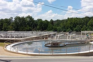
The main source of drinking water for Siloam Springs is the Illinois River. Some water also comes from Beaver Lake. The water is treated to make it safe to drink. This includes adding fluoride for healthy teeth.
Wastewater (used water from homes and businesses) is cleaned at the Siloam Springs Wastewater Treatment Plant. This plant has special rules because its cleaned water flows into a part of the Illinois River. This river is important to both Arkansas and Oklahoma. The plant has been updated to help keep the river clean.
Notable People from Siloam Springs
- Duncan Baird: A politician who served in the Arkansas government. He graduated from Siloam Springs High School.
- Jonathan Barnett: Another politician from the area.
- Preston Bynum: A lobbyist who used to represent Siloam Springs in the state government.
- Mike Flynn: A radio host known for his show The Folk Sampler.
- Alice Ghostley: An actress who spent some of her younger years in Siloam Springs.
- Jim Winn: A former Major League Baseball pitcher who went to John Brown University.
- Jonathan Earl Woods: A politician who served in the Arkansas government.
See also
 In Spanish: Siloam Springs (Arkansas) para niños
 | John T. Biggers |
 | Thomas Blackshear |
 | Mark Bradford |
 | Beverly Buchanan |


