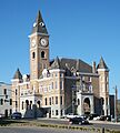
Washington County, Arkansas facts for kids
Quick facts for kids
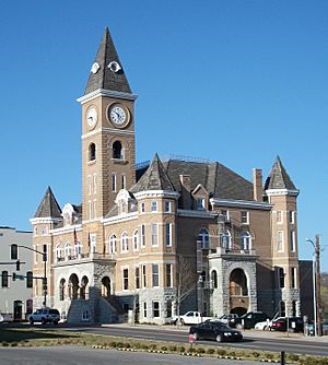
Washington County
|
|||
|---|---|---|---|
|
|||
|
|||
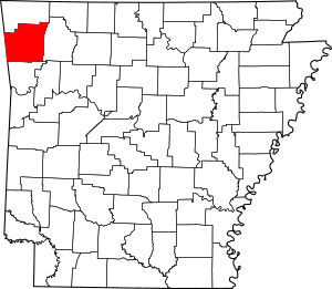
Location within the U.S. state of Arkansas
|
|||
 Arkansas's location within the U.S. |
|||
| Country | |||
| State | |||
| Founded | October 17, 1828 | ||
| Named for | George Washington | ||
| Seat | Fayetteville | ||
| Largest city | Fayetteville | ||
| Area | |||
| • Total | 951.72 sq mi (2,464.9 km2) | ||
| • Land | 945.43 sq mi (2,448.7 km2) | ||
| • Water | 6.29 sq mi (16.3 km2) 0.6%% | ||
| Population
(2020)
|
|||
| • Total | 245,871 | ||
| • Estimate
(2023)
|
261,549 |
||
| • Density | 258.3438/sq mi (99.7471/km2) | ||
| Time zone | UTC−6 (Central) | ||
| • Summer (DST) | UTC−5 (CDT) | ||
| ZIP Codes |
72701, 72703, 72704, 72717, 72727, 72729, 72730, 72738, 72744, 72749, 72753, 72761, 72762, 72764, 72769, 72773, 72774, 72959
|
||
| Area code | 479 | ||
| Congressional district | 3rd | ||
Washington County is a busy and important area in the Northwest Arkansas region. It's a center for jobs, schools, and fun cultural activities. The county was created in 1828 and was the 17th county in Arkansas.
Washington County has 13 cities and towns. These include Fayetteville, which is the main county seat, and Springdale. You'll also find smaller towns and quiet neighborhoods here. The county is named after George Washington, who was the first President of the United States.
This county is located in the Ozark Mountains. It's split into two main parts. The northern part has rolling hills called the Springfield Plateau and is where most people live. The southern part has steeper, forested mountains known as the Boston Mountains and is less populated.
Washington County is home to parts of the Ozark National Forest. It also has two state parks, two wildlife areas, and many city parks. You can explore historical places like Civil War battlefields and old log cabins. These spots help tell the story of Washington County.
The county covers about 952 square miles. In 2020, over 245,000 people lived here. This makes it the 4th largest county in Arkansas by size and the 3rd largest by population. The economy here is strong in areas like business, education, sales, and poultry farming.
Washington County has always been known for its great schools. The University of Arkansas, the biggest four-year college in the state, opened in Fayetteville in 1871. A campus of the Northwest Arkansas Community College also opened in Springdale in 2019. Today, Washington County has eight public school districts, including two of the largest in Arkansas. It also has two private schools.
Contents
History of Washington County
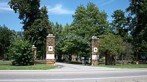
Washington County started as part of the Cherokee Territory after a treaty in 1817. The area was then called Lovely County. Just one year later, Washington County was formed after another treaty with the Cherokee.
The main court house was built in the city of Washington. This city is now known as Fayetteville. Its name was changed to avoid confusion with another town called Washington, Arkansas. Many of the county's first settlements were in the Lee Creek Valley. These included towns like Cane Hill and Evansville.
Two colleges, Arkansas College and Cane Hill College, were founded in Washington County in 1834. Later, the University of Arkansas was started in Fayetteville in 1871.
The county saw important battles during the American Civil War. These included the Battle of Fayetteville, the Battle of Prairie Grove, and the Battle of Cane Hill. Many people in the county supported the Union during the war. This was because there were few enslaved people and plantations here.
In 1858, the Butterfield Overland Mail route came through the county. This helped more families move to the area.
Apples and Railroads
In the late 1800s, Washington County was famous for its apples. The wet weather, high land, and good soil were perfect for apple orchards. Apples were first planted around Lincoln, Evansville, and Cane Hill in the 1830s. Soon, apple orchards grew all over the county.
By 1900, the county produced over 600,000 bushels of apples. This was the most in the state. Several new types of apples were even discovered here, like the Shannon Pippin and the Arkansas Black. The Ben Davis apple became very popular for selling and shipping. However, corn soon became the main crop, earning much more money than apples.
The Arkansas Industrial University was founded in Fayetteville in 1871. A man named William McIlroy donated land for the school. The university changed its name to the University of Arkansas in 1899.
Railroads also came to Washington County. The St. Louis – San Francisco Railway (Frisco) decided to build a line to Texas through Fort Smith. People in Fayetteville worked hard to get the railroad to pass through their town. They sold or gave away land for the tracks. They succeeded, and the first passenger train arrived in Fayetteville in 1881. The county continued to grow with more churches and schools after the railroad was finished.
During the Great Depression in the 1920s, some people in rural areas moved away. They went to Fayetteville or to Oklahoma because of high taxes. These rural areas later became parts of the Ozark National Forest and Devil's Den State Park.
Geography and Nature
Washington County covers about 952 square miles. Most of this is land, with a small part being water. It is the fourth-largest county in Arkansas by area. The county is located in the Boston Mountains, which are part of the Ozark Mountains.
Devil's Den State Park in the southern part of the county is famous for its beautiful views. Washington County also has Lake Wedington. This lake is in a scenic area west of Fayetteville.
How the Land Was Formed
Washington County's land has a long history. Millions of years ago, oceans covered this area. These oceans came and went for 300 million years. They left behind different layers of sand and mud. This created fossil-rich limestone and ripple-marked sandstone. You can still see these rocks in the northern part of the county. They are proof of ancient oceans.
Over time, different types of rock formed. These include shale, limestone, and chert. Chert is a hard rock found all over the county. Early settlers liked this area because of its many streams. These streams could power mills. They also used the sandstone and clay for building.
Today, Washington County has two main land forms: the Boston Mountains and the Springfield Plateau. The Boston Mountains are rugged and steep in the south. In the north, the older rocks of the Springfield Plateau are visible.
Neighboring Counties
- Benton County (north)
- Madison County (east)
- Crawford County (south)
- Adair County, Oklahoma (west)
Protected Natural Areas
- Ozark National Forest (part of it is in Washington County)
People and Population
| Historical population | |||
|---|---|---|---|
| Census | Pop. | %± | |
| 1830 | 2,182 | — | |
| 1840 | 7,148 | 227.6% | |
| 1850 | 9,970 | 39.5% | |
| 1860 | 14,673 | 47.2% | |
| 1870 | 17,266 | 17.7% | |
| 1880 | 23,844 | 38.1% | |
| 1890 | 32,024 | 34.3% | |
| 1900 | 34,256 | 7.0% | |
| 1910 | 33,889 | −1.1% | |
| 1920 | 35,468 | 4.7% | |
| 1930 | 39,255 | 10.7% | |
| 1940 | 41,114 | 4.7% | |
| 1950 | 49,979 | 21.6% | |
| 1960 | 55,797 | 11.6% | |
| 1970 | 77,370 | 38.7% | |
| 1980 | 100,494 | 29.9% | |
| 1990 | 113,409 | 12.9% | |
| 2000 | 157,715 | 39.1% | |
| 2010 | 203,065 | 28.8% | |
| 2020 | 245,871 | 21.1% | |
| 2023 (est.) | 261,549 | 28.8% | |
| U.S. Decennial Census 1790–1960 1900–1990 1990–2000 2010–2019 2020 |
|||
In 2020, the 2020 United States census counted 245,871 people living in Washington County. There were 89,249 households and 56,596 families.
Who Lives Here?
The county is home to a diverse group of people. Here's a look at the different groups in 2020:
- White (not Hispanic): 65.3%
- Black or African American (not Hispanic): 3.39%
- Native American: 0.99%
- Asian: 2.29%
- Pacific Islander: 3.55%
- Other/Mixed races: 6.27%
- Hispanic or Latino (any race): 18.2%
The average age in the county in 2010 was about 30.7 years old. About 25.4% of the people were under 18 years old.
Education in Washington County
Washington County has a long history of being a center for education in Arkansas. Cane Hill College was the first college in Arkansas. This was before the University of Arkansas started in 1871.
A study in 2012 showed that most adults in Washington County (84.2%) had a high school degree or more. Also, 31.9% had a bachelor's degree or higher. This rate is one of the highest in Arkansas.
Local Schools
Washington County has many public school districts. Some of the largest include:
- Elkins School District
- Farmington School District
- Fayetteville School District
- Greenland Public Schools
- Lincoln School District
- Prairie Grove School District
- Siloam Springs Schools
- Springdale School District
- West Fork School District
There are also private schools like Haas Hall Academy and Ozark Montessori Academy Springdale.
Colleges and Universities
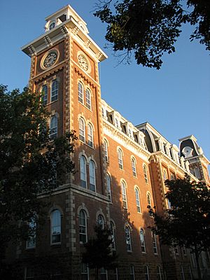
The University of Arkansas in Fayetteville was founded in 1871. It's built on a hilltop farm, which is why it's sometimes called "The Hill." It's the biggest college in Arkansas. In 2019, over 23,000 students were enrolled there. Many students come from outside Arkansas, which helps the local economy.
The Northwest Arkansas Community College opened a campus in Springdale in 2019.
Libraries for Everyone
Washington County has the Fayetteville Public Library and the Washington County Library System (WCLS). The WCLS has eight branches, including the Springdale Public Library. These libraries offer books, e-books, movies, and help with research. They also have special services for kids, businesses, and people looking into their family history.
Culture and Fun Activities
Washington County has many places that help keep its history and culture alive. The Washington County Historical Museum teaches visitors about the area's past. The Shiloh Museum of Ozark History in Springdale also shares regional history.
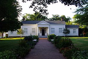
The Clinton House Museum in Fayetteville is a special house museum. It's dedicated to Bill Clinton and Hillary Rodham. They both taught at the University of Arkansas School of Law and got married there in 1975.
Over 100 places in Washington County are listed on the National Register of Historic Places. These include historic neighborhoods, Civil War battlefields like Cane Hill Battlefield and Prairie Grove Battlefield Park, and old homes.
Yearly Events and Festivals
Many exciting events happen in Washington County every year. Some of the biggest include:
- Arkansas Razorbacks football games in the fall. These games bring thousands of visitors to the area.
- The Walmart Shareholder's Meeting at Bud Walton Arena. Over 5,000 employees from around the world come to Fayetteville for this event.
- Bikes, Blues, & BBQ. This huge motorcycle rally on Dickson Street in Fayetteville attracts over 400,000 people.
- Roots Fest. This is a five-day music and food festival in Fayetteville.
- Battle of Prairie Grove Reenactment. Hundreds of Civil War reenactors gather at Prairie Grove Battlefield State Park in December of even-numbered years.
- NWA Pride. This is the largest LGBTQ+ Pride event in Arkansas, held in Fayetteville every June.
Communities in Washington County
Cities You Can Visit
- Elkins
- Elm Springs
- Farmington
- Fayetteville (This is the county seat!)
- Goshen
- Greenland
- Johnson
- Lincoln
- Prairie Grove
- Springdale
- Tontitown
- West Fork
- Winslow
Small Towns
Other Small Places (Unincorporated Communities)
Townships (Historical Areas)
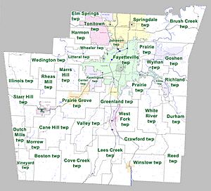
Townships are older divisions of a county. They include rural areas and sometimes parts of towns or cities. Today, they are mostly important for historical research, like finding out about your family's past. Each town or city in Washington County is at least partly in a township with the same name.
Here are the townships in Washington County:
- Boston
- Brush Creek
- Cane Hill
- Center
- Cove Creek
- Crawford
- Durham
- Dutch Mills
- Elkins (Elkins)
- Elm Springs (Elm Springs)
- Farmington (Farmington)
- Fayetteville (Fayetteville)
- Goshen (Goshen)
- Greenland (Greenland)
- Harmon
- Illinois
- Johnson (Johnson)
- Lee's Creek
- Lincoln (Lincoln)
- Litteral
- Marrs Hill
- Morrow
- Prairie
- Prairie Grove (Prairie Grove)
- Reed
- Rhea's Mill
- Richland
- Springdale (most of Springdale)
- Starr Hill
- Tontitown (Tontitown)
- Valley
- Vineyard
- Wedington
- West Fork (West Fork)
- White River
- Winslow (Winslow)
- Wyman
Getting Around and Services
Main Roads
Washington County has been part of important travel routes for a long time. These include the Ozark Trail, the Trail of Tears, and the Butterfield Overland Mail route.
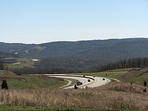
Today, Interstate 49 is the main highway in the county. It connects the University of Arkansas to Fort Smith and Interstate 40 to the south. It also links to other cities in Northwest Arkansas to the north. There are plans to extend Interstate 49 even further. It will eventually connect New Orleans, Louisiana with Kansas City, Missouri through Washington County.
Here are some of the other important roads in the county:
 Interstate 49
 U.S. Route 62
 U.S. Route 71
 U.S. Route 412
 U.S. Route 71B
 Highway 16
 Highway 45
 Highway 59
 Highway 74
 Highway 112
 Highway 156
 Highway 170
 Highway 180
 Highway 220
 Highway 244
 Highway 265
 Highway 303
Public Transportation
- Jefferson Lines (bus service)
- Ozark Regional Transit (local bus service)
- Razorback Transit (bus service for the University of Arkansas)
Water and Other Services
The Arkansas Department of Health makes sure that public water systems are safe. Washington County has twelve community water systems. Two of the biggest are the City of Fayetteville and Springdale Water Utilities. Both of these systems get their water from Beaver Water District. Many smaller cities in Washington County also buy water from these larger systems.
Images for kids
See also
 In Spanish: Condado de Washington (Arkansas) para niños
 | Kyle Baker |
 | Joseph Yoakum |
 | Laura Wheeler Waring |
 | Henry Ossawa Tanner |


