Farmington, Arkansas facts for kids
Quick facts for kids
Farmington, Arkansas
|
|
|---|---|

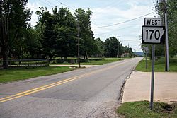
Looking south along Highway 170
|
|
| Motto(s):
"Feels Like Home"
|
|

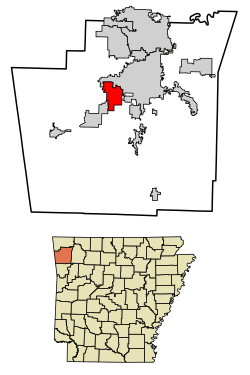
Location of Farmington in Washington County, Arkansas.
|
|
| Country | United States |
| State | Arkansas |
| County | Washington |
| Settled | 1828 |
| Incorporated | October 15, 1946 |
| Area | |
| • City | 9.88 sq mi (25.58 km2) |
| • Land | 9.83 sq mi (25.45 km2) |
| • Water | 0.05 sq mi (0.13 km2) |
| Elevation | 1,217 ft (371 m) |
| Population
(2020)
|
|
| • City | 7,584 |
| • Density | 771.75/sq mi (297.99/km2) |
| • Metro | 463,402 |
| Time zone | UTC-6 (Central (CST)) |
| • Summer (DST) | UTC-5 (CDT) |
| ZIP code |
72730
|
| Area code(s) | 479 |
| FIPS code | 05-23170 |
| GNIS feature ID | 2403598 |
| Website | City of Farmington Arkansas |
Farmington is a city in Washington County, Arkansas, United States. It sits in a valley among the Boston Mountains, which are part of the Ozark Mountains. The first settlers arrived in 1828. However, Farmington officially became a city in 1946.
Farmington is located just west of Fayetteville. It is part of the larger Northwest Arkansas metropolitan area. The city has grown a lot recently. Its population increased by 66% between 2000 and 2010. Many people who live in Farmington travel to work in nearby cities.
Contents
History of Farmington
Early Settlement and the Civil War
The first people settled here in 1828. They came from the southern United States. The area was first known as Engel's Mill. It was renamed Farmington when a post office was built in 1868.
The Civil War greatly affected the community. Most people in the area supported the Confederates. The Battle of Prairie Grove happened nearby. The city faced attacks from both armies. Unofficial groups also raided the area.
Around 1870, the city was officially planned out. This means its streets and lots were mapped.
Growth and Modern Times
In the 1890s, residents found success. They grew strawberries and grapes. They shipped these crops using the St. Louis–San Francisco Railway. During World War II, the railway tracks were removed. The company had wanted to do this for years. They used the war effort as an excuse.
Farmington officially became a city on October 15, 1946.
Geography
Farmington is about 9.8 square miles (25.58 square kilometers) in size. All of this area is land.
Population and People
| Historical population | |||
|---|---|---|---|
| Census | Pop. | %± | |
| 1960 | 216 | — | |
| 1970 | 908 | 320.4% | |
| 1980 | 1,283 | 41.3% | |
| 1990 | 1,322 | 3.0% | |
| 2000 | 3,605 | 172.7% | |
| 2010 | 5,974 | 65.7% | |
| 2020 | 7,584 | 27.0% | |
| U.S. Decennial Census 2015 Estimate |
|||
In 2020, Farmington had a population of 7,584 people. There were 2,584 households in the city.
Economy
Farmington is located next to Fayetteville on its western side. Some parts of Fayetteville along Highway 16 are north of Farmington.
Fun Things to Do in Farmington
Yearly Events
Farmington hosts several fun events each year:
- FreedomFest celebrates Independence Day. It features food, drinks, music, and fireworks. There is also entertainment for kids.
- Back to School Bonanza helps students get ready for school. It offers dental checks, clothes, food, and school supplies. The Farmington United Methodist Church hosts this event.
- Farmington Fall Festival takes place at Creekside Park. It includes live music, pony rides, and an art show. Many vendors also set up stalls.
- Farmington Christmas Parade happens in early December. The Farmington Crimson Regiment Marching Band performs. Many Christmas-themed floats are also part of the parade.
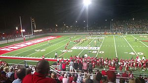
- The Farmington Cardinals football team plays the Prairie Grove Tigers every year. This game is a big rivalry. It is called the "Battle of '62." This name comes from Highway 62, which connects the two towns. Hundreds of people from both towns come to watch.
Education
The Farmington School District provides education for most students. Farmington's main high school is Farmington Career Academies. It is usually called Farmington High School. Their mascot is the cardinal. Their team colors are scarlet red and white.
Some parts of Farmington are in other school districts. These include the Prairie Grove School District and the Fayetteville School District. Students in these areas attend Prairie Grove High School or Fayetteville High School.
Farmington has different schools for different age groups:
- Two elementary schools
- One intermediate school (for 4th and 5th graders)
- One middle school (for 6th and 7th graders)
- One junior high school (for 8th and 9th graders)
- One high school (for 10th, 11th, and 12th graders)
Farmington High School moved into a new building in 2017. This included a new football field. Older school buildings also received updates.
Transportation
As of 2023, Farmington does not have regular bus routes. However, Ozark Regional Transit offers a service where you can call for a ride. The closest long-distance bus service is in nearby Fayetteville. It is provided by Jefferson Lines.
Famous People from Farmington
- Sarah Colonna: An American comedian, actress, and author. She is known for her work on the TV show Chelsea Lately.
See also
 In Spanish: Farmington (Arkansas) para niños
 | Kyle Baker |
 | Joseph Yoakum |
 | Laura Wheeler Waring |
 | Henry Ossawa Tanner |


