Arkansas Highway 265 facts for kids
Quick facts for kids
Highway 265 |
||||
|---|---|---|---|---|
| Dick Trammel Highway | ||||
 |
||||
| Route information | ||||
| Maintained by AHTD | ||||
| Section 1 | ||||
| Length | 19.70 mi (31.70 km) | |||
| South end | ||||
| North end | ||||
| Section 2 | ||||
| Length | 18.21 mi (29.31 km) | |||
| South end | ||||
| North end | ||||
| Section 3 | ||||
| Length | 3.324 mi (5.349 km) | |||
| South end | ||||
| North end | ||||
| Location | ||||
| Counties: | Washington, Benton | |||
| Highway system | ||||
| Arkansas Highway System Interstates • US • State Business • Spurs • Scenic
|
||||
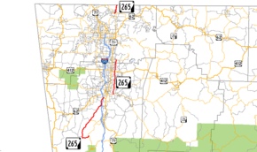
Arkansas Highway 265 (also called AR 265 or the Dick Trammel Highway) is a special name for three different state highways in Northwest Arkansas. These roads help people travel across the region.
The first part of Highway 265 is about 19.70 miles (31.70 km) long. It starts near Strickler and goes north to Fayetteville. There, it connects with major roads like I-49 and US 71.
The second part begins in east Fayetteville. It travels north through Springdale and ends in Rogers. This section is about 18.21 miles (29.31 km) long.
The third and shortest part is about 3.324 miles (5.349 km) long. It starts in Pea Ridge and goes north to the Missouri state line. The Arkansas Department of Transportation (ARDOT) takes care of all these highways.
Did you know parts of these highways used to be a famous old route? It was called the Butterfield Stagecoach Route. This route was used from 1857 to 1861. It carried important mail all the way from St. Louis, Missouri to San Francisco, California.
Contents
Exploring Arkansas Highway 265
Arkansas Highway 265 is made up of three main sections. Each section helps connect different towns and areas in Northwest Arkansas.
The Southern Journey: Strickler to Fayetteville

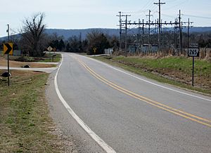
The first part of AR 265 starts near Strickler at AR 170. This road then winds its way north. It passes through a town called Greenland.
Eventually, this part of the highway reaches Fayetteville. Here, it meets up with big roads like I-49 and US 71. After these crossings, the road continues north into Fayetteville as Arkansas Highway 112.
Traveling Through Fayetteville and Springdale
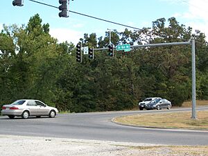
The second section of AR 265 begins in southeast Fayetteville. It starts at AR 16. This part of the highway is wider, with four lanes and a middle turn lane. It helps people get to many neighborhoods in Fayetteville.
As it goes north, AR 265 crosses several other roads. These include AR 45 and US 412. It also passes near the Springdale Municipal Airport. The highway then enters Benton County.
In Benton County, it meets AR 264 in Bethel Heights. The road then becomes a two-lane road. It continues north through Lowell until it reaches Rogers. This section ends in Rogers at AR 94.
The Northern Stretch: Pea Ridge to Missouri
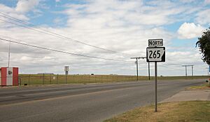
The third and final part of AR 265 is located further north. It starts west of Pea Ridge at AR 94. From there, it heads directly north.
This short section of the highway goes all the way to the Missouri state line. Once it crosses into Missouri, the road changes its name. It becomes Missouri Route KK.
A Look Back: History of the Route

Even though AR 265 is a modern highway, its path is very old. Long ago, it was a Native American trail called the Great Osage Trail. Later, it became a Military Road. This road connected St. Louis to Fort Smith. It was also part of the sad journey known as the Trail of Tears.
From 1857 to 1861, the Butterfield Overland Mail Route used parts of this path. This route was important for carrying mail across the country. It also helped set up telegraph lines to the west.
Some parts of the highway today are still called "Old Wire Road." This name reminds us of the old telegraph lines. In Fayetteville, some parts are also known as "Old Missouri Road." While AR 265 doesn't follow the exact same path as the old stagecoaches everywhere, it definitely shares a lot of history with these important old routes.
The first part of AR 265, from Strickler to Fayetteville, was officially named in 1958. The second part, through Fayetteville and Springdale, was extended to its current length in 1973. The northernmost section, from Pea Ridge to Missouri, was also named in 1973. It was last paved in 1990.
See Also
 | Dorothy Vaughan |
 | Charles Henry Turner |
 | Hildrus Poindexter |
 | Henry Cecil McBay |


