Great Osage Trail facts for kids

The Great Osage Trail was an important path used by Native American tribes. It was also known as the Osage Trace or the Kaw Trace. This trail went through parts of what are now the Midwest and Plains States in the U.S.
These paths were first made by large herds of buffalo and other migrating animals. Later, Native American tribes like the Osage Indians used them for travel and trade.

European settlers later gave the name "Osage Trails" to many of these routes. For example, parts of the famous U.S. Route 66 in southern Missouri follow an old Osage Trail. Also, U.S. Route 24 in central Missouri follows the "Great Osage Trail" from Franklin, Missouri westward.
The Great Osage Trail Becomes the Santa Fe Trail
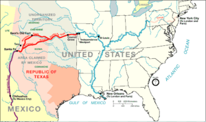
In 1825, the Great Osage Trail became the first part of the famous Santa Fe Trail. This new trail started in central Missouri, near towns like Franklin and Boonville, Missouri. It followed the Missouri River westward.
Then, the trail turned southwest through Independence, Missouri. From there, it continued into Kansas, Colorado, and finally to Santa Fe, New Mexico in "Old" Mexico.
Starting Points of the Santa Fe Trail
The Santa Fe Trail changed its starting point over time.
- Old Franklin: The Santa Fe trade first began in Old Franklin, a small town on the Missouri River. This lasted until 1831.
- Independence: In 1831, the trade moved to Independence. This town was 100 miles further west. It was also close to a big bend in the Missouri River. This made it a better place to prepare for trips to Mexico. It was easier to get to Independence by water than by land from Franklin.
- Westport and Kansas City: The main trade stayed in Independence until about 1838-1840. Then, it began to shift to Westport. Later, it moved to Westport Landing, which is known today as Kansas City, Missouri.
The Tree of Peace and the Trail

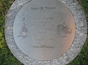
On October 24, 1999, an important event happened along the Great Osage Trail. An Iroquois chieftain named Jake Swamp led a special ceremony. They planted an Iroquois "Tree of Peace".
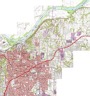
This tree was planted in Independence, Missouri. It is just south of Lexington Street, which is part of the old Great Osage Trail. The tree is on the property of the Community of Christ's Independence Temple. This site was also important to early Mormon settlers, who bought the land in 1831.
Early Latter-day Saint travelers used these trails. They traveled along the Boone's Lick Road from St. Louis to Franklin. Then, they used the Great Osage Trail/Santa Fe Trail to reach Missouri's western border.
 | Roy Wilkins |
 | John Lewis |
 | Linda Carol Brown |

