Bethel Heights, Arkansas facts for kids
Quick facts for kids
Bethel Heights, Arkansas
|
|||
|---|---|---|---|
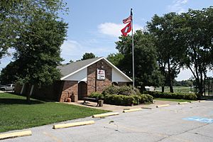
City Hall
|
|||
|
|||
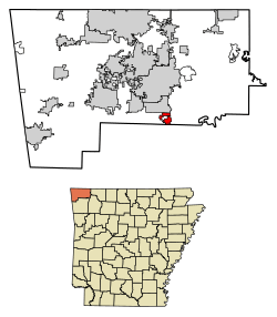
Location of Bethel Heights in Benton County, Arkansas.
|
|||
| Country | United States | ||
| State | Arkansas | ||
| County | Benton | ||
| Government | |||
| • Type | Mayor-council | ||
| Area | |||
| • Total | 2.22 sq mi (5.76 km2) | ||
| • Land | 2.21 sq mi (5.74 km2) | ||
| • Water | 0.01 sq mi (0.03 km2) | ||
| Elevation | 1,348 ft (411 m) | ||
| Population
(2010)
|
|||
| • Total | 2,372 | ||
| • Estimate
(2019)
|
2,771 | ||
| • Density | 1,251.02/sq mi (482.94/km2) | ||
| Time zone | UTC-6 (Central (CST)) | ||
| • Summer (DST) | UTC-5 (CDT) | ||
| ZIP Code |
72764
|
||
| Area code(s) | 479 | ||
| FIPS code | 05-05740 | ||
| GNIS feature ID | 0076320 | ||
Bethel Heights was a small city in Benton County, Arkansas, United States. It started as a small community around a school in the late 1800s. The town officially became a city in 1967. This was done to avoid being taken over by bigger nearby towns.
Bethel Heights offered services like police, fire, and wastewater to its residents. However, students went to schools in Springdale, and the city bought its water from Springdale too. In the 21st century, the area around Bethel Heights grew very fast. The city's population increased from 714 people in 2000 to 2,372 in 2010. Because of challenges with its wastewater system, the people of Bethel Heights voted to join Springdale completely in August 2020.
Contents
History of Bethel Heights
Long ago, the land that became Benton County was used for hunting by the Osage people. After the Louisiana Purchase, white settlers began to claim land in the Bethel Heights area around 1856.
As the towns of Lowell and Springdale started to grow closer, people in the Bethel area decided to form their own town in 1967. This helped them keep their community separate.
Where Was Bethel Heights?
Bethel Heights was located in the southern part of Benton County. It was surrounded by Springdale on its east, south, and west sides. To the north, it bordered Lowell.
A main road, U.S. Route 71 Business, ran north to south along the west side of the city. Highway 264 went east to west through the middle of the city.
The city covered about 2.2 square miles (5.76 square kilometers). Only a very small part of this area was water.
The Northwest Arkansas Region
Bethel Heights was part of the Northwest Arkansas region. This area includes three counties: Benton, Madison, and Washington. This region has been one of the fastest-growing areas in the United States for over ten years.
The population of Northwest Arkansas grew a lot. It went from about 347,000 people in 2000 to over 463,000 in 2010. This was a big increase of more than 33 percent!
People Who Lived There
| Historical population | |||
|---|---|---|---|
| Census | Pop. | %± | |
| 1970 | 284 | — | |
| 1980 | 296 | 4.2% | |
| 1990 | 281 | −5.1% | |
| 2000 | 714 | 154.1% | |
| 2010 | 2,372 | 232.2% | |
| 2020 | 3,015 | 27.1% | |
| U.S. Decennial Census 2014 Estimate |
|||
In 2010, Bethel Heights had 2,372 people. Many different groups of people lived there. About half of the people were non-Hispanic white. Other groups included Black or African American, Native American, Asian, and Pacific Islander people. A significant number of residents were Hispanic or Latino.
In 2000, there were 714 people living in Bethel Heights. Most households were married couples living together. Many families had children under 18 living with them.
The average age of people in the city was 35 years old. About 28.6% of the population was under 18.
Schools in Bethel Heights
Most of the former city of Bethel Heights was part of the Springdale Public Schools district. Some smaller parts were zoned for Rogers Public Schools.
In 2022, students from the Bethel Heights area went to several different schools. These included Bayyari, Hunt, and Monitor elementary schools. For middle school, students attended Hellstern, Sonora, and Helen Tyson. Junior high schools included Central, Lakeside, and Southwest. Finally, students went to Springdale High School and Har-Ber High School for high school.
Early residents of Bethel Heights started a small school called Bethel or New Kirk in the late 1800s. This school joined the Springdale Public Schools in 1948. By 2018, Springdale Public Schools became the largest school district in Arkansas. Students from Bethel Heights usually graduated from Springdale High School.
City Services
The city of Bethel Heights provided wastewater services to its residents. This system was put in place in 2003. However, the city had trouble keeping the system working correctly.
Over several years, there were problems with the wastewater system. This led to the city having to make changes and fix issues.
Springdale Water Utilities provided clean drinking water to Bethel Heights. After the wastewater problems, new water connections were stopped for a while in 2019.
Electricity in Bethel Heights was provided by American Electric Power (AEP/SWEPCO) and Carroll Electric Cooperative. Other services like phone and internet were provided by companies like AT&T, Black Hills Energy, and Cox Communications.
See also
 In Spanish: Bethel Heights (Arkansas) para niños
 | Roy Wilkins |
 | John Lewis |
 | Linda Carol Brown |


