West Wyoming, Pennsylvania facts for kids
Quick facts for kids
West Wyoming, Pennsylvania
|
|
|---|---|
|
Borough
|
|

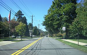
8th Street in West Wyoming
|
|

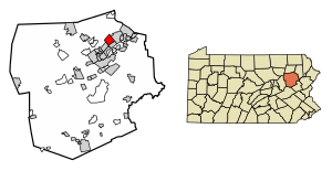
Location of West Wyoming in Luzerne County, Pennsylvania.
|
|
| Country | United States |
| State | Pennsylvania |
| County | Luzerne |
| Region | Greater Pittston |
| Incorporated | 1898 |
| Government | |
| • Type | Borough Council |
| Area | |
| • Total | 3.59 sq mi (9.31 km2) |
| • Land | 3.59 sq mi (9.31 km2) |
| • Water | 0.00 sq mi (0.00 km2) |
| Population
(2020)
|
|
| • Total | 2,631 |
| • Estimate
(2021)
|
2,636 |
| • Density | 744.78/sq mi (287.54/km2) |
| Time zone | UTC-5 (Eastern (EST)) |
| • Summer (DST) | UTC-4 (EDT) |
| Area code(s) | 570 |
| FIPS code | 42-84272 |
West Wyoming is a small town, called a borough, located in Luzerne County, Pennsylvania, United States. It is part of the larger Greater Pittston area. In 2020, about 2,631 people lived there.
Contents
History of West Wyoming
How West Wyoming Started

Back in 1768, a group called the Susquehanna Company from Connecticut planned to divide the Wyoming Valley into five sections. Each section was meant for forty settlers. West Wyoming was first part of Kingston Township. The very first forty settlers arrived in February 1769.
Around 1800, two brothers, Benjamin and Gilbert Carpenter, built several mills. These mills were located along Abrahams Creek. The first businesses included a grist mill (for grinding grain) and a saw mill (for cutting wood).
Becoming a Borough
The community separated from Kingston Township in 1885. Before becoming West Wyoming, the town had other names. These included Carpentersville, Shoemaker's Mills, and New Troy. It officially became the Borough of West Wyoming in 1898.
Geography of West Wyoming
West Wyoming is part of the Greater Pittston region. It is located at coordinates 41°18′50″N 75°51′6″W / 41.31389°N 75.85167°W. The United States Census Bureau says the borough covers about 9.4 square kilometers (3.6 square miles) of land. There is no water area within its borders.
The northern and northeastern parts of West Wyoming have thick forests and mountains. Frances Slocum State Park is also nearby. West Eighth Street and Abrahams Creek go through a mountain pass. This pass connects Greater Pittston to the Back Mountain area. West Eighth Street meets Shoemaker Avenue near the eastern part of the borough. Most homes and businesses are found in the southern and eastern areas of West Wyoming.
West Wyoming shares its borders with several other communities. These include Exeter Township to the north. To the northeast and east is Exeter Borough. Wyoming Borough is to the southeast. Swoyersville Borough is to the southwest. Finally, Kingston Township is to the west and northwest.
Population and People
| Historical population | |||
|---|---|---|---|
| Census | Pop. | %± | |
| 1900 | 1,344 | — | |
| 1910 | 1,621 | 20.6% | |
| 1920 | 1,938 | 19.6% | |
| 1930 | 2,769 | 42.9% | |
| 1940 | 2,992 | 8.1% | |
| 1950 | 2,863 | −4.3% | |
| 1960 | 3,166 | 10.6% | |
| 1970 | 3,659 | 15.6% | |
| 1980 | 3,288 | −10.1% | |
| 1990 | 3,117 | −5.2% | |
| 2000 | 2,833 | −9.1% | |
| 2010 | 2,725 | −3.8% | |
| 2020 | 2,631 | −3.4% | |
| 2021 (est.) | 2,636 | −3.3% | |
| Sources: | |||
In 2000, there were 2,833 people living in West Wyoming. There were 1,183 households and 822 families. The population density was about 780 people per square mile. Most of the people living there were White (99.33%).
About 26% of households had children under 18 living with them. The average household had 2.39 people. The average family had 2.91 people.
The population included 20.9% under 18 years old. About 21.9% were 65 years or older. The average age was 42 years.
Education in West Wyoming
Students in West Wyoming attend schools within the Wyoming Area School District.
See also
 In Spanish: West Wyoming para niños
 | Lonnie Johnson |
 | Granville Woods |
 | Lewis Howard Latimer |
 | James West |


