Western Way facts for kids
Quick facts for kids Western Way |
|
|---|---|

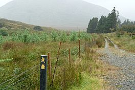
The Western Way in Lettershanbally forest
|
|
| Length | 179 kilometres (111 miles) |
| Location | Counties Galway & Mayo, Ireland |
| Designation | National Waymarked Trail |
| Trailheads | Oughterard, Ballycastle |
| Use | Hiking |
| Difficulty | Moderate |
| Season | Any |
The Western Way (Irish: Bealach an Iarthair) is a very long hiking path in Ireland. It stretches for 179 kilometres (111 miles), which is about 111 miles! This exciting trail starts in Oughterard, County Galway, and finishes in Ballycastle, County Mayo. Most people take about seven days to walk the entire path.
The Western Way is known as a National Waymarked Trail. This means it's a special, well-marked path for hikers. Different groups help manage and look after the trail. These include the National Trails Office, the Irish Sports Council, Coillte, and local councils in Galway and Mayo.
Contents
Exploring the Western Way Trail
The Western Way is split into two main parts: one in County Galway and one in County Mayo. Both sections offer amazing views and different types of landscapes for hikers to explore.
The Galway Adventure
The trail begins in the town of Oughterard in County Galway. From there, it follows the western side of Lough Corrib, a large lake. Imagine walking beside the water with beautiful scenery all around!
Next, the path goes across the Maumturks mountains. It crosses a mountain pass called Maumeen. A mountain pass is like a natural gap or path through mountains. After crossing the pass, the trail goes down into the Inagh Valley. It then follows the base of the "Turks" (the Maumturks mountains) all the way to Leenaun. Leenaun is a village at the very end of Killary Harbour, which is a fjord. A fjord is a long, narrow sea inlet with steep sides, often created by glaciers. The Galway part of the trail finishes here.
Journey Through Mayo
From Leenaun, the trail enters County Mayo. It climbs over Sheefry Bridge and then goes down into the town of Westport. The path continues through other towns like Newport, Sheskin, Ballycastle, Killala, and Ballina.
The Western Way officially ends at Lough Talt. This lake is located in the Ox Mountains, close to the border with Sligo. If you're feeling extra adventurous, you can even continue your journey onto the Sligo Way from here!
Other Walks in North Mayo
The Bangor Trail is another marked path in this area. It mainly crosses blanket bog and rough land in the Nephin Beg Mountain range. A blanket bog is a type of wetland covered in peat, which is partly decayed plant matter. This trail connects the town of Newport with Bangor Erris in North Mayo.
There are also several looped cliff walks along the North Mayo coast. These paths offer stunning views of the cliffs, Benwee Head, and Glinsk. They overlook Broadhaven Bay and usually start from a place called Carrowteige.
 | John T. Biggers |
 | Thomas Blackshear |
 | Mark Bradford |
 | Beverly Buchanan |


