Westminster Millennium Pier facts for kids
Type | River tourist/leisure services |
---|---|
Locale | River Thames, London, UK |
Owner | London River Services |
Operator | London River Services |
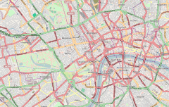
Coordinates | 51°30′07″N 0°07′24″W / 51.501901°N 0.123223°W |
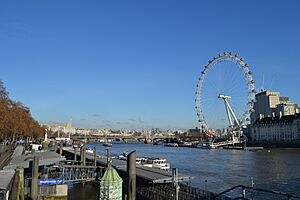
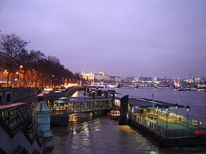
Westminster Millennium Pier is a pier on the River Thames, in the City of Westminster in London, UK. It is operated by London River Services and served by various river transport and cruise operators. It is located next to Westminster Bridge on the north bank of the Thames, and is close to one of London's most prominent landmarks, Big Ben.
Construction
The development of Westminster Millennium Pier was funded by the Millennium Commission as part of the Thames 2000 project, and it was one of five new piers opened in 2000 by the Commission on the Thames (the others being Blackfriars Millennium Pier, London Eye Pier, Tower Millennium Pier and Millbank Millennium Pier). Its creation was funded by the project as part of an integrated transport and regeneration strategy for the Thames led by London's Cross River Partnership.
Services
The pier is served by various services including:
- Thames River Services between Westminster, St. Katharine Pier, Greenwich Pier and the Thames Flood Barrier (Pre-booked groups can disembark at Barrier Gardens Pier).
- City Cruises leisure cruises between Westminster and Greenwich Pier
- Circular Cruise Westminster to St Katharine's Circular
- Thames River Boats cruises to Hampton Court Palace
Connections
Local attractions
North bank
- Big Ben and the Palace of Westminster
- Westminster Abbey and St. Margaret's, Westminster
- Churchill Museum and Cabinet War Rooms
- The Boudica statue
South Bank
- London Eye
- London Aquarium
- Dali Universe
- Florence Nightingale Museum
Lines
Preceding station | London River Services | Following station | ||
---|---|---|---|---|
Terminus | Westminster to Greenwich Express Service |
toward Greenwich Pier
|
||
St. Katharine Pier
toward Westminster Millennium Pier
|
Westminster to St Katharine's Circular |
toward Westminster Millennium Pier
|
<mapframe text=" Map of Thames piers in London = TfL piers = Other operators' piers"
latitude="51.4854" longitude="-0.121193" zoom="12" width="850" height="300" align="center"> { "type": "FeatureCollection", "features": [
/* ============ unusual ================== */
{ "type": "Feature", "properties": { "title": " Tower Lifeboat Station " ,
"description": "
",
"marker-symbol": "london-underground", "marker-size": "small", "marker-color": "f90" }, "geometry": { "type": "Point", "coordinates": [ -0.117412,51.50993 ] } },
{ "type": "Feature", "properties": { "title": " Savoy Pier (closed)" ,
"description": "
",
"marker-symbol": "ferry", "marker-size": "small", "marker-color": "900" }, "geometry": { "type": "Point", "coordinates": [ -0.119403,51.50875 ] } },
/* ============ Turks/W London piers ================== */
{ "type": "Feature", "properties": { "title": " Hampton Court Pier ",
"description": "
",
"marker-symbol": "ferry", "marker-size": "small", "marker-color": "06C" }, "geometry": { "type": "Point", "coordinates": [ -0.34119691338629243,51.403704668702034 ] } },
{ "type": "Feature", "properties": { "title": " Kingston Town End Pier",
"description": "
",
"marker-symbol": "ferry", "marker-size": "small", "marker-color": "06C" }, "geometry": { "type": "Point", "coordinates": [ -0.3084218502044678,51.40550726091131 ] } },
{ "type": "Feature", "properties": { "title": " Kingston Turks Pier",
"description": "
",
"marker-symbol": "ferry", "marker-size": "small", "marker-color": "06C" }, "geometry": { "type": "Point", "coordinates": [ -0.30807403321973403,51.41242139111915
] } }, { "type": "Feature", "properties": { "title": " Richmond Landing Stage",
"description": "
",
"marker-symbol": "ferry", "marker-size": "small", "marker-color": "06C" }, "geometry": { "type": "Point", "coordinates": [ -0.30557602643966675,51.45690335239062 ] } },
{ "type": "Feature", "properties": { "title": " Richmond St Helena Pier",
"description": "
",
"marker-symbol": "ferry", "marker-size": "small", "marker-color": "06C" }, "geometry": { "type": "Point", "coordinates": [ -0.3086739778518677,51.458820284989834 ] } },
/* ============ MAIN PIERS A-Z ================== */
/* ============ B ================== */
{ "type": "Feature", "properties": { "title": " Barking Riverside Pier ",
"description": "
",
"marker-symbol": "ferry", "marker-size": "medium", "marker-color": "999" }, "geometry": { "type": "Point", "coordinates": [ 0.117560,51.516303 ] } },
{ "type": "Feature", "properties": { "title": " Battersea Power Station Pier ",
"description": "
",
"marker-symbol": "ferry", "marker-size": "medium", "marker-color": "06C" }, "geometry": { "type": "Point", "coordinates": [ -0.14576733112335205,51.48387505935585 ] } },
{ "type": "Feature", "properties": { "title": " Blackfriars Millennium Pier ",
"description": "
",
"marker-symbol": "london-underground", "marker-size": "medium", "marker-color": "06C" }, "geometry": { "type": "Point", "coordinates": [ -0.1017, 51.5107 ] } },
{ "type": "Feature", "properties": { "title": " Bankside Pier ",
"description": "
",
"marker-symbol": "london-underground", "marker-size": "large", "marker-color": "06C" }, "geometry": { "type": "Point", "coordinates": [ -0.09634, 51.508553 ] } },
/* ============ C ================== */
{ "type": "Feature", "properties": { "title": " Cadogan Pier",
"description": "
",
"marker-symbol": "ferry", "marker-size": "medium", "marker-color": "06C" }, "geometry": { "type": "Point", "coordinates": [ -0.167081,51.482793 ] } },
{ "type": "Feature", "properties": { "title": " Canary Wharf Pier ",
"description": "
",
"marker-symbol": "ferry", "marker-size": "medium", "marker-color": "3399FF" }, "geometry": { "type": "Point", "coordinates": [ -0.028692,51.505183 ] } },
{ "type": "Feature", "properties": { "title": " Chelsea Harbour Pier ",
"description": "
",
"marker-symbol": "ferry", "marker-size": "medium", "marker-color": "06C" }, "geometry": { "type": "Point", "coordinates": [ -0.17987966537475586,51.47393231987457 ] } },
/* ============ E ================== */
{ "type": "Feature", "properties": { "title": " Embankment Pier ",
"description": "
",
"marker-symbol": "london-underground", "marker-size": "large", "marker-color": "06C" }, "geometry": { "type": "Point", "coordinates": [ -0.121193, 51.5073 ] } },
/* ============ F ================== */
{ "type": "Feature", "properties": { "title": " Festival Pier " ,
"description": "
",
"marker-symbol": "london-underground", "marker-size": "medium", "marker-color": "06C" }, "geometry": { "type": "Point", "coordinates": [ -0.117222,51.506667 ] } },
/* ============ G ================== */
{ "type": "Feature", "properties": { "title": " Greenland Pier" ,
"description": "
",
"marker-symbol": "ferry", "marker-size": "medium", "marker-color": "06C" }, "geometry": { "type": "Point", "coordinates": [ -0.0319, 51.4947 ] } },
{ "type": "Feature", "properties": { "title": " Greenwich Pier " ,
"description": "
",
"marker-symbol": "london-underground", "marker-size": "medium", "marker-color": "06C" }, "geometry": { "type": "Point", "coordinates": [ -0.009422,51.484022 ] } },
/* ============ H ================== */
{ "type": "Feature", "properties": { "title": " Ham House Ferry Terminal" ,
"description": "
",
"marker-symbol": "ferry", "marker-size": "small", "marker-color": "3399FF" }, "geometry": { "type": "Point", "coordinates": [ -0.3133249282836914,51.446441532028004
] } },
{ "type": "Feature", "properties": { "title": " Hammerton's Ferry North Pier" ,
"description": "
",
"marker-symbol": "ferry", "marker-size": "small", "marker-color": "3399FF" }, "geometry": { "type": "Point", "coordinates": [ -0.31461775302886963,51.446919628814506 ] } },
/* ===================== HAM HOUSE FERRY===================== */ { "type": "Feature", "properties": {"stroke": "#3399FF","stroke-width": 5}, "geometry": { "type": "LineString", "coordinates": [ [ -0.3133249282836914,51.446441532028004], [-0.31461775302886963,51.446919628814506] ] } }, /* ============================================================= */
{ "type": "Feature", "properties": { "title": " Hampton Pier" ,
"description": "
",
"marker-symbol": "ferry", "marker-size": "small", "marker-color": "3399FF" }, "geometry": { "type": "Point", "coordinates": [ -0.36187415722195526,51.412303988826565 ] } },
{ "type": "Feature", "properties": { "title": " Moulsey Hurst Pier" ,
"description": "
",
"marker-symbol": "ferry", "marker-size": "small", "marker-color": "3399FF" }, "geometry": { "type": "Point", "coordinates": [ -0.36278074386898895,51.41146751852914
] } },
/* ===================== HAMPTONE FERRY===================== */ { "type": "Feature", "properties": {"stroke": "#3399FF","stroke-width": 5}, "geometry": { "type": "LineString", "coordinates": [ [ -0.36187415722195526,51.412303988826565], [-0.36278074386898895,51.41146751852914] ] } }, /* ============================================================= */
/* ============ K ================== */
{ "type": "Feature", "properties": { "title": " Kew Pier " ,
"description": "
",
"marker-symbol": "ferry", "marker-size": "medium", "marker-color": "06C" }, "geometry": { "type": "Point", "coordinates": [ -0.2865, 51.4866
] } },
/* ============ L ================== */
{ "type": "Feature", "properties": { "title": " Lambeth Pier " ,
"description": "
",
"marker-symbol": "ferry", "marker-size": "small", "marker-color": "06C" }, "geometry": { "type": "Point", "coordinates": [ -0.121982,51.494913 ] } },
{ "type": "Feature", "properties": { "title": " London Bridge City Pier " ,
"description": "
",
"marker-symbol": "ferry", "marker-size": "medium", "marker-color": "06C" }, "geometry": { "type": "Point", "coordinates": [ -0.084683,51.506903
] } },
{ "type": "Feature", "properties": { "title": " London Eye Pier " ,
"description": "
",
"marker-symbol": "ferry", "marker-size": "medium", "marker-color": "06C" }, "geometry": { "type": "Point", "coordinates": [ -0.120527,51.50341
] } },
/* ============ M ================== */
{ "type": "Feature", "properties": { "title": " Masthouse Terrace Pier " ,
"description": "
",
"marker-symbol": "ferry", "marker-size": "medium", "marker-color": "06C" }, "geometry": { "type": "Point", "coordinates": [ -0.022187,51.48753 ] } },
{ "type": "Feature", "properties": { "title": " Millbank Millennium Pier " ,
"description": "
",
"marker-symbol": "london-underground", "marker-size": "medium", "marker-color": "06C" }, "geometry": { "type": "Point", "coordinates": [ -0.124992, 51.491864 ] } },
/* ============ N ================== */
{ "type": "Feature", "properties": { "title": " Nelson Dock Pier " ,
"description": "
",
"marker-symbol": "ferry", "marker-size": "medium", "marker-color": "3399FF" }, "geometry": { "type": "Point", "coordinates": [ -0.031811,51.504555
] } },
/* ===================== ROTHERHITHE FERRY===================== */ { "type": "Feature", "properties": {"stroke": "#3399FF","stroke-width": 5}, "geometry": { "type": "LineString", "coordinates": [ [ -0.031811,51.504555], [-0.028692,51.505183] ] } }, /* ============================================================= */
{ "type": "Feature", "properties": { "title": " North Greenwich Pier " ,
"description": "
",
"marker-symbol": "ferry", "marker-size": "medium", "marker-color": "06C" }, "geometry": { "type": "Point", "coordinates": [ 0.009056, 51.502189
] } },
/* ============ P ================== */
{ "type": "Feature", "properties": { "title": " Plantation Wharf Pier" ,
"description": "
",
"marker-symbol": "ferry", "marker-size": "medium", "marker-color": "06C" }, "geometry": { "type": "Point", "coordinates": [ -0.18194839492657877,51.466866951978766
] } },
{ "type": "Feature", "properties": { "title": " Putney Pier " ,
"description": "
",
"marker-symbol": "ferry", "marker-size": "medium", "marker-color": "06C" }, "geometry": { "type": "Point", "coordinates": [ -0.2155,51.4673 ] } },
/* ============ R ================== */
{ "type": "Feature", "properties": { "title": " Royal Wharf Pier " ,
"description": "
",
"marker-symbol": "ferry", "marker-size": "medium", "marker-color": "06C" }, "geometry": { "type": "Point", "coordinates": [ 0.025557973709799953,51.49734948256893 ] } },
/* ============ S ================== */
{ "type": "Feature", "properties": { "title": " St Katharine's Pier " ,
"description": "
",
"marker-symbol": "ferry", "marker-size": "medium", "marker-color": "06C" }, "geometry": { "type": "Point", "coordinates": [ -0.073535,51.506071 ] } },
{ "type": "Feature", "properties": { "title": " St George Wharf " ,
"description": "
",
"marker-symbol": "ferry", "marker-size": "medium", "marker-color": "06C" }, "geometry": { "type": "Point", "coordinates": [ -0.126111,51.485556 ] } },
/* ============ T ================== */
{ "type": "Feature", "properties": { "title": " Tower Millennium Pier " ,
"description": "
",
"marker-symbol": "ferry", "marker-size": "medium", "marker-color": "06C" }, "geometry": { "type": "Point", "coordinates": [ -0.079182,51.507367
] } },
/* ============ W ================== */
{ "type": "Feature", "properties": { "title": " Wandsworth Riverside Quarter Pier" ,
"description": "
",
"marker-symbol": "ferry", "marker-size": "medium", "marker-color": "06C" }, "geometry": { "type": "Point", "coordinates": [ -0.20062923431396484, 51.46298478175757 ] } },
{ "type": "Feature", "properties": { "title": " Westminster Millennium Pier " ,
"description": "
",
"marker-symbol": "london-underground", "marker-size": "large", "marker-color": "06C" }, "geometry": { "type": "Point", "coordinates": [ -0.123223,51.501901 ] } },
{ "type": "Feature", "properties": { "title": " West India Pier" ,
"description": "
",
"marker-symbol": "ferry", "marker-size": "small", "marker-color": "900" }, "geometry": { "type": "Point", "coordinates": [ -0.027222,51.501389 ] } },
{ "type": "Feature", "properties": { "title": " Woolwich Arsenal Pier " ,
"description": "
",
"marker-symbol": "ferry", "marker-size": "medium", "marker-color": "06C" }, "geometry": { "type": "Point", "coordinates": [ 0.070982, 51.495858 ] } },
{ "type": "Feature", "properties": { "title": " Woolwich Pier" ,
"description": "
",
"marker-symbol": "ferry", "marker-size": "medium", "marker-color": "3399FF" }, "geometry": { "type": "Point", "coordinates": [ 0.06251962429284053,51.49511045588362 ] } },
{ "type": "Feature", "properties": { "title": " North Woolwich Pier" ,
"description": "
",
"marker-symbol": "ferry", "marker-size": "medium", "marker-color": "3399FF" }, "geometry": { "type": "Point", "coordinates": [ 0.0612264647915195,51.49774990416117 ] } },
/* ===================== WOOLWICH FERRY===================== */ { "type": "Feature", "properties": {"stroke": "#3399FF","stroke-width": 5}, "geometry": { "type": "LineString", "coordinates": [ [ 0.06251962429284053,51.49511045588362], [0.0612264647915195,51.49774990416117] ] } }, /* ============================================================= */
] }</mapframe>