Weston, Iowa facts for kids
Quick facts for kids
Weston, Iowa
|
|
|---|---|
| Country | United States |
| State | Iowa |
| County | Pottawattamie |
| Township | Hazel Dell |
| Area | |
| • Total | 0.43 sq mi (1.10 km2) |
| • Land | 0.43 sq mi (1.10 km2) |
| • Water | 0.00 sq mi (0.00 km2) |
| Elevation | 1,112 ft (339 m) |
| Population
(2020)
|
|
| • Total | 78 |
| • Density | 182.67/sq mi (70.59/km2) |
| Time zone | Central (CST) |
| ZIP code |
51576
|
| Area code(s) | 712 |
| FIPS code | 19-84495 |
| GNIS feature ID | 2583495 |
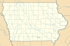
Weston is a small community in Pottawattamie County, Iowa, in the United States. It's known as a census-designated place, which means it's a special area identified by the government for counting people.
Weston is located in the southeastern part of Hazel Dell Township. You can find it between the cities of Council Bluffs and Underwood, not far from Interstate 80.
A Look Back at Weston
Weston has been a community for a long time. In 1925, the population of Weston was 92 people.
Who Lives in Weston?
Every ten years, the United States counts all its people in what's called a census. This helps us understand how many people live in different places.
According to the 2020 census, there were 78 people living in Weston. This shows how the population has changed over the years.
| Historical population | |||
|---|---|---|---|
| Census | Pop. | %± | |
| 2020 | 78 | — | |
| U.S. Decennial Census | |||
Want to Learn More?
- In Spanish: Weston (Iowa) para niños
Black History Month on Kiddle
Contemporary African-American Artists:
 | Janet Taylor Pickett |
 | Synthia Saint James |
 | Howardena Pindell |
 | Faith Ringgold |

All content from Kiddle encyclopedia articles (including the article images and facts) can be freely used under Attribution-ShareAlike license, unless stated otherwise. Cite this article:
Weston, Iowa Facts for Kids. Kiddle Encyclopedia.

