Weston, Ohio facts for kids
Quick facts for kids
Weston, Ohio
|
|
|---|---|
|
Village
|
|

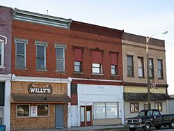
Local businesses in downtown Weston
|
|

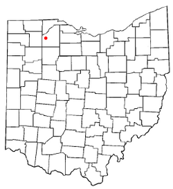
Location of Weston, Ohio
|
|

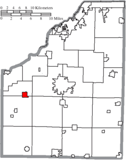
Location of Weston in Wood County
|
|
| Country | United States |
| State | Ohio |
| County | Wood |
| Area | |
| • Total | 1.14 sq mi (2.96 km2) |
| • Land | 1.14 sq mi (2.95 km2) |
| • Water | 0.00 sq mi (0.01 km2) |
| Elevation | 679 ft (207 m) |
| Population
(2020)
|
|
| • Total | 1,455 |
| • Density | 1,276.32/sq mi (492.93/km2) |
| Time zone | UTC-5 (Eastern (EST)) |
| • Summer (DST) | UTC-4 (EDT) |
| ZIP code |
43569
|
| Area code(s) | 419 |
| FIPS code | 39-83972 |
| GNIS feature ID | 2400154 |
| Website | http://www.westonohio.org/ |
Weston is a small village located in Wood County, Ohio, in the United States. In 2020, about 1,455 people lived there. Weston is only about 10 miles west of Bowling Green, Ohio, which is a town known for its university.
Contents
History of Weston Village
Weston started out with a different name. It was first called Taylortown. A man named Thomas Taylor planned out the village in 1853, and it was named after him. Another early name for the village was New Westfield.
The current name, Weston, comes from the nearby Weston Township. A post office was set up in 1856 under the name New Westfield. Later, in 1863, its name was changed to Weston. The village officially became a town in 1873.
Weston's Location and Size
Weston is a small village. According to the United States Census Bureau, the village covers a total area of about 1.13 square miles (2.93 square kilometers). All of this area is land.
People Living in Weston
Weston has seen its population change over the years. Here is a quick look at how many people have lived in the village:
| Historical population | |||
|---|---|---|---|
| Census | Pop. | %± | |
| 1880 | 698 | — | |
| 1890 | 845 | 21.1% | |
| 1900 | 953 | 12.8% | |
| 1910 | 913 | −4.2% | |
| 1920 | 844 | −7.6% | |
| 1930 | 794 | −5.9% | |
| 1940 | 859 | 8.2% | |
| 1950 | 973 | 13.3% | |
| 1960 | 1,075 | 10.5% | |
| 1970 | 1,269 | 18.0% | |
| 1980 | 1,708 | 34.6% | |
| 1990 | 1,716 | 0.5% | |
| 2000 | 1,659 | −3.3% | |
| 2010 | 1,590 | −4.2% | |
| 2020 | 1,455 | −8.5% | |
| U.S. Decennial Census | |||
Weston's Population in 2010
In 2010, there were 1,590 people living in Weston. These people lived in 609 households, and 424 of these were families. The village had about 1,407 people per square mile.
Most of the people in Weston were White (91.6%). About 11.8% of the population identified as Hispanic or Latino.
The average age of people in Weston was 35.8 years old. About 29.2% of the residents were under 18 years old. Also, 10.9% of the people were 65 years old or older. The population was almost evenly split between males (49.4%) and females (50.6%).
Weston Public Library
The Weston Public Library serves the communities in the southwestern part of Wood County. It has its main office in Weston and a branch in Grand Rapids.
In 2006, the library was very active. It loaned out 96,919 items, like books and movies. It also offered 186 programs for its 3,399 members who had library cards. The library had over 35,000 books and other items in its collection. It also subscribed to more than 130 different magazines and newspapers.
See also
 In Spanish: Weston (Ohio) para niños
 | Jackie Robinson |
 | Jack Johnson |
 | Althea Gibson |
 | Arthur Ashe |
 | Muhammad Ali |


