Wether Down facts for kids
Quick facts for kids Wether Down |
|
|---|---|

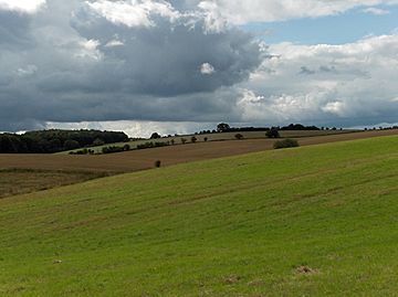
View from Wether Down towards Betterton Down
|
|
| Highest point | |
| Elevation | 234 m (768 ft) |
| Prominence | 37 m (121 ft) |
| Parent peak | Butser Hill |
| Geography | |
| Location | Hampshire, England |
| Parent range | South Downs |
| OS grid | SU675197 |
| Topo map | OS Landranger |
Wether Down is a tall hill located in Hampshire, England. It is one of the highest points in the county. This hill is also part of the beautiful South Downs area. It rises to about 234 meters (768 feet) above the sea.
Wether Down is mostly open land with no trees. At the very top, you can find a special marker called a trig point. This point was once used by mapmakers to measure distances. There is also a tall mast that sends out signals, like for mobile phones or radio.
Contents
Exploring Wether Down's History
Wether Down has been an important place for a very long time. People lived here even before recorded history. We know this because of some old structures found nearby.
Ancient Structures on the Hill
Around Wether Down, you can see signs of ancient life. These include "cross dykes" and a "long barrow."
What are Cross Dykes?
Cross dykes are old ditches and banks that cross over a piece of land. They were built by people long ago. These structures might have been used to mark boundaries. They could also have been for defense or to control movement.
Discovering Long Barrows
A long barrow is a very old burial mound. It is shaped like a long, low hill. People in ancient times used these barrows to bury their dead. Finding a long barrow near Wether Down tells us that people lived and buried their loved ones here many centuries ago. These findings help us learn about how early communities lived.
Wether Down and the South Downs
Wether Down is a key part of the South Downs. This area is known for its rolling hills and stunning views. It is a popular place for walking and enjoying nature.
Why Visit the South Downs?
The South Downs offer many outdoor activities. You can hike along trails and see amazing landscapes. The area is also home to different types of plants and animals. It's a great place to connect with nature and learn about England's countryside.
 | Bessie Coleman |
 | Spann Watson |
 | Jill E. Brown |
 | Sherman W. White |

