White Bear Township, Ramsey County, Minnesota facts for kids
Quick facts for kids
White Bear Township, Minnesota
|
|
|---|---|
|
Township
|
|
| Country | United States |
| State | Minnesota |
| County | Ramsey |
| Area | |
| • Total | 10.8 sq mi (28.1 km2) |
| • Land | 7.5 sq mi (19.3 km2) |
| • Water | 3.4 sq mi (8.7 km2) |
| Elevation | 932 ft (284 m) |
| Population
(2020)
|
|
| • Total | 11,049 |
| • Density | 1,023/sq mi (393.2/km2) |
| Time zone | UTC-6 (Central (CST)) |
| • Summer (DST) | UTC-5 (CDT) |
| FIPS code | 27-69916 |
| GNIS feature ID | 0665981 |
| Website | www.ci.white-bear-township.mn.us |
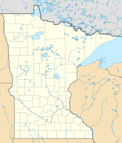
White Bear Township is a community in Ramsey County, Minnesota, United States. It is known as an "urban township." In 2020, about 11,049 people lived here. This was a small increase from 10,949 people in 2010.
White Bear Township was first set up in 1858. It was named after the nearby White Bear Lake. Over time, several cities were formed from parts of the original township. These cities include White Bear Lake, Vadnais Heights, Gem Lake, and North Oaks.
The township originally covered about 36 square miles (93 square kilometers). Now, it is made up of four separate pieces of land. These pieces cover about 9.3 square miles (24.1 square kilometers). White Bear Township is the only township left in Ramsey County. Two small communities, Bald Eagle and Bellaire, are also located within the township.
Geography and Location
White Bear Township has a total area of about 10.8 square miles (28 square kilometers). A large part of this area is land, about 7.5 square miles (19.4 square kilometers). The rest, about 3.4 square miles (8.8 square kilometers), is water. This means water makes up about 31% of the township's total area.
Several important roads pass through the community. These include Interstate Highway 35E and U.S. Highway 61. Other main routes are County Highway 96 and State Highway 96. These roads help people travel in and out of the township.
Population Information
| Historical population | |||
|---|---|---|---|
| Census | Pop. | %± | |
| 1860 | 267 | — | |
| 1870 | 430 | 61.0% | |
| 1880 | 700 | 62.8% | |
| 1890 | 1,087 | 55.3% | |
| 1900 | 1,018 | −6.3% | |
| 1910 | 1,422 | 39.7% | |
| 1920 | 1,138 | −20.0% | |
| 1930 | 2,238 | 96.7% | |
| 1940 | 3,430 | 53.3% | |
| 1950 | 7,049 | 105.5% | |
| 1960 | 6,175 | −12.4% | |
| 1970 | 5,666 | −8.2% | |
| 1980 | 5,921 | 4.5% | |
| 1990 | 9,424 | 59.2% | |
| 2000 | 11,293 | 19.8% | |
| 2010 | 10,949 | −3.0% | |
| 2020 | 11,049 | 0.9% | |
| U.S. Decennial Census | |||
Who Lives Here? (2010 Census)
The 2010 census helps us understand the people living in White Bear Township. At that time, there were 10,949 people. These people lived in 4,261 households, and 3,225 of these were families.
The census also looks at the different backgrounds of the people. Most residents, about 94.5%, identified as White. Other groups included 0.7% African American and 0.4% Native American. About 2.2% of the population was Asian, and 0.1% was Pacific Islander. About 0.6% were from other backgrounds, and 1.5% identified with two or more backgrounds.
People who identified as Hispanic or Latino made up 2.4% of the total population.
See also
 In Spanish: Municipio de White Bear para niños


