White Brook facts for kids
Quick facts for kids White Brook |
|
|---|---|

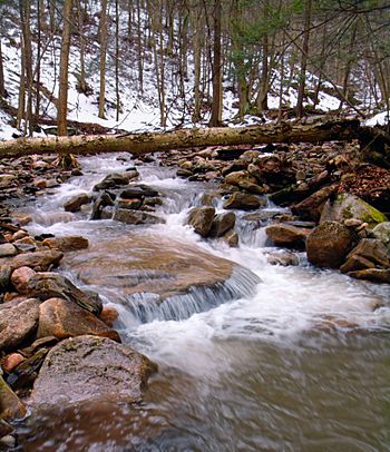
White Brook in March 2011
|
|
| Physical characteristics | |
| Main source | near the edge of a plateau in North Branch Township, Wyoming County, Pennsylvania 2,043 feet (623 m) |
| River mouth | Mehoopany Creek in Forkston Township, Wyoming County, Pennsylvania near Kasson Brook 879 feet (268 m) 41°29′55″N 76°07′47″W / 41.4986°N 76.1297°W |
| Length | 1.8 miles (2.9 km) |
| Basin features | |
| Progression | Mehoopany Creek → Susquehanna River → Chesapeake Bay |
| Basin size | 1.75 square miles (4.5 km2) |
| Tributaries |
|
White Brook is a small stream, also called a tributary, that flows into Mehoopany Creek. You can find it in Wyoming County, Pennsylvania, in the United States. It's about 1.8 miles (2.9 km) long.
The brook flows through two areas: North Branch Township and Forkston Township. The land area that drains into White Brook, called its watershed, is about 1.75 square miles (4.5 km2). This stream is known for its very clean, cold water, making it a great home for fish. It even has a small waterfall and a hiking trail nearby!
Contents
Where White Brook Flows
White Brook starts high up, near the edge of a flat area called a plateau, in North Branch Township. It flows towards the south-southwest for a short distance. Then, it enters a valley.
The stream changes direction, flowing south-southeast for a while. It then enters Forkston Township. Here, it reaches the bottom of the valley. Another small stream joins White Brook from its right side.
After that, White Brook flows east-southeast, then east-northeast. It leaves the valley and flows east for a bit longer. Finally, it joins Mehoopany Creek. White Brook meets Mehoopany Creek about 8.88 miles (14.29 km) before Mehoopany Creek ends.
Land and Rocks Around the Brook
The land where White Brook joins Mehoopany Creek is about 879 feet (268 meters) above sea level. Where White Brook begins, it's much higher, around 2043 feet (623 meters) above sea level.
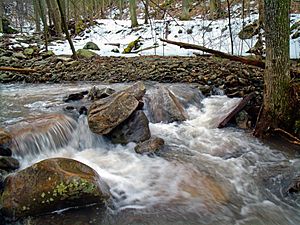
There's a cool waterfall on White Brook. It's about 15 feet (4.6 meters) tall! The waterfall is in a rough, rocky area called a glen. This glen has many smaller waterfalls, rocky ledges, and large boulders. The rocks in the stream are often white and smooth. Getting to this waterfall can be tricky, as there isn't a clear path.
Animals and the Environment
The watershed of White Brook covers about 1.75 square miles (4.5 km2). This is the area of land where all the rain and snow eventually flow into White Brook. The end of the stream is on a map called the Dutch Mountain quadrangle. However, its beginning is on a different map called the Jenningsville quadrangle.
White Brook is known as a High-Quality Coldwater Fishery. This means its water is very clean and cold, which is perfect for certain types of fish. Wild trout live and reproduce naturally in White Brook. You can find them from where the stream starts all the way to where it joins Mehoopany Creek. There are also a few small houses, or cottages, located along the lower parts of the stream.
History and Fun Activities
White Brook was officially added to the Geographic Names Information System on August 2, 1979. This system helps keep track of names for places like rivers and mountains.
Since the year 2000, people have worked to make the streambanks of White Brook stronger. This helps prevent erosion and keeps the stream healthy.
White Brook is located within Pennsylvania State Game Lands Number 57. This is a large area of land set aside for wildlife and outdoor activities. There's an old, steep trail that follows the stream. It leads to a "beautiful" view at a spot called Flat Top. In the higher parts of the stream's watershed, you can find trails for all-terrain vehicles (ATVs). These trails are kept clear by removing brush and trees.
 | Victor J. Glover |
 | Yvonne Cagle |
 | Jeanette Epps |
 | Bernard A. Harris Jr. |


