White Deer Township, Pennsylvania facts for kids
Quick facts for kids
White Deer Township, Pennsylvania
|
|
|---|---|
|
Township
|
|

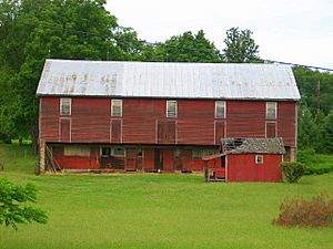
An old red barn in White Deer Township
|
|

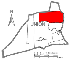
Map of Union County, Pennsylvania highlighting White Deer Township
|
|

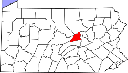
Map of Pennsylvania highlighting Union County
|
|
| Country | United States |
| State | Pennsylvania |
| County | Union |
| Settled | 1772 |
| Incorporated | 1776 |
| Area | |
| • Total | 46.43 sq mi (120.26 km2) |
| • Land | 46.17 sq mi (119.58 km2) |
| • Water | 0.26 sq mi (0.68 km2) |
| Population
(2020)
|
|
| • Total | 4,331 |
| • Estimate
(2021)
|
4,323 |
| • Density | 99.59/sq mi (38.45/km2) |
| Time zone | UTC-5 (EST) |
| • Summer (DST) | UTC-4 (EDT) |
| ZIP code |
17887
|
| Area code(s) | 272 and 570 |
| FIPS code | 42-119-84496 |
White Deer Township is a community located in Union County, Pennsylvania, in the United States. In 2020, about 4,331 people lived here. It's a great place to learn about history and nature!
Contents
History of White Deer Township
White Deer Township has a rich past. Two important bridges, the Watsontown River Bridge and the Factory Bridge, are listed on the National Register of Historic Places. This means they are special places that are protected because of their historical value.
Exploring White Deer Township's Geography
White Deer Township covers about 46.6 square miles (120.7 square kilometers). Most of this area is land, with a small part being water.
Where is White Deer Township Located?
The township is surrounded by other interesting places:
- To the north, you'll find Lycoming County and Gregg Township.
- To the east, the West Branch Susquehanna River flows, and across it is Northumberland County.
- To the south are Kelly Township and Buffalo Township.
- To the west, it borders West Buffalo Township.
Inside White Deer Township, there are also smaller communities like White Deer, New Columbia, and a part of West Milton.
People and Population in White Deer Township
| Historical population | |||
|---|---|---|---|
| Census | Pop. | %± | |
| 2000 | 4,273 | — | |
| 2010 | 4,437 | 3.8% | |
| 2020 | 4,331 | −2.4% | |
| 2021 (est.) | 4,323 | −2.6% | |
| U.S. Decennial Census | |||
The population of White Deer Township has changed a bit over the years. In 2000, there were 4,273 people. By 2010, the population grew to 4,437. In the most recent census in 2020, the population was 4,331.
Most people living in the township are White (about 98%). There are also smaller groups of African American and Asian residents, as well as people from other backgrounds. About 0.70% of the population is Hispanic or Latino.
Households and Families
In 2000, there were 1,644 households in the township. A household is a group of people living together in one home. Most of these (about 65%) were married couples living together. About 32% of households had children under 18 living with them.
The average household had about 2.59 people. Families were a bit larger, with an average of 2.94 people.
Age Groups in the Township
The population in White Deer Township includes people of all ages:
- About 24% were under 18 years old.
- About 6.8% were young adults aged 18 to 24.
- The largest group, about 28.9%, was between 25 and 44 years old.
- About 27.5% were between 45 and 64 years old.
- About 12.8% were 65 years old or older.
The average age in the township was 40 years.
Education in White Deer Township
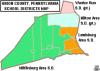
Students in White Deer Township attend public schools through the Milton Area School District. This district provides education for many students in the area. If families are looking for other options, there are also private and charter schools nearby.
See also
 In Spanish: Municipio de White Deer para niños


