Whitewater, Missouri facts for kids
Quick facts for kids
Whitewater, Missouri
|
|
|---|---|

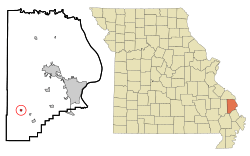
Location of Whitewater, Missouri
|
|
| Country | United States |
| State | Missouri |
| County | Cape Girardeau |
| Area | |
| • Total | 0.21 sq mi (0.56 km2) |
| • Land | 0.21 sq mi (0.56 km2) |
| • Water | 0.00 sq mi (0.00 km2) |
| Elevation | 374 ft (114 m) |
| Population
(2020)
|
|
| • Total | 88 |
| • Density | 411.21/sq mi (158.50/km2) |
| Time zone | UTC-6 (Central (CST)) |
| • Summer (DST) | UTC-5 (CDT) |
| ZIP code |
63785
|
| Area code(s) | 573 |
| FIPS code | 29-79612 |
| GNIS feature ID | 0728793 |
Whitewater is a small village located in Cape Girardeau County, Missouri, in the United States. It is part of Hubble Township. In 2020, about 88 people lived there. Whitewater is also part of the larger Cape Girardeau–Jackson Metropolitan Statistical Area. This means it's connected to the bigger towns of Cape Girardeau and Jackson.
Contents
History of Whitewater
Whitewater was first settled in 1866. The land belonged to William 'Uncle Bill' DeVore and Linus Sanford. It officially became a town in 1898.
The village was located along the St. Louis, Iron Mountain and Southern Railway line. This railway helped the town grow. By 1915, Whitewater had about 350 people. It had several stores, hotels, a school, and churches.
The first mayor of Whitewater was P. N. O'Brien. He was born in St. Louis in 1851. Before coming to Whitewater, he owned a grocery company in Cape Girardeau. He also helped start Shell & Albert, which was the first store in Whitewater. Mr. O'Brien served as the Whitewater postmaster for almost 25 years.
Geography of Whitewater
Whitewater is located about five miles northwest of Delta. It sits along the Upper Whitewater River. The village is on Missouri Route A. This road is about seven miles west of Dutchtown.
The Headwater Diversion Channel helps control the flow of the Whitewater River. This channel is just south of the village. According to the United States Census Bureau, Whitewater covers a total area of about 0.21 square miles (0.56 square kilometers). All of this area is land.
Population and People
The number of people living in Whitewater has changed over the years. Here's a look at the population counts from different years:
| Historical population | |||
|---|---|---|---|
| Census | Pop. | %± | |
| 1880 | 53 | — | |
| 1900 | 122 | — | |
| 1910 | 250 | 104.9% | |
| 1920 | 284 | 13.6% | |
| 1930 | 223 | −21.5% | |
| 1940 | 175 | −21.5% | |
| 1950 | 187 | 6.9% | |
| 1960 | 169 | −9.6% | |
| 1970 | 135 | −20.1% | |
| 1980 | 161 | 19.3% | |
| 1990 | 103 | −36.0% | |
| 2000 | 113 | 9.7% | |
| 2010 | 125 | 10.6% | |
| 2020 | 88 | −29.6% | |
| U.S. Decennial Census 2020 | |||
2010 Census Information
In 2010, there were 125 people living in Whitewater. These people lived in 46 households. A household is a group of people living together. Out of these, 35 were families. The village had about 595 people per square mile.
Most of the people in the village were White (99.20%). A small number (0.80%) were from two or more races.
- About 32.6% of households had children under 18 living with them.
- 56.5% of households were married couples living together.
- 13.0% had a female head of the house with no husband.
- 6.5% had a male head of the house with no wife.
- About 23.9% were not families.
The average age of people in the village was 39.3 years.
- 28% of residents were under 18 years old.
- 4% were between 18 and 24 years old.
- 20.8% were between 25 and 44 years old.
- 25.6% were between 45 and 64 years old.
- 21.6% were 65 years or older.
The village had more females (59.2%) than males (40.8%).
See also
 In Spanish: Whitewater (Misuri) para niños
 | James B. Knighten |
 | Azellia White |
 | Willa Brown |

