Widdick Chine facts for kids
Quick facts for kids Widdick Chine |
|
|---|---|
 |
|
| Location | Isle of Wight |
| Coordinates | 50°40′42″N 1°32′52″W / 50.678365°N 1.547907°W |
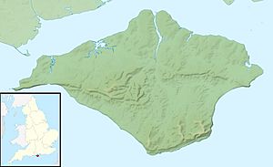
Widdick Chine is a special natural valley on the west coast of the Isle of Wight in England. It is located just west of the small village of Totland. A "chine" is a local word for a steep, narrow valley or gully that has been carved into the coastline by a stream or river.
Contents
Exploring Widdick Chine
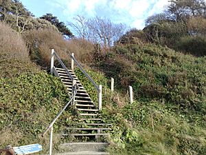
Widdick Chine is a deep, narrow gully that cuts into the coastal cliffs. It is covered with lots of plants and trees, making it look very green and natural.
How Water Shaped the Chine
In the past, water used to flow down this steep valley. This water helped to create the chine over many years. To protect the cliff from too much wear and tear, the water has been moved. Now, it flows through a pipe that goes all the way down to the beach. This helps to stop the cliff from eroding, which means wearing away.
Steps to the Beach
To make it easier for people to visit, a set of steps has been built down the chine. These steps connect the village of Totland to the sandy beach of Totland Bay. It's a great way to get down to the shore!
Water Source and Nearby Paths
The pipe in Widdick Chine collects water from the northern side of Tennyson Down. This is a famous chalk downland area nearby. The Isle of Wight Coastal Path also uses the steps of Widdick Chine. This path is a long walking route that goes all around the island's coast.
The Old Lifeboat House
At the very bottom of Widdick Chine, right on the beach, you can find an old building. This building used to be the Totland lifeboat house. Lifeboats are special boats used to rescue people at sea.
 | Aaron Henry |
 | T. R. M. Howard |
 | Jesse Jackson |


