Security-Widefield, Colorado facts for kids
Quick facts for kids
Security-Widefield, Colorado
|
|
|---|---|

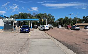
Looking northwest along Widefield Blvd. towards Fontaine Blvd.
|
|

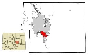
Location of the Security-Widefield CDP in El Paso County, Colorado
|
|
| Country | |
| State | |
| County | El Paso County |
| Government | |
| • Type | unincorporated communities |
| Area | |
| • Total | 13.477 sq mi (34.905 km2) |
| • Land | 12.993 sq mi (33.653 km2) |
| • Water | 0.483 sq mi (1.252 km2) |
| Elevation | 5,843 ft (1,781 m) |
| Population
(2020)
|
|
| • Total | 38,639 |
| • Density | 2,867.05/sq mi (1,106.976/km2) |
| Time zone | UTC-7 (MST) |
| • Summer (DST) | UTC-6 (MDT) |
| ZIP Code | |
| Area code(s) | 719 |
| GNIS feature | Security-Widefield CDP |
Security-Widefield is a special kind of community in El Paso County, Colorado, United States. It's called a census-designated place (CDP). This means it's a place that the government counts for population, but it's not officially a city or town.
Security-Widefield is made up of two smaller communities: Security and Widefield. Even though they are together, they are not run by their own city government. Instead, El Paso County manages them.
In 2020, about 38,639 people lived in Security-Widefield. It's also part of the larger Colorado Springs, CO Metropolitan Statistical Area. Mail for the area comes from either the Colorado Springs post office or the Fountain post office.
Contents
History of Security-Widefield
Security-Widefield has some interesting history.
Early Buildings and Landmarks
The S.A. Wilson Elementary School is an important building in Security-Widefield. It was built a long time ago, between 1959 and 1961. Because it's so old and important, it was added to the National Register of Historic Places in 2017. This list helps protect special places in the United States.
Notable Events in the Area
In March 1991, something sad happened in Widefield. A plane called United Airlines Flight 585 crashed there. All 25 people on board died. Investigators later found out the crash was caused by a problem with a part of the plane's steering system.
Geography and Location
Security-Widefield is divided by a main road.
Dividing the Communities
A road called Fontaine Boulevard runs from east to west and splits Security and Widefield. People usually think of Security as the part northwest of Fontaine Boulevard. Widefield is generally considered to be along the northern and southeastern parts of Fontaine, close to the City of Fountain.
Water Services in the Area
The neighborhoods of Security and Widefield get their water from different places. The northern part of Fontaine Boulevard is mostly served by the Security Water and Sanitation District. A smaller northern section and the southern section get their water from the Widefield Water and Sanitation District. This includes areas east of Grinnell.
Size of the Area
The total area of Security-Widefield is about 34.905 square kilometers (which is about 8,625 acres). A small part of this area, about 1.252 square kilometers (or 309 acres), is water.
Population Changes Over Time
The government keeps track of how many people live in Security-Widefield.
How the Population is Counted
The United States Census Bureau first started counting the population of just the Security area in 1960. Then, for the 1970 census, they expanded the area to include Widefield, creating the Security-Widefield CDP we know today.
Population Growth
The number of people living in Security-Widefield has grown a lot over the years:
- 1960: 9,017 people
- 1970: 15,297 people
- 1980: 18,768 people
- 1990: 23,822 people
- 2000: 29,845 people
- 2010: 32,882 people
- 2020: 38,639 people
Education for Students
Students in Security-Widefield go to schools managed by the Widefield School District 3. This district provides education for children living in the area.
See also

- In Spanish: Security-Widefield para niños


