
Fountain, Colorado facts for kids
Quick facts for kids
Fountain, Colorado
|
|||
|---|---|---|---|

Fountain, Colorado circa 1942
|
|||
|
|||
| Motto(s):
"Pure Colorado"
|
|||

Location of the City of Fountain in El Paso County, Colorado.
|
|||
| Country | United States | ||
| State | Colorado | ||
| County | El Paso | ||
| Founded | 1859 | ||
| Incorporated | April 23, 1903 | ||
| Area | |||
| • City | 22.367 sq mi (57.930 km2) | ||
| • Land | 22.342 sq mi (57.865 km2) | ||
| • Water | 0.025 sq mi (0.635 km2) | ||
| Elevation | 5,558 ft (1,694 m) | ||
| Population
(2020)
|
|||
| • City | 29,802 | ||
| • Estimate
(2022)
|
28,907 | ||
| • Density | 1,296/sq mi (500.5/km2) | ||
| • Urban | 632,494 (US: 66th) | ||
| • Metro | 768,832 (US: 79th) | ||
| • Front Range | 5,055,344 | ||
| Time zone | UTC–7 (Mountain (MST)) | ||
| • Summer (DST) | UTC–6 (MDT) | ||
| ZIP Code |
80817
|
||
| Area code(s) | 719 | ||
| FIPS code | 08-27865 | ||
| GNIS feature ID | 2410535 | ||
| Sales tax | 7.53% | ||
| Major Routes | |||


Fountain is a city in Colorado, United States. It's located in El Paso County. In 2020, about 29,802 people lived there. Fountain is part of the larger Colorado Springs area. It's also part of the Front Range Urban Corridor, a busy area in Colorado.
Fountain is about 10 miles (16 km) south of downtown Colorado Springs. It's also just east of Fort Carson, a large army base. Fountain, along with nearby towns like Security and Widefield, forms a community known as "Fountain Valley."
Contents
History of Fountain, Colorado
Fountain was started in 1859. It was built as a place to ship goods by train for local farms and ranches. The town got its name from Fountain Creek, a nearby stream. Fountain officially became a city in 1900.
In 1999, the New York Times newspaper called Fountain "America's Millennium City." This was a special honor. In 2002, the National Civic League named Fountain an "All-America City." This award recognizes cities that work well together to solve problems. The city is also home to Pikes Peak International Raceway, a famous race track.
Geography and Location
Fountain is located at 38°41′38″N 104°41′53″W / 38.69389°N 104.69806°W. The city covers about 24 square miles (62.2 square kilometers). Most of this area is land. Only a small part, about 0.04 square miles (0.1 square kilometers), is water. The stream that gave the city its name, Fountain Creek, flows south through the city.
Population and People
| Historical population | |||
|---|---|---|---|
| Census | Pop. | %± | |
| 1880 | 99 | — | |
| 1910 | 431 | — | |
| 1920 | 595 | 38.1% | |
| 1930 | 577 | −3.0% | |
| 1940 | 571 | −1.0% | |
| 1950 | 713 | 24.9% | |
| 1960 | 1,602 | 124.7% | |
| 1970 | 3,515 | 119.4% | |
| 1980 | 8,324 | 136.8% | |
| 1990 | 9,984 | 19.9% | |
| 2000 | 15,197 | 52.2% | |
| 2010 | 25,846 | 70.1% | |
| 2020 | 29,802 | 15.3% | |
| 2022 (est.) | 28,907 | 11.8% | |
| U.S. Decennial Census 2020 Census |
|||
Fountain's Population in 2020
According to the 2020 census, 29,802 people lived in Fountain. There were 9,931 households, which are groups of people living together. About 7,779 of these were families. The city had about 1,324 people per square mile (500.5 people per square kilometer). There were also 10,324 housing units available.
Getting Around Fountain
Fountain has its own bus service. This bus connects the city to Pikes Peak State College. Fountain is also part of the Bustang network. This is a system of buses that provides transportation between different cities. Fountain is on the Lamar-Pueblo-Colorado Springs Outrider line, making it easy to travel to other places.
Famous People from Fountain
Many interesting people have come from Fountain, Colorado. Here are a few:
- Don Cockroft – A former professional football player for the Cleveland Browns.
- Chase Headley – A professional baseball player who played for the New York Yankees.
- Peter La Farge – A singer-songwriter known for his song "The Ballad of Ira Hayes."
- Phil Loadholt – A former professional football player for the Minnesota Vikings.
- Pete Nelson – A designer and builder famous for creating amazing tree houses.
- Jon Watts – A film director who has directed several popular movies.
Images for kids
-
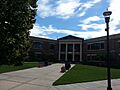
Fountain Valley Town Hall

See also
 In Spanish: Fountain (Colorado) para niños
