Winagami Lake facts for kids
Quick facts for kids Winagami Lake |
|
|---|---|

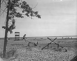
Sunset on Winagami Lake
|
|
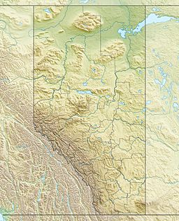
| Location | Big Lakes County / Smoky River No. 130, Alberta |
| Coordinates | 55°38′44″N 116°46′12″W / 55.64556°N 116.77000°W |
| Type | Hyper-eutrophic |
| Primary outflows | South Heart River |
| Catchment area | 221 km2 (85 sq mi) |
| Basin countries | Canada |
| Max. length | 14 km (8.7 mi) |
| Max. width | 6 km (3.7 mi) |
| Average depth | 1.7 m (5 ft 7 in) |
| Max. depth | 4.7 m (15 ft) |
| Surface elevation | 621 m (2,037 ft) |
| Settlements | Kathleeen |
Winagami Lake is a large, shallow lake located in northern Alberta, Canada. It's found in Big Lakes County and Municipal District of Smoky River No. 130. The lake is northeast of where Highway 2 and Highway 679 meet. All the water flowing into Winagami Lake eventually makes its way to the Athabasca River.
What's in a Name?
The name Winagami comes from the Cree language. In Cree, the phrase ᐃᐧᓇᑲᒣᐤ ᓵᑳᐦᐃᑲᐣ (which is pronounced winakamew sâkâhikan) means "dirty-water lake." This name likely describes the color or clarity of the lake's water.
Lake Features
Winagami Lake is quite large, stretching about 14 km (8.7 mi) long and 6 km (3.7 mi) wide. Even though it's big, it's also very shallow. The average depth of the lake is only about 1.7 m (5 ft 7 in). At its deepest point, it reaches about 4.7 m (15 ft).
The lake's water level is controlled by a special structure called a weir. A weir is like a small dam that helps manage how much water flows out of the lake. This helps keep the lake's water levels stable.
Animals and Plants
Winagami Lake is home to several types of fish. You can find lake whitefish, yellow perch, northern pike, and walleye swimming in its waters. These fish are an important part of the lake's ecosystem.
Winagami Lake Provincial Park
A big part of the lake's western, southern, and eastern shores are part of Winagami Lake Provincial Park. This park is a great place for people to visit and enjoy nature. It offers chances for camping, fishing, and other outdoor activities.
 | Sharif Bey |
 | Hale Woodruff |
 | Richmond Barthé |
 | Purvis Young |


