Wind Gap, Pennsylvania facts for kids
Quick facts for kids
Wind Gap, Pennsylvania
Gratdaal
|
|
|---|---|
|
Borough
|
|
| Borough of Wind Gap | |

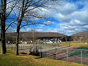
Wind Gap in December 2010
|
|

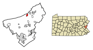
Location of Wind Gap in Northampton County, Pennsylvania (left) and of Northampton County in Pennsylvania
|
|
| Country | |
| State | |
| County | Northampton |
| Founded | 1893 |
| Area | |
| • Borough | 1.37 sq mi (3.54 km2) |
| • Land | 1.34 sq mi (3.47 km2) |
| • Water | 0.03 sq mi (0.08 km2) |
| Elevation | 755 ft (230 m) |
| Population
(2020)
|
|
| • Borough | 2,820 |
| • Density | 2,106.05/sq mi (813.36/km2) |
| • Metro | 865,310 (US: 68th) |
| Time zone | UTC-5 (EST) |
| • Summer (DST) | UTC-4 (EDT) |
| ZIP Code |
18091
|
| Area code(s) | 610 |
| FIPS code | 42-85664 |
| Primary airport | Lehigh Valley International Airport |
| Major hospital | Lehigh Valley Hospital–Cedar Crest |
| School district | Pen Argyl Area |
| Website | windgap-pa.gov |
Wind Gap is a small town, called a borough, located in Northampton County, Pennsylvania. In the Pennsylvania Dutch language, it is known as Gratdaal.
In 2020, about 2,820 people lived in Wind Gap. It is part of the larger Lehigh Valley area, which is home to over 860,000 people. This makes the Lehigh Valley one of the largest metropolitan areas in the United States.
Contents
Where is Wind Gap Located?
Wind Gap is found at coordinates 40°50′47″N 75°17′30″W / 40.84639°N 75.29167°W. It covers an area of about 1.4 square miles (3.5 square kilometers). Most of this area is land, with a very small part being water.
The town is about 21 miles (34 kilometers) north of Allentown. It is also about 50 miles (80 kilometers) southeast of Scranton, which is in the Wyoming Valley. Wind Gap sits 755 feet (230 meters) above sea level.
How Many People Live in Wind Gap?
|
||||||||||||||||||||||||||||||||||||||||||||||||||||||||||||||||
Over the years, the number of people living in Wind Gap has grown steadily. In 1900, there were 711 residents. By 2020, the population had increased to 2,820 people.
In 2000, there were 2,812 people living in the borough. There were 1,221 households, which are groups of people living together. About 26.6% of these households had children under 18. The average household had 2.25 people.
The population was spread out across different age groups. About 20.8% of residents were under 18 years old. About 19.2% were 65 years or older. The average age in Wind Gap was 39 years.
Getting Around Wind Gap
Wind Gap has about 13.45 miles (21.65 kilometers) of public roads. Some roads are kept up by the state of Pennsylvania, while others are maintained by the borough itself.
Two main highways pass near or through Wind Gap:
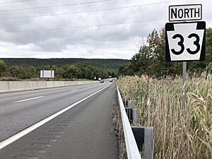
- Pennsylvania Route 33 (PA 33) runs north and south. It has an exit for PA 512 just outside the borough.
- Pennsylvania Route 512 (PA 512) goes through the middle of Wind Gap. It follows Broadway and Lehigh Avenue.
The famous Appalachian Trail, a long hiking path, also crosses the very northern part of Wind Gap.
Schools in Wind Gap
Students in Wind Gap are part of the Pen Argyl Area School District. Younger students attend local schools within the district. For high school, students in grades nine through 12 go to Pen Argyl Area High School. This high school is located in the nearby town of Pen Argyl.
See also
 In Spanish: Wind Gap para niños
 | Claudette Colvin |
 | Myrlie Evers-Williams |
 | Alberta Odell Jones |


