Winesburg, Holmes County, Ohio facts for kids
Quick facts for kids
Winesburg, Ohio
|
|
|---|---|

Welcome sign
|
|

Location of Winesburg in Ohio
|
|
| Country | United States |
| State | Ohio |
| County | Holmes |
| Township | Paint |
| Area | |
| • Total | 0.63 sq mi (1.63 km2) |
| • Land | 0.63 sq mi (1.62 km2) |
| • Water | 0.00 sq mi (0.01 km2) |
| Elevation | 1,286 ft (392 m) |
| Population
(2020)
|
|
| • Total | 340 |
| • Density | 542.26/sq mi (209.28/km2) |
| Time zone | UTC-5 (Eastern (EST)) |
| • Summer (DST) | UTC-4 (EDT) |
| ZIP code |
44690
|
| Area code(s) | 330 |
| FIPS code | 39-86072 |
| GNIS feature ID | 2628988 |
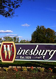
Winesburg is a small community in Holmes County, Ohio, in the United States. It is called a census-designated place (CDP) because the government counts its population for official records. In 2020, about 340 people lived there.
Winesburg is located on top of a hill in an area known for its Amish communities. A main road, U.S. Route 62, runs right through the town. It is important to know that this real town is not the setting for the famous book Winesburg, Ohio by Sherwood Anderson. That book tells fictional stories about people in a small town.
Contents
History of Winesburg
How Winesburg Got Its Name
The community of Winesburg was started in 1829. It was first named Weinsberg. This name came from a town in Germany.
In 1833, the postal service opened a post office in the town. They changed the spelling of the name to "Winesburg." This is the name it has kept ever since.
Geography of Winesburg
Where is Winesburg Located?
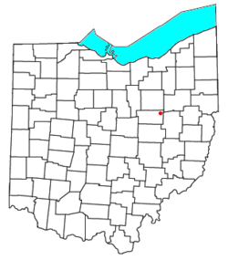
Winesburg is in the southeastern part of Paint Township. This is in the northeastern part of Holmes County. The community sits on a high area, like a ridge.
Water from the north side of Winesburg flows into the Middle Fork of Sugar Creek. Water from the south side flows into Indian Trail Creek. This creek then joins the South Fork of Sugar Creek. All these creeks eventually lead to the Tuscarawas River, which flows into the Ohio River.
Size and Roads
According to the U.S. Census Bureau, Winesburg covers a total area of about 1.63 square kilometers (0.63 square miles). Most of this area is land, with a very small amount (about 0.40%) being water.
U.S. Route 62 is a major road that goes through Winesburg. It is known as Main Street in the town. This road connects Winesburg to other cities. It goes northeast about 24 miles (39 km) to Canton. It also goes southwest about 13 miles (21 km) to Millersburg, which is the main town of Holmes County.
Population of Winesburg
How Many People Live in Winesburg?
| Historical population | |||
|---|---|---|---|
| Census | Pop. | %± | |
| 2020 | 340 | — | |
| U.S. Decennial Census | |||
The population of Winesburg was counted in the 2020 census. At that time, 340 people lived in the community.
Images for kids
See also
 In Spanish: Winesburg (Ohio) para niños
 | Roy Wilkins |
 | John Lewis |
 | Linda Carol Brown |


