Winfield, Tennessee facts for kids
Quick facts for kids
Winfield, Tennessee
|
|
|---|---|
 |
|

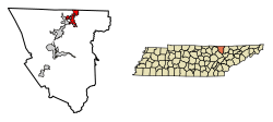
Location of Winfield in Scott County, Tennessee.
|
|
| Country | United States |
| State | Tennessee |
| County | Scott |
| Incorporated | 1983 |
| Area | |
| • Total | 6.80 sq mi (17.63 km2) |
| • Land | 6.79 sq mi (17.60 km2) |
| • Water | 0.01 sq mi (0.03 km2) |
| Elevation | 1,326 ft (404 m) |
| Population
(2020)
|
|
| • Total | 947 |
| • Density | 139.39/sq mi (53.81/km2) |
| Time zone | UTC-5 (Eastern (EST)) |
| • Summer (DST) | UTC-4 (EDT) |
| ZIP code |
37892
|
| Area code(s) | 423 |
| FIPS code | 47-81280 |
| GNIS feature ID | 1304634 |
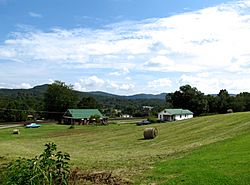
Winfield is a small town located in Scott County, Tennessee, in the United States. It was first settled a long time ago and has a population of about 947 people as of 2020. The town has an interesting history, including a name change from its original name, Chitwood.
Contents
History of Winfield
The town was originally called Chitwood. This name came from Captain James Chitwood, a hero from the American Revolutionary War, whose family settled in the area.
After the American Civil War, the town's name was changed to Winfield. This change happened because the Chitwood family had members who supported both sides during the war. The new name, Winfield, was chosen to honor Winfield Scott, a famous general in the U.S. Army.
The town was officially recognized and set up as an incorporated town in 1983.
Geography of Winfield
Winfield is located in a specific spot in Tennessee, at coordinates 36°33′43″N 84°27′2″W / 36.56194°N 84.45056°W.
Land and Water Area
The town covers a total area of about 6.4 square miles (17.63 square kilometers). Most of this area is land, about 6.4 square miles (17.60 square kilometers). Only a very small part, about 0.04 square miles (0.03 square kilometers), is water.
Chitwood Mountain
The highest point in Winfield is a place called Chitwood Mountain. It stands tall at 2,139 feet (652 meters) above sea level.
Population in Winfield
The population of Winfield has changed over the years. Here's how many people have lived in the town during different census counts:
| Historical population | |||
|---|---|---|---|
| Census | Pop. | %± | |
| 1990 | 564 | — | |
| 2000 | 911 | 61.5% | |
| 2010 | 967 | 6.1% | |
| 2020 | 947 | −2.1% | |
| Sources: | |||
As of the 2020 United States census, there were 947 people living in Winfield. These people lived in 416 different households, and 293 of those were families.
Who Lives in Winfield?
Most of the people living in Winfield are White (non-Hispanic), making up about 96.3% of the population. There are also smaller numbers of people who identify as Native American, Asian, or of mixed race. A small percentage of the population is also Hispanic or Latino.
Media in Winfield
People in Winfield can get their news and entertainment from a few local sources:
- The Independent Herald (a newspaper)
- Hive 105, WBNT-FM (a radio station)
See also
 In Spanish: Winfield (Tennessee) para niños
 | Sharif Bey |
 | Hale Woodruff |
 | Richmond Barthé |
 | Purvis Young |

