
Winston, Georgia facts for kids
Quick facts for kids
Winston, Georgia
|
|
|---|---|

Location in Douglas County and the state of Georgia
|
|
| Country | |
| State | |
| County | Douglas |
| Elevation | 364.8 m (1,197 ft) |
| Time zone | UTC-5 (Eastern (EST)) |
| • Summer (DST) | UTC-4 (EDT) |
| ZIP code |
30187
|
| Area code(s) | 770 |
Winston is a small community located in Douglas County, Georgia, in the United States. It is an unincorporated area, which means it is not officially a city or town with its own local government, but it used to be.
Winston has its own special ZIP code, 30187. This ZIP code covers parts of both Douglas and Carroll counties. You can find Winston in the southwestern part of Douglas County.
Contents
History of Winston
The community of Winston was named after an early settler known as "Uncle Jackie" Winn.
In 1906, the Georgia General Assembly officially made Winston a town. This meant it had its own local government. However, in 1995, the town's official status was removed. So, Winston is no longer an incorporated town.
Parks and Outdoor Fun
Winston and the surrounding area have several great parks where you can enjoy nature and play sports.
Clinton Nature Preserve
This large, 200-acre park is located on Ephesus Church Road. It was given to Douglas County by Ms. Annie Mae Clinton. Her will stated that the park should stay as natural as possible.
- The preserve has many nature trails for hiking and open areas to explore.
- There is a half-mile walking track around a special playground. This playground is designed to be easy for everyone to use, including those with disabilities.
- Deep in the woods, about a mile from the entrance, you can find the Carnes Cabin. This old house was built before the American Civil War and is listed on the National Register of Historic Places.
F M Boatwright Memorial Park
This park is another green space in Winston. It is a memorial park for people to relax and enjoy.
Post Road Park
Located on Post Road, this park is great for sports.
- It has a football field and two softball fields.
- There are also concession stands for snacks, restrooms, and a small playground for younger kids.
Winston Park
You can find Winston Park next to Winston Elementary School on Bankhead Highway.
- This park features a playground and seven youth baseball fields.
- It also has two lighted tennis courts, a concession stand, and a meeting room.
Schools in Winston
Winston is home to several schools that are part of the Douglas County School System.
Public Schools
- Mason Creek Elementary School, whose students are known as "Wolf Cubs."
- Mason Creek Middle School, whose students are known as "Wolves."
- Winston Elementary School, whose students are known as "Wildcats."
Private Schools
- Winston Academy is a child care center located in the community.
Colleges and Career Schools
For older students, there are several colleges and technical schools nearby in Douglasville.
- West Georgia Technical College (Douglasville Campus)
- Georgia Highlands College (Douglasville Campus)
- Strayer University (Douglasville Campus)
Libraries Nearby
While Winston does not have its own library, there are libraries in the nearby communities. You can find libraries in Douglasville, Villa Rica, Lithia Springs, Hiram, and Dallas.
Historic Buildings
The John Thomas Carnes Family Log House is a very old building from around 1828. It is located within the Clinton Nature Preserve. This historic log house is listed on the National Register of Historic Places, which means it is an important historical site.
Weather in Winston
The Winston area does not experience many earthquakes. The chance of an earthquake here is much lower than the average for Georgia and the entire U.S.
However, Winston has a higher chance of tornadoes compared to the rest of Georgia and the U.S. It is important to be aware of weather warnings in the area.
Notable Person
- Austin Hill is a NASCAR driver who is from Winston.
Images for kids
-
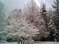
A sunny day in Winston.
-
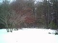
A winter day in Winston.


