
Hiram, Georgia facts for kids
Quick facts for kids
Hiram, Georgia
|
|||
|---|---|---|---|

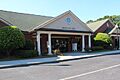
Downtown Hiram
|
|||
|
|||

Location in Paulding County and the state of Georgia
|
|||

Hiram, Georgia
Location in Metro Atlanta
|
|||
| Country | United States | ||
| State | Georgia | ||
| County | Paulding | ||
| Area | |||
| • Total | 3.96 sq mi (10.25 km2) | ||
| • Land | 3.93 sq mi (10.18 km2) | ||
| • Water | 0.03 sq mi (0.06 km2) | ||
| Elevation | 965 ft (294 m) | ||
| Population
(2020)
|
|||
| • Total | 4,929 | ||
| • Density | 1,253.88/sq mi (484.10/km2) | ||
| Time zone | UTC-5 (Eastern (EST)) | ||
| • Summer (DST) | UTC-4 (EDT) | ||
| ZIP code |
30141
|
||
| Area code(s) | 770/678/470 | ||
| FIPS code | 13-39076 | ||
| GNIS feature ID | 0331996 | ||


Hiram (pronounced HIGH-rum) is a city in Paulding County, Georgia, United States. As of the 2020 census, the city had a population of 4,929 people.
Contents
History of Hiram
The town of Hiram was officially created by the Georgia General Assembly in 1891. It was named after Hiram Baguette, who was the very first postmaster (the person in charge of the post office) for the town.
Geography of Hiram
Hiram is located at specific coordinates: 33.865575 degrees North and 84.774593 degrees West.
The city covers a total area of about 3.96 square miles (10.25 square kilometers). Most of this area is land, with a very small part being water.
If you stand at the intersection of US Highway 278 and Georgia State Route 92, you can see the tallest buildings in Atlanta. The Bank of America Tower, for example, is about 23 miles away.
Hiram is connected to other nearby towns by major roads. Acworth is about 18 miles (29 km) north via GA-92. Douglasville is 9 miles (14 km) south on the same road. If you take US-278, Dallas is 8 miles (13 km) to the northwest, and Powder Springs is 5 miles (8 km) to the east.
Population and People
| Historical population | |||
|---|---|---|---|
| Census | Pop. | %± | |
| 1900 | 105 | — | |
| 1910 | 254 | 141.9% | |
| 1920 | 329 | 29.5% | |
| 1930 | 303 | −7.9% | |
| 1940 | 282 | −6.9% | |
| 1950 | 299 | 6.0% | |
| 1960 | 358 | 19.7% | |
| 1970 | 441 | 23.2% | |
| 1980 | 1,030 | 133.6% | |
| 1990 | 1,389 | 34.9% | |
| 2000 | 1,361 | −2.0% | |
| 2010 | 3,546 | 160.5% | |
| 2020 | 4,929 | 39.0% | |
| U.S. Decennial Census | |||
Hiram, along with its neighbor Dallas and Paulding County, has seen a lot of growth in recent years.
Population Growth
Between 2000 and 2010, the population of Hiram more than doubled. It jumped from 1,361 people in 2000 to 3,546 people in 2010. This was an increase of over 160 percent!
The county itself also grew a lot. Paulding County's population went from 81,678 in 2000 to 142,324 people.
2020 Census Information
As of the 2020 United States census, Hiram had 4,929 residents. There were 1,510 households and 1,030 families living in the city.
2010 Census Information

In 2010, the city had 3,543 people and 1,538 households. The population density was about 452.5 people per square mile.
About 60.88% of the people were White, and 32% were African American. About 7.54% of the population identified as Hispanic or Latino.
In terms of age, about 28.4% of the population was under 18 years old. About 33.7% were between 25 and 44 years old. The average age in the city was 32 years.
Transportation
Major Highways in Hiram
 U.S. Route 278
 State Route 92
 State Route 120
 State Route 6
 State Business Route 6
 State Route 360
Education
Hiram has its own schools. These include Hiram High School and Hiram Elementary School. Nearby middle schools are Dobbins Middle School, P.B. Ritch Middle School, and East Paulding Middle School.
Fun Things to Do
Hiram offers some great places for recreation:
- Silver Comet Trail
- Ben Hill Strickland Park
Images for kids
-
Hiram City Hall
See also
 In Spanish: Hiram (Georgia) para niños
