Woodland, Michigan facts for kids
Quick facts for kids
Woodland, Michigan
|
|
|---|---|
|
Village
|
|

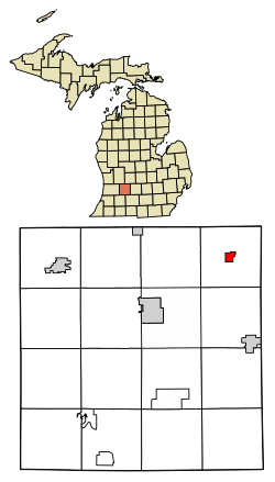
Location of Woodland, Michigan
|
|
| Country | United States |
| State | Michigan |
| County | Barry |
| Area | |
| • Total | 0.85 sq mi (2.20 km2) |
| • Land | 0.85 sq mi (2.20 km2) |
| • Water | 0.00 sq mi (0.00 km2) |
| Elevation | 869 ft (265 m) |
| Population
(2020)
|
|
| • Total | 391 |
| • Density | 461.08/sq mi (178.03/km2) |
| Time zone | UTC-5 (Eastern (EST)) |
| • Summer (DST) | UTC-4 (EDT) |
| ZIP code |
48897
|
| Area code(s) | 269 |
| FIPS code | 26-88420 |
| GNIS feature ID | 1616751 |
Woodland is a small village located in Barry County, which is part of the U.S. state of Michigan. In 2020, about 391 people lived there. The village is found within a larger area called Woodland Township.
Geography of Woodland
Woodland is in the northeast part of Barry County. It covers a total area of about 0.82 square miles (2.12 square kilometers), and all of this area is land.
This small town is mainly a farming area. It also serves as a "bedroom community." This means many people who live in Woodland travel to bigger cities like Lansing or Grand Rapids for work. Woodland has its own local government and an elementary school for younger students.
Woodland was first settled in 1837 by Charles and Jonathon Galloway, and Charles Haight. The area and the township were named "Woodland" because of the many thick forests that used to be there. The Chicago, Kalamazoo and Saginaw Railway train line came through in 1889. This helped the village grow a lot. Woodland officially became a village in 1892.
Woodland's Population History
| Historical population | |||
|---|---|---|---|
| Census | Pop. | %± | |
| 1880 | 266 | — | |
| 1900 | 319 | — | |
| 1910 | 304 | −4.7% | |
| 1920 | 356 | 17.1% | |
| 1930 | 407 | 14.3% | |
| 1940 | 402 | −1.2% | |
| 1950 | 410 | 2.0% | |
| 1960 | 374 | −8.8% | |
| 1970 | 473 | 26.5% | |
| 1980 | 431 | −8.9% | |
| 1990 | 466 | 8.1% | |
| 2000 | 495 | 6.2% | |
| 2010 | 425 | −14.1% | |
| 2020 | 391 | −8.0% | |
| U.S. Decennial Census | |||
Population in 2010
According to the census from 2010, there were 425 people living in Woodland. These people lived in 162 different homes, and 116 of these were families.
The population density was about 518 people per square mile (200 people per square kilometer). This means that for every square mile of land, there were about 518 people living there. There were also 180 housing units, which are places where people can live.
Most of the people in the village were White (about 97%). A small number were African American or Asian. Some people were from other races, and a few were from two or more races. About 4% of the population identified as Hispanic or Latino.
Out of the 162 homes, about 38% had children under 18 living there. Nearly half (about 49%) were married couples living together. About 16% of homes had a female head of household without a husband. About 6% had a male head of household without a wife. About 28% were "non-families," meaning people living together who are not related.
About 25% of all homes had only one person living in them. About 10% of homes had someone living alone who was 65 years old or older. On average, there were about 2.62 people in each household and 3.03 people in each family.
The average age of people in the village was 35.5 years. About 27% of residents were under 18 years old. About 10% were between 18 and 24. About 28% were between 25 and 44. About 23% were between 45 and 64. Finally, about 13% were 65 years old or older. Slightly more than half of the population (51%) was male, and 49% was female.
See also
 In Spanish: Woodland (Míchigan) para niños
 | Shirley Ann Jackson |
 | Garett Morgan |
 | J. Ernest Wilkins Jr. |
 | Elijah McCoy |

