Woodstock, Ohio facts for kids
Quick facts for kids
Woodstock, Ohio
|
|
|---|---|
|
Village
|
|

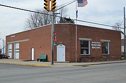
Village Hall
|
|

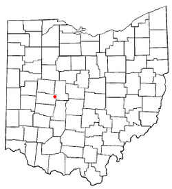
Location of Woodstock, Ohio
|
|

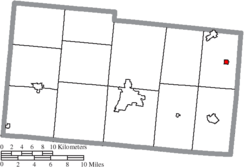
Location of Woodstock in Champaign County
|
|
| Country | United States |
| State | Ohio |
| County | Champaign |
| Township | Rush |
| Area | |
| • Total | 0.28 sq mi (0.73 km2) |
| • Land | 0.28 sq mi (0.73 km2) |
| • Water | 0.00 sq mi (0.00 km2) |
| Elevation | 1,047 ft (319 m) |
| Population
(2020)
|
|
| • Total | 287 |
| • Density | 1,014.13/sq mi (392.23/km2) |
| Time zone | UTC-5 (Eastern (EST)) |
| • Summer (DST) | UTC-4 (EDT) |
| ZIP code |
43084
|
| Area code(s) | 937, 326 |
| FIPS code | 39-86478 |
| GNIS feature ID | 2399738 |
| Website | [1] |
Woodstock is a small village located in Champaign County, Ohio, in the United States. In 2020, about 287 people lived there.
Contents
Woodstock's Beginnings: A Look at Its History
Woodstock was officially planned and laid out in 1834. This means its streets and lots were mapped out for people to build homes and businesses.
Where is Woodstock Located?
Woodstock is found in Ohio, a state in the United States. It sits on State Route 559. This road is about 12 miles (19 km) north of a town called Mechanicsburg.
How Big is Woodstock?
The United States Census Bureau says that Woodstock covers a total area of about 0.29 square miles (0.75 square kilometers). All of this area is land, with no water.
Who Lives in Woodstock? A Look at the Population
The number of people living in Woodstock has changed over the years. Here's how the population has looked during different census counts:
| Historical population | |||
|---|---|---|---|
| Census | Pop. | %± | |
| 1880 | 383 | — | |
| 1890 | 301 | −21.4% | |
| 1900 | 325 | 8.0% | |
| 1910 | 310 | −4.6% | |
| 1920 | 326 | 5.2% | |
| 1930 | 293 | −10.1% | |
| 1940 | 263 | −10.2% | |
| 1950 | 316 | 20.2% | |
| 1960 | 310 | −1.9% | |
| 1970 | 281 | −9.4% | |
| 1980 | 292 | 3.9% | |
| 1990 | 296 | 1.4% | |
| 2000 | 317 | 7.1% | |
| 2010 | 305 | −3.8% | |
| 2020 | 287 | −5.9% | |
| U.S. Decennial Census | |||
Understanding the 2010 Census Data
In 2010, the census showed that 305 people lived in Woodstock. There were 103 households, which are groups of people living together in one home. Most of these (82) were families.
- The village had about 1051.7 people per square mile (406.1 people per square kilometer).
- There were 113 housing units, like houses or apartments.
- Most residents (98.4%) were White.
- A small number (1.0%) were Native American.
- About 0.7% of the population identified as Hispanic or Latino.
Woodstock Households and Families
Out of the 103 households in 2010:
- 42.7% had children under 18 living with them.
- 59.2% were married couples living together.
- 13.6% had a female head of household with no husband present.
- 6.8% had a male head of household with no wife present.
- 20.4% were not families (for example, single people living alone).
The average household had about 2.96 people. The average family had about 3.35 people.
Age and Gender in Woodstock
The average age in Woodstock in 2010 was 33.2 years old.
- 33.4% of residents were under 18 years old.
- 5.7% were between 18 and 24 years old.
- 29.1% were between 25 and 44 years old.
- 23.9% were between 45 and 64 years old.
- 7.9% were 65 years old or older.
When it came to gender, 52.8% of the population was male and 47.2% was female.
Woodstock's Climate
The climate in Woodstock, Ohio, changes throughout the year, with different temperatures and rainfall amounts.
|
||||||||||||||||||||||||||||||||||||||||||||||||||||||||||||||||||||||||||||||||||||||||||||||||
See also
 In Spanish: Woodstock (Ohio) para niños
 | Madam C. J. Walker |
 | Janet Emerson Bashen |
 | Annie Turnbo Malone |
 | Maggie L. Walker |

